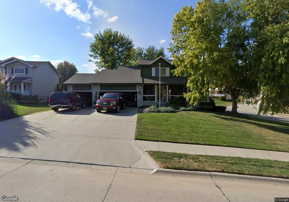
13406 S 20th St Bellevue, NE 68123
Estimated Value: $384,550 - $452,000
4
Beds
4
Baths
2,207
Sq Ft
$187/Sq Ft
Est. Value
About This Home
This home is located at 13406 S 20th St, Bellevue, NE 68123 and is currently estimated at $412,388, approximately $186 per square foot. 13406 S 20th St is a home located in Sarpy County with nearby schools including Fairview Elementary School, Bellevue Mission Middle School, and Bellevue West High School.
Ownership History
Date
Name
Owned For
Owner Type
Purchase Details
Closed on
Apr 2, 2024
Sold by
Turner-Cox Family Trust and Cox-Turner Eleanor T
Bought by
Schiefelbein Daniel E and Schiefelbein Deborah D
Current Estimated Value
Purchase Details
Closed on
Jul 8, 2008
Sold by
Stinson Michael J and Stinson Elizabeth A
Bought by
Jensen Wade L and Jensen Heather F
Home Financials for this Owner
Home Financials are based on the most recent Mortgage that was taken out on this home.
Original Mortgage
$207,750
Interest Rate
6.11%
Purchase Details
Closed on
May 20, 2004
Sold by
Horizon Realty Inc
Bought by
Stinson Michael J and Stinson Elizabeth A
Home Financials for this Owner
Home Financials are based on the most recent Mortgage that was taken out on this home.
Original Mortgage
$173,679
Interest Rate
4.25%
Create a Home Valuation Report for This Property
The Home Valuation Report is an in-depth analysis detailing your home's value as well as a comparison with similar homes in the area
Home Values in the Area
Average Home Value in this Area
Purchase History
| Date | Buyer | Sale Price | Title Company |
|---|---|---|---|
| Schiefelbein Daniel E | $555,000 | Platinum Title & Escrow | |
| Jensen Wade L | $216,000 | Fat | |
| Stinson Michael J | $218,000 | -- |
Source: Public Records
Mortgage History
| Date | Status | Borrower | Loan Amount |
|---|---|---|---|
| Previous Owner | Jensen Wade L | $207,750 | |
| Previous Owner | Stinson Michael J | $173,679 | |
| Closed | Stinson Michael J | $43,420 |
Source: Public Records
Tax History Compared to Growth
Tax History
| Year | Tax Paid | Tax Assessment Tax Assessment Total Assessment is a certain percentage of the fair market value that is determined by local assessors to be the total taxable value of land and additions on the property. | Land | Improvement |
|---|---|---|---|---|
| 2025 | -- | $346,799 | $60,000 | $286,799 |
| 2024 | -- | $329,509 | $60,000 | $269,509 |
| 2023 | -- | $309,128 | $55,000 | $254,128 |
| 2022 | $0 | $285,880 | $50,000 | $235,880 |
| 2021 | $0 | $265,275 | $50,000 | $215,275 |
| 2020 | $0 | $261,879 | $50,000 | $211,879 |
| 2019 | $0 | $244,718 | $40,000 | $204,718 |
| 2018 | $0 | $229,581 | $40,000 | $189,581 |
| 2017 | $0 | $229,665 | $40,000 | $189,665 |
| 2016 | -- | $223,143 | $40,000 | $183,143 |
| 2015 | $4,541 | $221,822 | $40,000 | $181,822 |
| 2014 | $4,541 | $209,266 | $35,000 | $174,266 |
| 2012 | -- | $207,711 | $35,000 | $172,711 |
Source: Public Records
Map
Nearby Homes
- 13801 S 22nd Cir
- 2512 Nottingham Dr
- 0000 Cedar Island Road East of Old 36th St
- 1506 Halifax St
- 13908 S 17th St
- 14112 S 22nd St
- 13403 S 28th St
- 14107 S 18th St
- 14002 Tregaron Ridge Ave Unit B
- 2923 Blackhawk Dr
- 12901 S 29th Place
- 12722 S 28th Ave
- 14319 Tregaron Dr
- 1909 Plymouth Rock Rd
- 13902 Rahn Blvd
- 14502 S 22nd St
- 3105 Mirror Cir
- 3108 Mirror Cir
- 2940 Leawood Dr
- 1709 Mayflower Rd
- 13408 S 20th St
- 2105 Greenwald St
- 2010 Greenwald St
- 2008 Greenwald St
- 13410 S 20th St
- 13409 S 20th St
- 13407 S 20th St
- 2104 Greenwald St
- 2006 Greenwald St
- 13411 S 20th St
- 13405 S 20th St
- 13407 S 22nd St
- 13502 S 20th St
- 2106 Greenwald St
- 13409 S 22nd St
- 2101 Whitted Dr
- 2011 Whitted Dr
- 13403 S 20th St
- 2103 Whitted Dr
- 13501 S 20th St