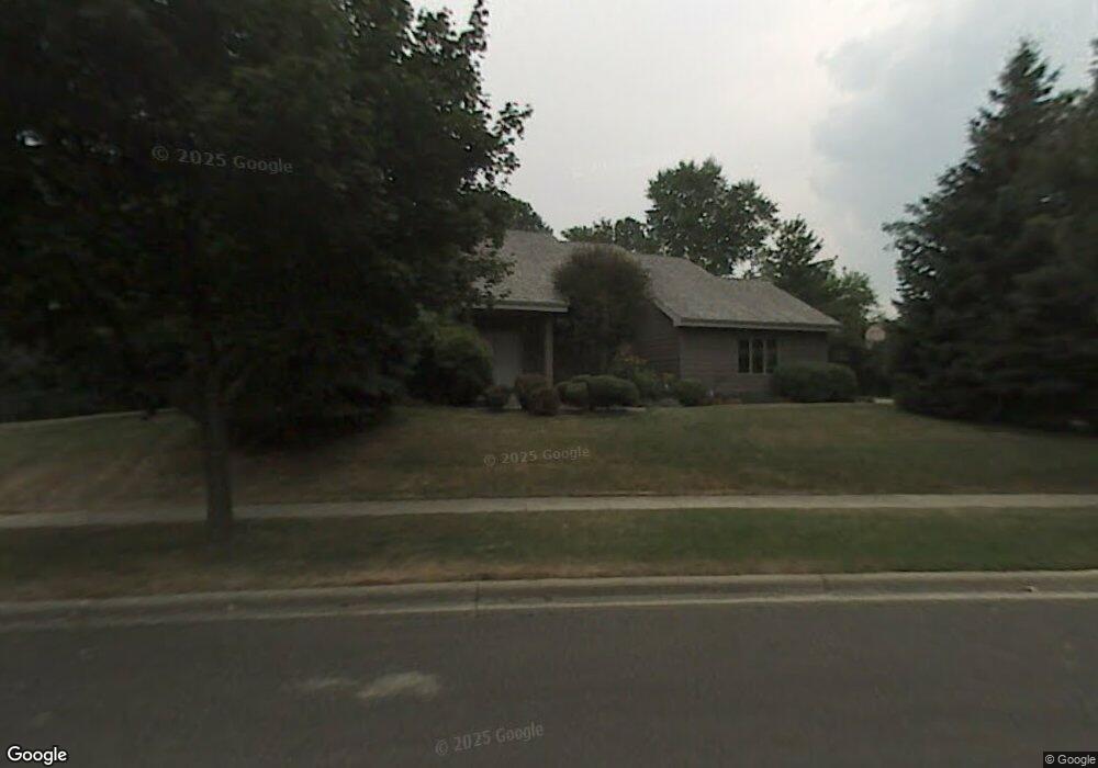
1341 Boundary Rd Middleton, WI 53562
Stonefield NeighborhoodEstimated Value: $946,000 - $1,141,000
Studio
--
Bath
--
Sq Ft
15,072
Sq Ft Lot
About This Home
This home is located at 1341 Boundary Rd, Middleton, WI 53562 and is currently estimated at $1,032,478. 1341 Boundary Rd is a home located in Dane County with nearby schools including Elm Lawn Elementary School, Kromrey Middle School, and Middleton High School.
Ownership History
Date
Name
Owned For
Owner Type
Purchase Details
Closed on
Apr 20, 2017
Sold by
Lee Peter U and Lee Rosaida A
Bought by
Roden Bernard A and Roden Lori Lee
Current Estimated Value
Home Financials for this Owner
Home Financials are based on the most recent Mortgage that was taken out on this home.
Original Mortgage
$392,000
Outstanding Balance
$257,636
Interest Rate
4.14%
Mortgage Type
New Conventional
Estimated Equity
$774,842
Create a Home Valuation Report for This Property
The Home Valuation Report is an in-depth analysis detailing your home's value as well as a comparison with similar homes in the area
Home Values in the Area
Average Home Value in this Area
Purchase History
| Date | Buyer | Sale Price | Title Company |
|---|---|---|---|
| Roden Bernard A | $490,000 | None Available |
Source: Public Records
Mortgage History
| Date | Status | Borrower | Loan Amount |
|---|---|---|---|
| Open | Roden Bernard A | $392,000 |
Source: Public Records
Tax History
| Year | Tax Paid | Tax Assessment Tax Assessment Total Assessment is a certain percentage of the fair market value that is determined by local assessors to be the total taxable value of land and additions on the property. | Land | Improvement |
|---|---|---|---|---|
| 2025 | $13,245 | $710,500 | $155,200 | $555,300 |
| 2023 | $11,780 | $710,500 | $155,200 | $555,300 |
| 2022 | $11,756 | $710,500 | $155,200 | $555,300 |
| 2021 | $11,482 | $575,400 | $155,200 | $420,200 |
| 2020 | $11,602 | $575,400 | $155,200 | $420,200 |
| 2019 | $10,940 | $575,400 | $155,200 | $420,200 |
| 2018 | $10,227 | $575,400 | $155,200 | $420,200 |
| 2017 | $9,944 | $488,000 | $148,100 | $339,900 |
| 2016 | $9,883 | $488,000 | $148,100 | $339,900 |
| 2015 | $10,092 | $488,000 | $148,100 | $339,900 |
| 2014 | $9,635 | $440,300 | $128,000 | $312,300 |
| 2013 | $8,493 | $440,300 | $128,000 | $312,300 |
Source: Public Records
Map
Nearby Homes
- 22 Pebble Beach Cir
- 14 Hidden Hollow Trail
- 16 Hidden Hollow Trail
- 1525 Windfield Way
- 837 N Gammon Rd Unit D
- 1030 Rooster Run Unit 19
- 21 Julia Cir
- 7009 Fortune Dr
- 7106 Fortune Dr Unit 1
- 7106 Fortune Dr Unit 23
- 1626 Meadow Crest Ln
- 6242 University Ave
- 6251 Charing Cross Ln Unit E5
- 2051 Allen Blvd Unit 101
- 2051 Allen Blvd Unit 205
- 1626 Laurel Crest
- 6829 Cooper Ave
- 5526 Englewood Dr
- 2142 Allen Blvd Unit 4
- 5745 Bittersweet Place
- 1337 Boundary Rd
- 929 Sauk Ridge Trail
- 1342 Boundary Rd
- 1 Hodgson Ct
- 933 Sauk Ridge Trail
- 1333 Boundary Rd
- 1336 Boundary Rd
- 9 Hodgson Ct
- 1346 Boundary Rd
- 1332 Boundary Rd
- 1345 Boundary Rd
- 937 Sauk Ridge Trail
- 930 Sauk Ridge Trail
- 1329 Boundary Rd
- 10 Hodgson Ct
- 1350 Boundary Rd
- 6307 Sleepy Hollow Cir
- 2 Hodgson Ct
- 1326 Boundary Rd
- 6303 Sleepy Hollow Cir
Your Personal Tour Guide
Ask me questions while you tour the home.