
Seller's Agent in 2026
Brandon Spognardi
RE/MAX
(267) 987-5470
1 in this area
66 Total Sales
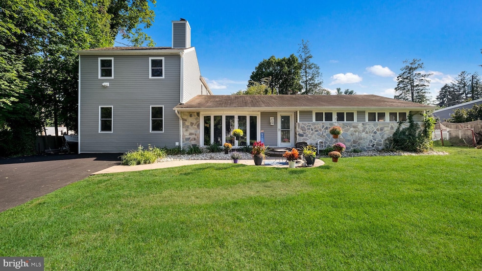

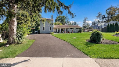
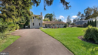
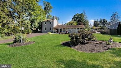
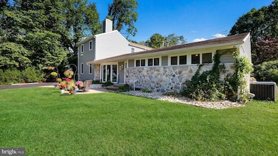
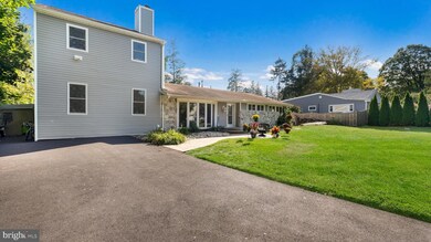
Welcome to 1341 Carol Road, a beautiful home in the desirable Abington Township. Step inside through the gracious foyer into a warm and elegant living space. The main level features newer hand scraped hardwood floors throughout. A bedroom with its own ensuite bathroom occupies the first floor living area. This bedroom has plenty of closet space and an updated bathroom that features a walk-in shower, and newer vanity and toilet. Walk-out into the living room which is featured by a wood-burning fireplace and oversized windows, flooding the space with natural light. Off the living area is a newly updated powder room. The kitchen has been updated with gorgeous custom cabinetry and shelving, stainless steel appliances, granite countertops, real brick accent wall and a sizable pantry cabinet. Enter into the home addition to a game-room area, with plenty of space for entertaining. Next, move over to the beautiful family room which showcases a custom-built entertainment center that includes three fireplaces (one main and two side) and a built-in TV space. The space also features a dry bar with built-in refrigerator. Utility space and storage is off the back of the addition. Head upstairs through the stairwell with large ceilings, custom lighting and a sky light. The spacious primary bedroom suite has vaulted ceilings, new flooring, and a large walk-in closet space with custom shelving. There are two additional well-proportioned bedrooms. A convenient second‐floor laundry area adds functionality. Several SEPTA train stations nearby, and easy access to major roadways for commuting. Shopping, dining, parks and community amenities are all within reach, making this both a convenient and peaceful place to call home. Do not miss out on this amazing opportunity! *Pool in the backyard is unfinished. Invoices for the necessary work to be completed will be attached*
* Backyard is being graded and leveled.*
Last Agent to Sell the Property
(215) 343-9950 remaxsigfrontdesk@yahoo.com RE/MAX Signature Brokerage Phone: 2153439950 License #RS349278 Listed on: 09/27/2025
Co-Listed By
(215) 343-9950 remaxsigfrontdesk@yahoo.com RE/MAX Signature Brokerage Phone: 2153439950
| Date | Type | Sale Price | Title Company |
|---|---|---|---|
| Interfamily Deed Transfer | -- | None Available | |
| Deed | $163,000 | -- | |
| Deed | $142,000 | -- |
| Date | Status | Loan Amount | Loan Type |
|---|---|---|---|
| Open | $250,762 | No Value Available |
| Date | Event | Price | List to Sale | Price per Sq Ft |
|---|---|---|---|---|
| 03/05/2026 03/05/26 | Sold | $710,000 | -4.0% | $167 / Sq Ft |
| 01/15/2026 01/15/26 | Price Changed | $739,900 | -4.5% | $174 / Sq Ft |
| 11/23/2025 11/23/25 | Price Changed | $775,000 | -3.0% | $182 / Sq Ft |
| 11/02/2025 11/02/25 | Price Changed | $799,000 | -2.5% | $188 / Sq Ft |
| 10/21/2025 10/21/25 | Price Changed | $819,900 | -0.6% | $192 / Sq Ft |
| 09/27/2025 09/27/25 | For Sale | $824,900 | -- | $194 / Sq Ft |
| Year | Tax Paid | Tax Assessment Tax Assessment Total Assessment is a certain percentage of the fair market value that is determined by local assessors to be the total taxable value of land and additions on the property. | Land | Improvement |
|---|---|---|---|---|
| 2025 | $6,493 | $140,220 | -- | -- |
| 2024 | $6,493 | $140,220 | -- | -- |
| 2023 | $6,223 | $140,220 | $0 | $0 |
| 2022 | $6,023 | $140,220 | $0 | $0 |
| 2021 | $5,699 | $140,220 | $0 | $0 |
| 2020 | $5,618 | $140,220 | $0 | $0 |
| 2019 | $5,618 | $140,220 | $0 | $0 |
| 2018 | $5,618 | $140,220 | $0 | $0 |
| 2017 | $5,452 | $140,220 | $0 | $0 |
| 2016 | $5,397 | $140,220 | $0 | $0 |
| 2015 | $5,074 | $140,220 | $0 | $0 |
| 2014 | $5,074 | $140,220 | $0 | $0 |
Seller's Agent in 2026
Brandon Spognardi
RE/MAX
(267) 987-5470
1 in this area
66 Total Sales
Seller Co-Listing Agent in 2026
John Spognardi
RE/MAX
(215) 431-8282
5 in this area
277 Total Sales
Buyer's Agent in 2026
Chris Caine
RE/MAX
(215) 605-9207
5 in this area
75 Total Sales
Source: Bright MLS
MLS Number: PAMC2155806
APN: 30-00-06704-007
Disclaimer: Certain information contained herein is derived from information provided by parties other than Homes.com. All information provided is deemed reliable, but is not guaranteed to be accurate and should be independently verified.
![]() The data relating to real estate for sale on this website appears in part through the BRIGHT Internet Data Exchange program, a voluntary cooperative exchange of property listing data between licensed real estate brokerage firms, and is provided by BRIGHT through a licensing agreement.
The data relating to real estate for sale on this website appears in part through the BRIGHT Internet Data Exchange program, a voluntary cooperative exchange of property listing data between licensed real estate brokerage firms, and is provided by BRIGHT through a licensing agreement.
Listing information is from various brokers who participate in the Bright MLS IDX program and not all listings may be visible on the site.
The property information being provided on or through the website is for the personal, non-commercial use of consumers and such information may not be used for any purpose other than to identify prospective properties consumers may be interested in purchasing.
Some properties which appear for sale on the website may no longer be available because they are for instance, under contract, sold or are no longer being offered for sale.
Property information displayed is deemed reliable but is not guaranteed.
Copyright 2026 Bright MLS, Inc.
Ask me questions while you tour the home.