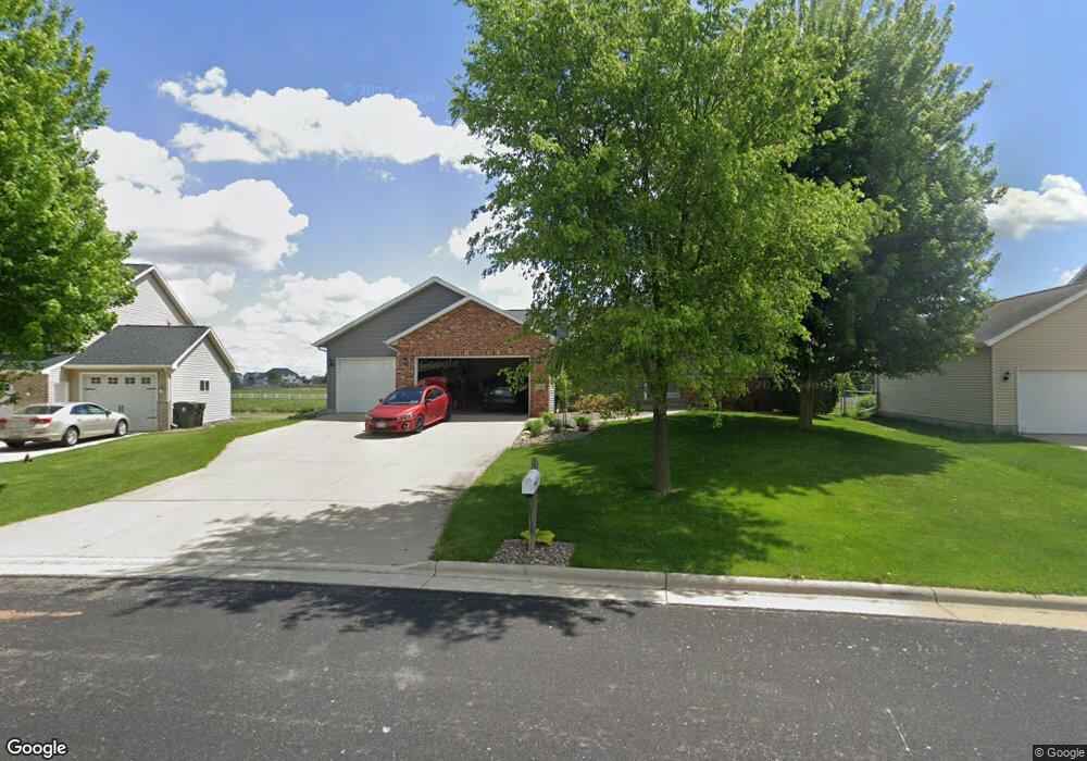
1341 Circle Dr Sun Prairie, WI 53590
Northern Sun Prairie NeighborhoodEstimated Value: $462,000 - $538,000
3
Beds
2
Baths
1,686
Sq Ft
$298/Sq Ft
Est. Value
About This Home
This home is located at 1341 Circle Dr, Sun Prairie, WI 53590 and is currently estimated at $501,992, approximately $297 per square foot. 1341 Circle Dr is a home located in Dane County with nearby schools including Bird Elementary School, Patrick Marsh Middle School, and Peace Lutheran School & Prekindergarten.
Ownership History
Date
Name
Owned For
Owner Type
Purchase Details
Closed on
Mar 10, 2014
Sold by
Weitzman Christopher D
Bought by
Weitzman Jennifer A
Current Estimated Value
Purchase Details
Closed on
May 19, 2006
Sold by
Mindbam Kevin and Mindbam Kevin A
Bought by
Weitzman Chrsitpher D and Weitzman Jennifr A
Home Financials for this Owner
Home Financials are based on the most recent Mortgage that was taken out on this home.
Original Mortgage
$207,871
Outstanding Balance
$121,351
Interest Rate
6.54%
Mortgage Type
Construction
Estimated Equity
$380,641
Purchase Details
Closed on
May 16, 2005
Sold by
Glynn Construction Llc
Bought by
Mindham Kevin
Home Financials for this Owner
Home Financials are based on the most recent Mortgage that was taken out on this home.
Original Mortgage
$73,900
Interest Rate
6.07%
Mortgage Type
Future Advance Clause Open End Mortgage
Create a Home Valuation Report for This Property
The Home Valuation Report is an in-depth analysis detailing your home's value as well as a comparison with similar homes in the area
Home Values in the Area
Average Home Value in this Area
Purchase History
| Date | Buyer | Sale Price | Title Company |
|---|---|---|---|
| Weitzman Jennifer A | -- | None Available | |
| Weitzman Chrsitpher D | $299,900 | None Available | |
| Mindham Kevin | $74,900 | None Available |
Source: Public Records
Mortgage History
| Date | Status | Borrower | Loan Amount |
|---|---|---|---|
| Open | Weitzman Chrsitpher D | $207,871 | |
| Previous Owner | Mindham Kevin | $73,900 |
Source: Public Records
Tax History Compared to Growth
Tax History
| Year | Tax Paid | Tax Assessment Tax Assessment Total Assessment is a certain percentage of the fair market value that is determined by local assessors to be the total taxable value of land and additions on the property. | Land | Improvement |
|---|---|---|---|---|
| 2024 | $9,417 | $496,100 | $76,000 | $420,100 |
| 2023 | $8,561 | $496,100 | $76,000 | $420,100 |
| 2021 | $7,657 | $364,200 | $70,700 | $293,500 |
| 2020 | $7,825 | $364,200 | $70,700 | $293,500 |
| 2019 | $7,276 | $301,000 | $64,300 | $236,700 |
| 2018 | $6,506 | $291,200 | $64,300 | $226,900 |
| 2017 | $6,241 | $291,200 | $64,300 | $226,900 |
| 2016 | $6,003 | $253,900 | $56,700 | $197,200 |
| 2015 | $5,605 | $244,200 | $56,700 | $187,500 |
| 2014 | $5,564 | $240,800 | $56,700 | $184,100 |
| 2013 | $6,256 | $240,800 | $56,700 | $184,100 |
Source: Public Records
Map
Nearby Homes
- 633 Stonehaven Dr
- 680 Stonehaven Dr
- 208 Scenic Ct
- 6532 N Bird St
- 1048 Stonewood Crossing
- 1046 Stonehaven Dr
- 955 Liberty Blvd Unit 103
- 856 Saint Albert the Great Dr Unit 856
- 1171 School St Unit 1171
- 972 Chandler Ln Unit 972
- 994 Chandler Ln
- 952 Chandler Ln Unit 952
- 1325 Bunker Hill Dr Unit 3104
- 1180 Patriot Way
- 1010 Andrews Dr
- 1295 Stonehaven Dr
- 1013 Vandenburg St
- 921 Pine St
- 6615 Kades Forge
- 1294 Saint Albert the Great Dr
- 1337 Circle Dr
- 1345 Circle Dr
- 1333 Circle Dr
- 480 Stonehaven Dr
- 1349 Circle Dr
- 1342 Circle Dr
- 1336 Circle Dr
- 1352 Circle Dr
- 1353 Circle Dr
- 1330 Circle Dr
- 1355 Circle Dr
- 550 Stonehaven Dr
- 1360 Circle Dr
- 505 Ruxton Ridge Dr
- 481 Stonehaven Dr
- 1359 Circle Dr
- 580 Stonehaven Dr
- 451 Stonehaven Dr
- 502 Ruxton Ridge Dr
- 1364 Circle Dr