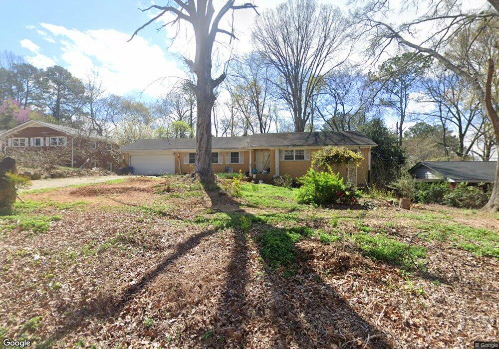
1341 John Robert Dr Morrow, GA 30260
Estimated Value: $120,408 - $329,000
4
Beds
3
Baths
2,141
Sq Ft
$114/Sq Ft
Est. Value
About This Home
This home is located at 1341 John Robert Dr, Morrow, GA 30260 and is currently estimated at $243,352, approximately $113 per square foot. 1341 John Robert Dr is a home located in Clayton County with nearby schools including Morrow Elementary School, Babb Middle School, and Charles R. Drew High School.
Ownership History
Date
Name
Owned For
Owner Type
Purchase Details
Closed on
Nov 17, 2025
Sold by
Dinh Hong Thi
Bought by
Tran Dieu Hai Thi and Truong Long The
Current Estimated Value
Purchase Details
Closed on
Mar 20, 2006
Sold by
Nguyen Kiet V
Bought by
Nguyen Kiet and Dinh Hong
Purchase Details
Closed on
Jun 29, 1993
Sold by
Edgar James E Evelyn D
Bought by
Fewox Harry O Maxine M
Home Financials for this Owner
Home Financials are based on the most recent Mortgage that was taken out on this home.
Original Mortgage
$79,100
Interest Rate
7.87%
Create a Home Valuation Report for This Property
The Home Valuation Report is an in-depth analysis detailing your home's value as well as a comparison with similar homes in the area
Home Values in the Area
Average Home Value in this Area
Purchase History
| Date | Buyer | Sale Price | Title Company |
|---|---|---|---|
| Tran Dieu Hai Thi | $120,000 | -- | |
| Nguyen Kiet | -- | -- | |
| Vanvannguyen Kiet Van | $148,000 | -- | |
| Fewox Harry O Maxine M | $98,900 | -- |
Source: Public Records
Mortgage History
| Date | Status | Borrower | Loan Amount |
|---|---|---|---|
| Previous Owner | Fewox Harry O Maxine M | $79,100 |
Source: Public Records
Tax History
| Year | Tax Paid | Tax Assessment Tax Assessment Total Assessment is a certain percentage of the fair market value that is determined by local assessors to be the total taxable value of land and additions on the property. | Land | Improvement |
|---|---|---|---|---|
| 2025 | $743 | $65,080 | $4,800 | $60,280 |
| 2024 | $843 | $66,200 | $4,800 | $61,400 |
| 2023 | $2,657 | $67,320 | $4,800 | $62,520 |
| 2022 | $802 | $65,880 | $4,800 | $61,080 |
| 2021 | $586 | $53,720 | $4,800 | $48,920 |
| 2020 | $525 | $48,800 | $4,400 | $44,400 |
| 2019 | $1,381 | $48,800 | $4,400 | $44,400 |
| 2018 | $1,381 | $48,800 | $4,400 | $44,400 |
| 2017 | $921 | $35,792 | $4,400 | $31,392 |
| 2016 | $923 | $35,872 | $4,400 | $31,472 |
| 2015 | $350 | $0 | $0 | $0 |
| 2014 | $349 | $20,000 | $4,400 | $15,600 |
Source: Public Records
Map
Nearby Homes
- 6423 Woodstone Terrace
- 6421 Woodstone Terrace
- 6440 Woodstone Terrace
- 6436 Stone Terrace Unit J10
- 1329 Woodstone Trace
- 1331 Woodstone Trace
- 1337 Woodstone Trace
- 1388 Wood Cir S Unit 4
- 1394 Wood Cir S
- 6425 Woodstone Way
- 6429 Woodstone Way
- 6424 Woodstone Way
- 6433 Stone Way
- 6437 Stone Way Unit O5
- 1217 Dove Ct
- 6250 Graceland Cir
- 6430 Oakleaf Way
- 1025 Lynwood Place
- 0 SE Old Rex Morrow Rd Unit 142 8001665
- 942 Majesty Ln
- 1331 John Robert Dr
- 1359 John Robert Dr
- 1327 Woodstone Trace Unit L6
- 1337 Woodstone Trc
- 1333 Woodstone Trace
- 1327 Woodstone Trace
- 1325 Woodstone Trace Unit 7
- 1335 Woodstone Trace
- 1337 Woodstone Trace
- 1342 John Robert Dr
- 6435 Stone Terrace Unit K1
- 6426 Stone Terrace Unit J5
- 1332 John Robert Dr
- 6434 Stone Terrace Unit J9
- 1352 John Robert Dr
- 6424 Stone Terrace Unit J04
- 6420 Stone Terrace Unit J-2
- 6438 Stone Terrace
- 6432 Stone Terrace Unit J8
- 6430 Stone Terrace Unit J7
Your Personal Tour Guide
Ask me questions while you tour the home.