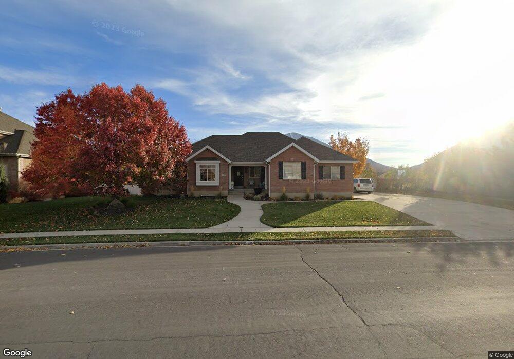
1341 S 1100 E Spanish Fork, UT 84660
Estimated Value: $527,000 - $622,000
3
Beds
3
Baths
1,808
Sq Ft
$326/Sq Ft
Est. Value
About This Home
This home is located at 1341 S 1100 E, Spanish Fork, UT 84660 and is currently estimated at $589,395, approximately $325 per square foot. 1341 S 1100 E is a home located in Utah County with nearby schools including Canyon Elementary School, Spanish Fork Jr High School, and Spanish Fork High School.
Ownership History
Date
Name
Owned For
Owner Type
Purchase Details
Closed on
Jun 5, 2017
Sold by
Silver Creek Properties Llc
Bought by
Black Black R and Black Irene
Current Estimated Value
Home Financials for this Owner
Home Financials are based on the most recent Mortgage that was taken out on this home.
Original Mortgage
$75,000
Outstanding Balance
$62,299
Interest Rate
3.97%
Mortgage Type
Credit Line Revolving
Estimated Equity
$527,096
Purchase Details
Closed on
Jun 16, 2003
Sold by
Harris Joel K and Harris Shelley A
Bought by
Black Kedric M and Black Leslie
Purchase Details
Closed on
Mar 21, 2000
Sold by
Harris Joel and Harris Shelley
Bought by
Harris Joel K and Harris Shelley A
Home Financials for this Owner
Home Financials are based on the most recent Mortgage that was taken out on this home.
Original Mortgage
$140,000
Interest Rate
8.34%
Purchase Details
Closed on
Nov 15, 1999
Sold by
Harward Randall T
Bought by
Harris Joel and Harris Shelley
Create a Home Valuation Report for This Property
The Home Valuation Report is an in-depth analysis detailing your home's value as well as a comparison with similar homes in the area
Home Values in the Area
Average Home Value in this Area
Purchase History
| Date | Buyer | Sale Price | Title Company |
|---|---|---|---|
| Black Black R | -- | United West Title | |
| Black Kedric M | -- | Affiliated First Title | |
| Harris Joel K | -- | Century Title | |
| Harris Joel | -- | Provo Land Title Company |
Source: Public Records
Mortgage History
| Date | Status | Borrower | Loan Amount |
|---|---|---|---|
| Open | Black Black R | $75,000 | |
| Previous Owner | Harris Joel K | $140,000 |
Source: Public Records
Tax History
| Year | Tax Paid | Tax Assessment Tax Assessment Total Assessment is a certain percentage of the fair market value that is determined by local assessors to be the total taxable value of land and additions on the property. | Land | Improvement |
|---|---|---|---|---|
| 2025 | $2,783 | $306,625 | -- | -- |
| 2024 | $2,783 | $286,825 | $0 | $0 |
| 2023 | $2,836 | $292,655 | $0 | $0 |
| 2022 | $2,878 | $291,225 | $0 | $0 |
| 2021 | $2,501 | $404,900 | $116,500 | $288,400 |
| 2020 | $2,323 | $365,700 | $105,900 | $259,800 |
| 2019 | $2,172 | $359,700 | $99,900 | $259,800 |
| 2018 | $1,989 | $318,400 | $92,500 | $225,900 |
| 2017 | $1,941 | $166,980 | $0 | $0 |
| 2016 | $1,743 | $147,950 | $0 | $0 |
| 2015 | $1,596 | $133,870 | $0 | $0 |
| 2014 | $1,506 | $126,775 | $0 | $0 |
Source: Public Records
Map
Nearby Homes
- 715 Scenic Dr
- 857 S 1300 E Unit 32
- 857 S 1300 E
- 834 S 1300 #16gc E
- 816 S 1300 #15gc E
- 1332 E 1670 S Unit 823
- 1147 S 1660 E
- 232 E 860 S Unit 158
- 815 S 1300 E Unit 34
- 789 S 1300 E
- 762 S 1360 E
- 762 S 1360 E Unit 25
- 1105 S 200 E
- 993 S 1660 E
- 1528 E 1790 S
- 1687 E 1000 S
- 357 E 1460 S Unit 45
- 385 E 1460 S Unit 47
- 2308 E 850 South St Unit 10
- 2256 E 760 S Unit 7
- 1307 S 1100 E
- 1359 S 1100 E
- 1285 S 1100 E Unit 47
- 1301 S 1100 E Unit 48
- 1272 S 1100 E Unit 25
- 1086 E 1330 S
- 1278 S 1100 E Unit 26
- 1284 S 1100 E Unit 27
- 1298 S 1100 E Unit 28
- 1128 E 1240 S
- 1111 E 1400 S
- 1081 E 1330 S
- 1308 S 1100 E Unit 29
- 1356 S 1100 E
- 1153 E 1400 S
- 1167 E 1400 S
- 1336 S 1100 E Unit 31
- 1066 E 1330 S
- 1078 E 1240 S
- 1396 S 1100 E
Your Personal Tour Guide
Ask me questions while you tour the home.