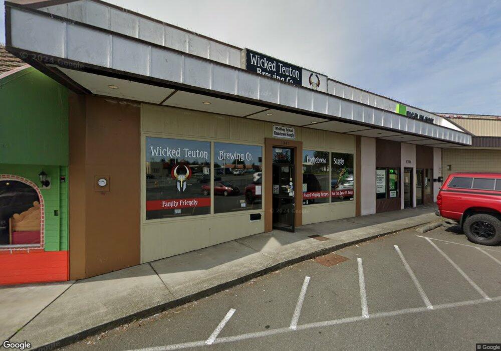
1341 SW Barlow St Oak Harbor, WA 98277
Estimated Value: $880,242
--
Bed
--
Bath
6,612
Sq Ft
$133/Sq Ft
Est. Value
About This Home
This home is located at 1341 SW Barlow St, Oak Harbor, WA 98277 and is currently estimated at $880,242, approximately $133 per square foot. 1341 SW Barlow St is a home located in Island County with nearby schools including Broadview Elementary School, Oak Harbor Middle School, and Oak Harbor High School.
Ownership History
Date
Name
Owned For
Owner Type
Purchase Details
Closed on
Sep 18, 2019
Sold by
Mcnamaras Llc
Bought by
Rodys Of Bremerton Llc
Current Estimated Value
Home Financials for this Owner
Home Financials are based on the most recent Mortgage that was taken out on this home.
Original Mortgage
$456,000
Outstanding Balance
$398,546
Interest Rate
3.6%
Mortgage Type
Commercial
Estimated Equity
$481,696
Create a Home Valuation Report for This Property
The Home Valuation Report is an in-depth analysis detailing your home's value as well as a comparison with similar homes in the area
Home Values in the Area
Average Home Value in this Area
Purchase History
| Date | Buyer | Sale Price | Title Company |
|---|---|---|---|
| Rodys Of Bremerton Llc | $570,000 | Premier Title Of Island Cnty |
Source: Public Records
Mortgage History
| Date | Status | Borrower | Loan Amount |
|---|---|---|---|
| Open | Rodys Of Bremerton Llc | $456,000 |
Source: Public Records
Tax History Compared to Growth
Tax History
| Year | Tax Paid | Tax Assessment Tax Assessment Total Assessment is a certain percentage of the fair market value that is determined by local assessors to be the total taxable value of land and additions on the property. | Land | Improvement |
|---|---|---|---|---|
| 2025 | $3,710 | $428,338 | $203,000 | $225,338 |
| 2024 | $3,765 | $437,268 | $203,000 | $234,268 |
| 2023 | $3,765 | $446,197 | $203,000 | $243,197 |
| 2022 | $4,760 | $445,380 | $203,000 | $242,380 |
| 2021 | $4,774 | $444,122 | $203,000 | $241,122 |
| 2020 | $3,822 | $443,976 | $203,000 | $240,976 |
| 2019 | $3,375 | $351,712 | $159,500 | $192,212 |
| 2018 | $3,826 | $337,237 | $145,000 | $192,237 |
| 2017 | $3,596 | $337,052 | $145,000 | $192,052 |
| 2016 | $4,025 | $337,150 | $145,000 | $192,150 |
| 2015 | $4,504 | $362,983 | $145,000 | $217,983 |
| 2013 | -- | $383,763 | $157,905 | $225,858 |
Source: Public Records
Map
Nearby Homes
- 485 SW Bayshore Dr Unit C201
- 270 SE Barrington Dr Unit A-304
- 30901 State Route 20 Unit D2
- 1850 SW Scenic Heights St Unit B304
- 476 SE Barrington Dr Unit E
- 942 SW Barrington Dr
- 0 SE Bayshore Dr Unit NWM2377102
- 0 XXX
- 651 SE Bayshore Dr Unit B304
- 651 SE Bayshore Dr Unit E101
- 651 SE Bayshore Dr Unit E102
- 0 XXX State Route 20 (Lot 3)
- 1101 SW Harrier Cir Unit 106
- 1121 SW Barrington Dr Unit 3
- 2331 Freund St
- 660 SW Harrier Cir Unit 1
- 2029 Baymont Dr
- 583 SE 6th Ave
- 1250 SW Heller Rd Unit C1
- 1250 SW Heller St Unit B2
- 1331 SW Barlow St
- 1351 SW Barlow St
- 31359 Washington 20
- 31531 Washington 20
- 31531 Washington 20 Unit 1
- 31239 Sr20
- 0 SE Pioneer Way
- 0 SE Pioneer Way Unit NWM1431289
- 31485 Washington 20
- 0 Washington 20
- 0 SE Barrington Dr
- 0 SE Barrington Dr Unit NWM1378051
- 1100 SW Bowmer St Unit 104
- 1100 SW Bowmer St
- 1100 SW Bowmer St Unit A101
- 31530 State Route 20
- 1040 SW Bowmer St
- 231 SW 10th Ave
- 31570 State Route 20 Unit 201A
- 253 SW 10th Ave