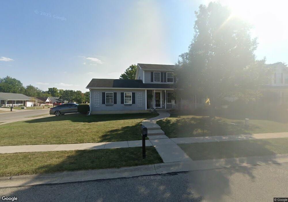
1341 Westview Ave Springfield, OH 45502
Estimated Value: $305,414 - $349,000
3
Beds
3
Baths
1,560
Sq Ft
$204/Sq Ft
Est. Value
About This Home
This home is located at 1341 Westview Ave, Springfield, OH 45502 and is currently estimated at $318,604, approximately $204 per square foot. 1341 Westview Ave is a home located in Clark County with nearby schools including Northridge Elementary School, Kenton Ridge Middle & High School, and Emmanuel Christian Academy.
Ownership History
Date
Name
Owned For
Owner Type
Purchase Details
Closed on
Jun 13, 2003
Sold by
Weldon G Haney Builder Inc
Bought by
Markey Jerome W and Markey Amy Lee
Current Estimated Value
Home Financials for this Owner
Home Financials are based on the most recent Mortgage that was taken out on this home.
Original Mortgage
$160,000
Outstanding Balance
$67,929
Interest Rate
5.71%
Mortgage Type
Purchase Money Mortgage
Estimated Equity
$250,675
Create a Home Valuation Report for This Property
The Home Valuation Report is an in-depth analysis detailing your home's value as well as a comparison with similar homes in the area
Home Values in the Area
Average Home Value in this Area
Purchase History
| Date | Buyer | Sale Price | Title Company |
|---|---|---|---|
| Markey Jerome W | $160,000 | -- |
Source: Public Records
Mortgage History
| Date | Status | Borrower | Loan Amount |
|---|---|---|---|
| Open | Markey Jerome W | $160,000 |
Source: Public Records
Tax History
| Year | Tax Paid | Tax Assessment Tax Assessment Total Assessment is a certain percentage of the fair market value that is determined by local assessors to be the total taxable value of land and additions on the property. | Land | Improvement |
|---|---|---|---|---|
| 2025 | $3,197 | $93,830 | $19,610 | $74,220 |
| 2024 | $3,119 | $82,920 | $17,640 | $65,280 |
| 2023 | $3,119 | $82,920 | $17,640 | $65,280 |
| 2022 | $3,148 | $82,920 | $17,640 | $65,280 |
| 2021 | $3,023 | $69,110 | $13,470 | $55,640 |
| 2020 | $3,025 | $69,110 | $13,470 | $55,640 |
| 2019 | $3,083 | $69,110 | $13,470 | $55,640 |
| 2018 | $2,923 | $63,670 | $13,470 | $50,200 |
| 2017 | $2,505 | $68,436 | $13,468 | $54,968 |
| 2016 | $2,487 | $68,436 | $13,468 | $54,968 |
| 2015 | $2,517 | $66,861 | $13,468 | $53,393 |
| 2014 | $2,517 | $66,861 | $13,468 | $53,393 |
| 2013 | $2,458 | $66,861 | $13,468 | $53,393 |
Source: Public Records
Map
Nearby Homes
- 5722 Victorian Way Unit 31
- 5564 Ridgewood Rd W
- 1325 Northfield Ct
- 937 Willow Rd
- Pendleton Plan at
- Holcombe Plan at
- Newcastle Plan at
- Chatham Plan at
- 5564 Ridgewood Rd E Unit 7
- 1470 Oldham Dr Unit 12
- 1707 Berwick Dr
- 1836 Dunseth Ln
- 1709 Thomas Dr
- 4741 Cullen Ave
- 1033 Westmont Cir
- 862 Brendle Trace Unit 20
- 4652 Reno Ln Unit 15
- 4446 Ridgewood Rd E Unit 3
- 4343 Burchill St
- 593 Hiser Ave
- 1337 Westview Ave
- 1340 Buckthorn Ct
- 1333 Westview Ave
- 1338 Buckthorn Ct
- 5744 Ridgewood Rd W
- 5744 W Ridgewood Rd
- 5760 Ridgewood Rd W
- 1340 Westview Ave
- 1336 Buckthorn Ct
- 1336 Westview Ave
- 5776 Ridgewood Rd W
- 1329 Westview Ave
- 1334 Buckthorn Ct
- 1332 Westview Ave
- 5714 Ridgewood Rd W
- 5792 Ridgewood Rd W
- 1325 Westview Ave
- 5698 Ridgewood Rd W
- 1328 Westview Ave
- 5815 Ridgewood Rd W
Your Personal Tour Guide
Ask me questions while you tour the home.