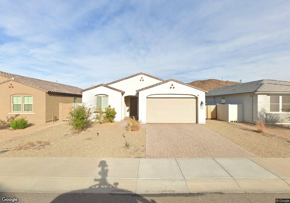
13410 W Rowel Rd Peoria, AZ 85383
Estimated Value: $491,000 - $518,000
3
Beds
2
Baths
1,779
Sq Ft
$283/Sq Ft
Est. Value
About This Home
This home is located at 13410 W Rowel Rd, Peoria, AZ 85383 and is currently estimated at $502,874, approximately $282 per square foot. 13410 W Rowel Rd is a home located in Maricopa County with nearby schools including Lake Pleasant Elementary School and Liberty High School.
Ownership History
Date
Name
Owned For
Owner Type
Purchase Details
Closed on
Sep 24, 2024
Sold by
Kang Hsuan and Kuo Jui An
Bought by
Chang Hao Ming and Su Fang I
Current Estimated Value
Home Financials for this Owner
Home Financials are based on the most recent Mortgage that was taken out on this home.
Original Mortgage
$334,750
Outstanding Balance
$331,303
Interest Rate
6.46%
Mortgage Type
New Conventional
Estimated Equity
$171,571
Purchase Details
Closed on
Feb 17, 2023
Sold by
Ashton Woods Arizona Llc
Bought by
Kang Hsuan and Kuo Jui An
Home Financials for this Owner
Home Financials are based on the most recent Mortgage that was taken out on this home.
Original Mortgage
$379,992
Interest Rate
6.48%
Mortgage Type
New Conventional
Purchase Details
Closed on
Jan 14, 2022
Sold by
Jen Arizona 43 Llc
Bought by
Ashton Woods Arizona Llc
Purchase Details
Closed on
Sep 12, 2012
Sold by
Fnbn Rescon I Llc
Bought by
Rancho Cabrillo Recovery Acquisition Llc
Create a Home Valuation Report for This Property
The Home Valuation Report is an in-depth analysis detailing your home's value as well as a comparison with similar homes in the area
Home Values in the Area
Average Home Value in this Area
Purchase History
| Date | Buyer | Sale Price | Title Company |
|---|---|---|---|
| Chang Hao Ming | $515,000 | Pioneer Title Agency | |
| Kang Hsuan | $474,990 | First American Title Insurance | |
| Ashton Woods Arizona Llc | $1,526,250 | First American Title | |
| Rancho Cabrillo Recovery Acquisition Llc | $4,500,000 | None Available |
Source: Public Records
Mortgage History
| Date | Status | Borrower | Loan Amount |
|---|---|---|---|
| Open | Chang Hao Ming | $334,750 | |
| Previous Owner | Kang Hsuan | $379,992 |
Source: Public Records
Tax History Compared to Growth
Tax History
| Year | Tax Paid | Tax Assessment Tax Assessment Total Assessment is a certain percentage of the fair market value that is determined by local assessors to be the total taxable value of land and additions on the property. | Land | Improvement |
|---|---|---|---|---|
| 2025 | $2,378 | $21,131 | -- | -- |
| 2024 | $481 | $20,125 | -- | -- |
| 2023 | $481 | $5,160 | $5,160 | $0 |
| 2022 | $463 | $11,595 | $11,595 | $0 |
| 2021 | $469 | $11,070 | $11,070 | $0 |
| 2020 | $470 | $10,365 | $10,365 | $0 |
| 2019 | $475 | $8,175 | $8,175 | $0 |
| 2018 | $452 | $7,245 | $7,245 | $0 |
| 2017 | $456 | $3,675 | $3,675 | $0 |
| 2016 | $439 | $3,585 | $3,585 | $0 |
| 2015 | $460 | $3,520 | $3,520 | $0 |
Source: Public Records
Map
Nearby Homes
- 26523 N Thornhill Dr
- 26428 N Thornhill Dr
- 14786 W Lariat Ln
- 14833 W Lariat Ln
- 26550 N 132nd Ln
- 13530 W Briles Rd
- 13140 W Rowel Rd
- 13523 W Remuda Dr
- 13125 W Lariat Ln
- 26451 N 131st Dr
- 26310 N 131st Dr
- 13670 W Briles Rd
- 13603 W Remuda Dr
- 13657 W Paso Trail
- 13612 W Desert Moon Way
- 13811 W Paso Trail
- 13049 W Redbird Rd
- 13130 W El Cortez Place
- 13219 W Cottontail Ln
- 13072 W Alyssa Ln
- 13410 W Rowel Rd
- 13414 W Rowel Rd
- 13404 W Rowel Rd
- 26517 N Thornhill Ct
- 13407 W Rowel Rd
- 13411 W Rowel Rd
- 13402 W Rowel Rd
- 13403 W Rowel Rd
- 13415 W Rowel Rd
- 26505 N Thornhill Ct
- 26511 N Thornhill Ct
- 13362 W Rowel Rd
- 13419 W Rowel Rd
- 13363 W Rowel Rd
- 13423 W Rowel Rd
- 13404 W Tether Trail
- 13358 W Rowel Rd
- 13408 W Tether Trail
- 13359 W Rowel Rd
- 13412 W Tether Trail