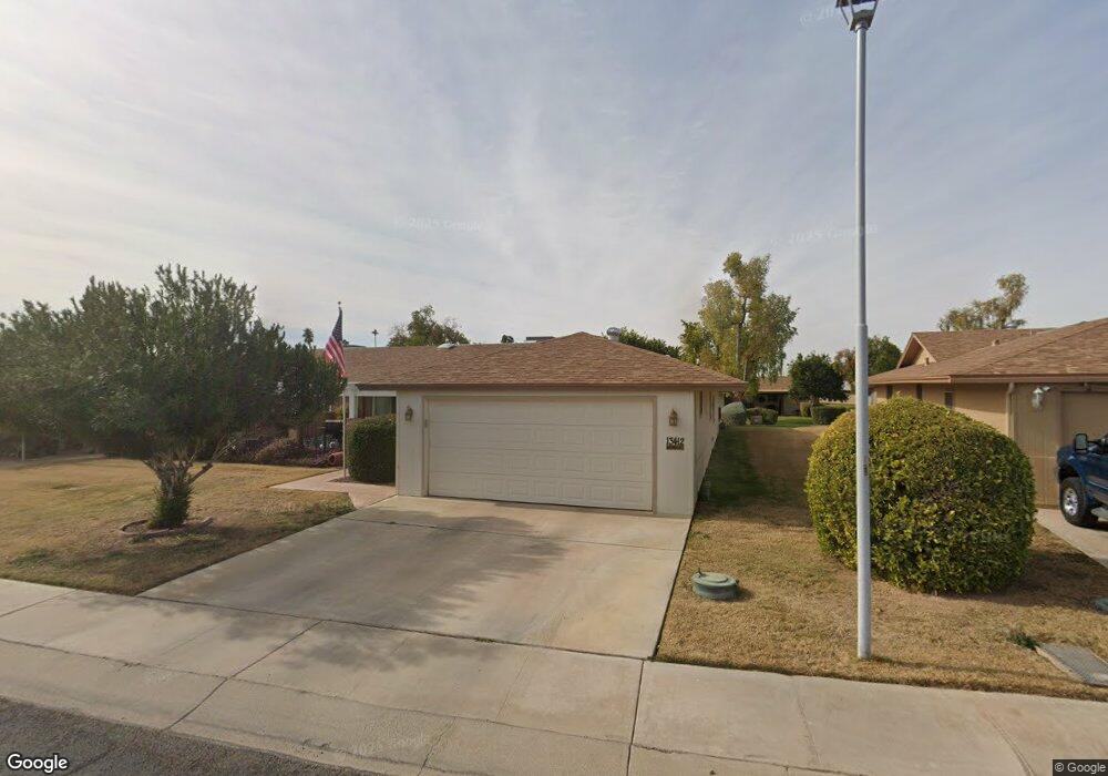
13412 N Cedar Dr Sun City, AZ 85351
Estimated Value: $232,352 - $287,000
--
Bed
2
Baths
1,683
Sq Ft
$159/Sq Ft
Est. Value
About This Home
This home is located at 13412 N Cedar Dr, Sun City, AZ 85351 and is currently estimated at $268,338, approximately $159 per square foot. 13412 N Cedar Dr is a home located in Maricopa County with nearby schools including Desert Mirage Elementary School, Ombudsman - Northwest Charter, and Arrowhead Montessori.
Ownership History
Date
Name
Owned For
Owner Type
Purchase Details
Closed on
Apr 28, 2017
Sold by
Mckernan Bermard D and Barratt Mckerman Revocable Tru
Bought by
Earl David E and Earl Martha Ann
Current Estimated Value
Purchase Details
Closed on
Apr 24, 2006
Sold by
Mckernan Bernard D and Mckernan Anna B
Bought by
Mckernan Bernard D and Mckernan Anna B
Purchase Details
Closed on
Mar 31, 2006
Sold by
Dahill Charles F and Dahill Kelly C
Bought by
Mckernan Bernard D and Mckernan Anna B
Purchase Details
Closed on
Aug 4, 1995
Sold by
Tanner Howard J and Tanner Lucille M
Bought by
Dahill Charles F and Dahill Kelly C
Home Financials for this Owner
Home Financials are based on the most recent Mortgage that was taken out on this home.
Original Mortgage
$66,800
Interest Rate
7.63%
Mortgage Type
New Conventional
Create a Home Valuation Report for This Property
The Home Valuation Report is an in-depth analysis detailing your home's value as well as a comparison with similar homes in the area
Home Values in the Area
Average Home Value in this Area
Purchase History
| Date | Buyer | Sale Price | Title Company |
|---|---|---|---|
| Earl David E | -- | First American Title Agency | |
| Mckernan Bernard D | -- | None Available | |
| Mckernan Bernard D | $185,000 | Capital Title Agency Inc | |
| Dahill Charles F | $83,500 | Security Title Agency |
Source: Public Records
Mortgage History
| Date | Status | Borrower | Loan Amount |
|---|---|---|---|
| Previous Owner | Dahill Charles F | $66,800 |
Source: Public Records
Tax History Compared to Growth
Tax History
| Year | Tax Paid | Tax Assessment Tax Assessment Total Assessment is a certain percentage of the fair market value that is determined by local assessors to be the total taxable value of land and additions on the property. | Land | Improvement |
|---|---|---|---|---|
| 2025 | $1,050 | $11,853 | -- | -- |
| 2024 | $952 | $11,288 | -- | -- |
| 2023 | $952 | $20,260 | $4,050 | $16,210 |
| 2022 | $900 | $17,350 | $3,470 | $13,880 |
| 2021 | $920 | $15,710 | $3,140 | $12,570 |
| 2020 | $898 | $14,000 | $2,800 | $11,200 |
| 2019 | $885 | $13,320 | $2,660 | $10,660 |
| 2018 | $776 | $11,780 | $2,350 | $9,430 |
| 2017 | $749 | $10,270 | $2,050 | $8,220 |
| 2016 | $702 | $8,420 | $1,680 | $6,740 |
| 2015 | $672 | $8,110 | $1,620 | $6,490 |
Source: Public Records
Map
Nearby Homes
- 13410 N Cedar Dr Unit 20
- 10114 W Candlewood Dr
- 10127 W Forrester Dr
- 10112 W Forrester Dr
- 10114 W Royal Oak Rd Unit 20
- 10134 W Forrester Dr
- 10137 W Forrester Dr Unit 20
- 13620 N Hawthorn Dr
- 13614 N Hawthorn Dr
- 13442 N Emberwood Dr
- 10225 W Thunderbird Blvd
- 10040 W Royal Oak Rd Unit B
- 10040 W Royal Oak Rd Unit H
- 13433 N Emberwood Dr
- 10030 W Royal Oak Rd Unit C
- 13606 N Redwood Dr Unit 209
- 13636 N Redwood Dr Unit 203
- 13067 N 100th Dr
- 13071 N 100th Dr
- 13420 N Emberwood Dr
- 13414 N Cedar Dr
- 13408 N Cedar Dr
- 10110 W Candlewood Dr
- 10112 W Candlewood Dr
- 10108 W Candlewood Dr Unit 52
- 13411 N Cedar Dr
- 13409 N Cedar Dr
- 13413 N Cedar Dr Unit 95
- 13406 N Cedar Dr
- 13407 N Cedar Dr
- 13415 N Cedar Dr Unit 20
- 10106 W Candlewood Dr
- 10116 W Candlewood Dr
- 10125 W Forrester Dr
- 13404 N Cedar Dr Unit 87
- 13405 N Cedar Dr
- 10104 W Candlewood Dr Unit 50
- 10111 W Forrester Dr Unit 97
- 10118 W Candlewood Dr
- 10109 W Forrester Dr