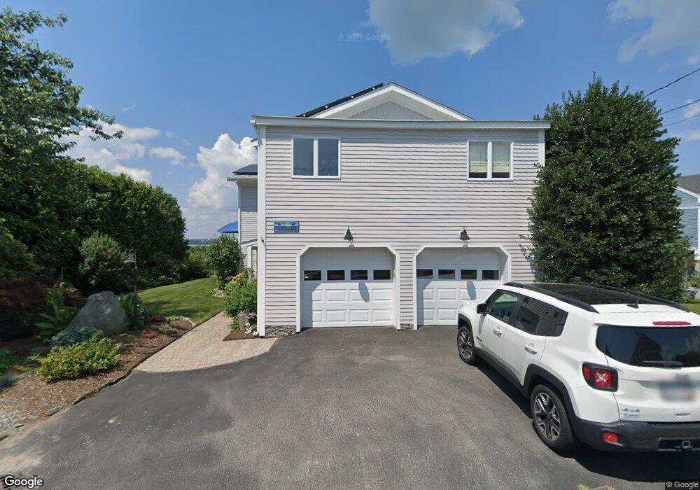
1342 Anthony Rd Portsmouth, RI 02871
Common Fence Point NeighborhoodEstimated Value: $818,366 - $1,319,000
2
Beds
2
Baths
1,512
Sq Ft
$698/Sq Ft
Est. Value
About This Home
This home is located at 1342 Anthony Rd, Portsmouth, RI 02871 and is currently estimated at $1,054,842, approximately $697 per square foot. 1342 Anthony Rd is a home located in Newport County with nearby schools including Portsmouth High School.
Ownership History
Date
Name
Owned For
Owner Type
Purchase Details
Closed on
Feb 11, 2019
Sold by
Allen Glenn D and Allen Raylene L
Bought by
Glenn Glenn D and Glenn R T
Current Estimated Value
Purchase Details
Closed on
Sep 30, 1977
Bought by
Allen Glenn D and Allen Raylene L
Create a Home Valuation Report for This Property
The Home Valuation Report is an in-depth analysis detailing your home's value as well as a comparison with similar homes in the area
Home Values in the Area
Average Home Value in this Area
Purchase History
| Date | Buyer | Sale Price | Title Company |
|---|---|---|---|
| Glenn Glenn D | -- | -- | |
| Allen Glenn D | $43,300 | -- |
Source: Public Records
Mortgage History
| Date | Status | Borrower | Loan Amount |
|---|---|---|---|
| Previous Owner | Allen Glenn D | $175,000 | |
| Previous Owner | Allen Glenn D | $190,000 |
Source: Public Records
Tax History Compared to Growth
Tax History
| Year | Tax Paid | Tax Assessment Tax Assessment Total Assessment is a certain percentage of the fair market value that is determined by local assessors to be the total taxable value of land and additions on the property. | Land | Improvement |
|---|---|---|---|---|
| 2025 | $11,057 | $832,600 | $492,100 | $340,500 |
| 2024 | $10,974 | $832,600 | $492,100 | $340,500 |
| 2023 | $10,641 | $832,600 | $492,100 | $340,500 |
| 2022 | $7,975 | $512,500 | $354,700 | $157,800 |
| 2021 | $7,846 | $512,500 | $354,700 | $157,800 |
| 2020 | $7,723 | $512,500 | $354,700 | $157,800 |
| 2019 | $8,182 | $498,900 | $292,100 | $206,800 |
| 2018 | $7,967 | $498,900 | $292,100 | $206,800 |
| 2017 | $7,693 | $498,900 | $292,100 | $206,800 |
| 2016 | $7,520 | $470,000 | $302,200 | $167,800 |
| 2015 | $7,426 | $470,000 | $302,200 | $167,800 |
| 2014 | $7,426 | $470,000 | $302,200 | $167,800 |
Source: Public Records
Map
Nearby Homes
- 1350 Anthony Rd
- 1055 Anthony Rd
- 0 Island Rd
- 169 Narragansett Blvd
- 0 Common Fence Blvd Unit 1364650
- 0 Common Fence Blvd Unit 1397142
- 134 Greenfield Ave
- 171 Leeshore Ln
- 83 Waters Edge Unit 24
- 87 Waters Edge
- 10 Mount Hope Ave
- 47 Watermark Dr
- 72 Rhode Island Blvd
- 24 Bismark Ave
- 9 Cutter Ln
- 0 Dighton Ave
- 42 Lewis St
- 15 Rocky Ave
- 898 Main Rd
- 896 Main Rd
- 1334 Anthony Rd
- 0 Mt View Terrace Unit 1135559
- 1326 Anthony Rd
- 1337 Anthony Rd
- 1345 Anthony Rd
- 1333 Anthony Rd
- 9 Mount View Rd
- 1321 Anthony Rd
- 1316 Anthony Rd
- 9 Mt Hope View Rd
- 1 Mount View Rd
- 1 Mount Hope View Rd
- 21 Mount Hope View Rd
- 21 Mount View Rd
- 31 Mount View Rd
- 17 Mount View Rd
- 1304 Anthony Rd
- 1309 Anthony Rd
- 1300 Anthony Rd
- 1303 Anthony Rd