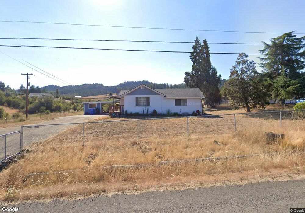
1342 Locust St Oakland, OR 97462
Estimated Value: $167,000 - $310,000
3
Beds
1
Bath
1,104
Sq Ft
$240/Sq Ft
Est. Value
About This Home
This home is located at 1342 Locust St, Oakland, OR 97462 and is currently estimated at $265,421, approximately $240 per square foot. 1342 Locust St is a home located in Douglas County with nearby schools including Oakland Elementary School, Lincoln Middle School, and Oakland High School.
Ownership History
Date
Name
Owned For
Owner Type
Purchase Details
Closed on
Jul 29, 2022
Sold by
Gerry Roberson
Bought by
Gerry D Roberson Living Trust
Current Estimated Value
Purchase Details
Closed on
Apr 24, 2014
Sold by
Thomas Eric M
Bought by
Roberson Gerry
Create a Home Valuation Report for This Property
The Home Valuation Report is an in-depth analysis detailing your home's value as well as a comparison with similar homes in the area
Home Values in the Area
Average Home Value in this Area
Purchase History
| Date | Buyer | Sale Price | Title Company |
|---|---|---|---|
| Gerry D Roberson Living Trust | -- | None Listed On Document | |
| Roberson Gerry | $60,001 | None Available |
Source: Public Records
Tax History Compared to Growth
Tax History
| Year | Tax Paid | Tax Assessment Tax Assessment Total Assessment is a certain percentage of the fair market value that is determined by local assessors to be the total taxable value of land and additions on the property. | Land | Improvement |
|---|---|---|---|---|
| 2024 | $1,202 | $138,842 | -- | -- |
| 2023 | $1,054 | $134,799 | $0 | $0 |
| 2022 | $1,023 | $130,873 | $0 | $0 |
| 2021 | $1,051 | $127,062 | $0 | $0 |
| 2020 | $1,023 | $123,362 | $0 | $0 |
| 2019 | $995 | $119,769 | $0 | $0 |
| 2018 | $968 | $116,281 | $0 | $0 |
| 2017 | $987 | $112,895 | $0 | $0 |
| 2016 | $958 | $109,607 | $0 | $0 |
| 2015 | $871 | $106,415 | $0 | $0 |
| 2014 | $845 | $103,316 | $0 | $0 |
| 2013 | -- | $100,307 | $0 | $0 |
Source: Public Records
Map
Nearby Homes
- 0 Locust St
- 134 SE 5th St
- 1858 Old Town Loop Rd
- 800 SE 5th St
- 413 SE Pear St
- 411 NE 1st St
- 312 SE Front St
- 106 Green Valley Rd
- 402 Northside Rd
- 1980 E Sixth Ave
- 839 Union Gap Loop Rd
- 660 Jade St
- 276 Union Gap Loop Rd
- 1175 Northside Rd
- 249 Union Gap Loop Rd
- 1762 E Fourth Ave
- 1545 E Fourth Ave
- 1555 Northside Rd
- 1234 E Fourth Ave
- 689 Sherwood Dr
- 1322 Locust St
- 1315 Locust St
- 1300 Locust St
- 1276 Locust St
- 1235 Locust St
- 1581 Oak St
- 1579 Oak St
- 1256 Locust St
- 1246 Locust St
- 140 Spencer Hill Ln
- 1541 Oak St
- 1583 Oak St
- 0 SE Locust St
- 1236 Locust St
- 121 Driver Valley Rd
- 1530 Oak St
- 1529 Oak St
- 1224 Locust St
- 150 Spencer Hill Ln
- 144 Spencer Hill Ln