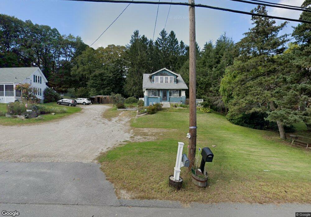
1342 Main St Leicester, MA 01524
Estimated Value: $356,334 - $412,000
3
Beds
2
Baths
1,514
Sq Ft
$252/Sq Ft
Est. Value
About This Home
This home is located at 1342 Main St, Leicester, MA 01524 and is currently estimated at $381,084, approximately $251 per square foot. 1342 Main St is a home located in Worcester County with nearby schools including Leicester Integrated Preschool, Leicester Memorial Elementary School, and Leicester Middle School.
Ownership History
Date
Name
Owned For
Owner Type
Purchase Details
Closed on
May 6, 2021
Sold by
Brennan Thomas V
Bought by
Brennan Ft 2021
Current Estimated Value
Purchase Details
Closed on
May 31, 2007
Sold by
Hunt Ann M
Bought by
Brennan Thomas
Home Financials for this Owner
Home Financials are based on the most recent Mortgage that was taken out on this home.
Original Mortgage
$184,000
Interest Rate
6.24%
Mortgage Type
Purchase Money Mortgage
Purchase Details
Closed on
Jan 17, 2003
Sold by
Morrill David L
Bought by
Hunt Ann M
Home Financials for this Owner
Home Financials are based on the most recent Mortgage that was taken out on this home.
Original Mortgage
$120,500
Interest Rate
6.18%
Mortgage Type
Purchase Money Mortgage
Create a Home Valuation Report for This Property
The Home Valuation Report is an in-depth analysis detailing your home's value as well as a comparison with similar homes in the area
Home Values in the Area
Average Home Value in this Area
Purchase History
| Date | Buyer | Sale Price | Title Company |
|---|---|---|---|
| Brennan Ft 2021 | -- | None Available | |
| Brennan Thomas | $230,000 | -- | |
| Hunt Ann M | $133,900 | -- |
Source: Public Records
Mortgage History
| Date | Status | Borrower | Loan Amount |
|---|---|---|---|
| Previous Owner | Brennan Thomas | $184,000 | |
| Previous Owner | Hunt Ann M | $120,500 |
Source: Public Records
Tax History Compared to Growth
Tax History
| Year | Tax Paid | Tax Assessment Tax Assessment Total Assessment is a certain percentage of the fair market value that is determined by local assessors to be the total taxable value of land and additions on the property. | Land | Improvement |
|---|---|---|---|---|
| 2025 | $31 | $264,000 | $65,600 | $198,400 |
| 2024 | $2,929 | $233,400 | $56,600 | $176,800 |
| 2023 | $2,798 | $217,600 | $56,600 | $161,000 |
| 2022 | $2,713 | $193,900 | $53,900 | $140,000 |
| 2021 | $2,857 | $188,800 | $53,900 | $134,900 |
| 2020 | $2,515 | $168,700 | $47,100 | $121,600 |
| 2019 | $2,355 | $156,200 | $42,400 | $113,800 |
| 2018 | $2,275 | $141,400 | $42,400 | $99,000 |
| 2017 | $2,189 | $141,400 | $42,400 | $99,000 |
| 2016 | $2,101 | $141,000 | $53,000 | $88,000 |
| 2015 | $2,050 | $141,000 | $53,000 | $88,000 |
Source: Public Records
Map
Nearby Homes
- 1326 Main St
- 0 Hawthorne St Unit 73444632
- 80 Rawson St
- 1472 Main St
- 56 Lake Sargent Dr
- 0 S Main St Unit 73392435
- 502 Pine St
- 27 Winslow Ave
- 19 Laurelwood Ave
- 10 Conway Dr
- 381 Pleasant St
- Lot B Paxton St
- Lot A Paxton St
- 135 Henshaw St
- 473 Pleasant St
- 500 Main St
- 164 Peter Salem Rd
- 2 Victor Ave
- 6 Pitcairn Ave
- 3 Flagg Dr
- 1340 Main St
- 1350 Main St
- 1326 Main St Unit 2
- 1326 Main St Unit 1
- 1355 Main St
- 1323 Main St
- 1312 Main St
- 1312 Main St Unit 1
- 1304 Main St
- 1296 Main St
- 1296 Main St Unit 2
- 1296 Main St Unit 1
- 30 Rawson St
- 22 Rawson St
- 1286 Main St
- 44 Rawson St
- 0 Auburn St Unit 70897675
- 0000 Confidential
- 0A Auburn St
- 0 Hawthorne St Unit 71262248