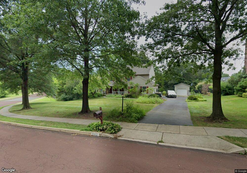
1342 Michael Way Lansdale, PA 19446
Estimated Value: $731,944 - $784,000
4
Beds
3
Baths
2,600
Sq Ft
$291/Sq Ft
Est. Value
About This Home
This home is located at 1342 Michael Way, Lansdale, PA 19446 and is currently estimated at $757,486, approximately $291 per square foot. 1342 Michael Way is a home located in Montgomery County with nearby schools including Walton Farm El School, Pennfield Middle School, and North Penn Senior High School.
Ownership History
Date
Name
Owned For
Owner Type
Purchase Details
Closed on
May 29, 2009
Sold by
Tepas Norine M and Tepas Dale B
Bought by
Lawrence Jody
Current Estimated Value
Home Financials for this Owner
Home Financials are based on the most recent Mortgage that was taken out on this home.
Original Mortgage
$35,000
Outstanding Balance
$22,292
Interest Rate
4.92%
Estimated Equity
$735,194
Purchase Details
Closed on
Jul 30, 1999
Sold by
Gorman Thomas J and Gorman Mary L
Bought by
Tepas Dale B and Tepas Norine M
Create a Home Valuation Report for This Property
The Home Valuation Report is an in-depth analysis detailing your home's value as well as a comparison with similar homes in the area
Home Values in the Area
Average Home Value in this Area
Purchase History
| Date | Buyer | Sale Price | Title Company |
|---|---|---|---|
| Lawrence Jody | $435,000 | None Available | |
| Tepas Dale B | $319,000 | -- |
Source: Public Records
Mortgage History
| Date | Status | Borrower | Loan Amount |
|---|---|---|---|
| Open | Lawrence Jody | $35,000 | |
| Open | Lawrence Jody | $348,000 |
Source: Public Records
Tax History Compared to Growth
Tax History
| Year | Tax Paid | Tax Assessment Tax Assessment Total Assessment is a certain percentage of the fair market value that is determined by local assessors to be the total taxable value of land and additions on the property. | Land | Improvement |
|---|---|---|---|---|
| 2025 | $10,138 | $250,310 | $100,940 | $149,370 |
| 2024 | $10,138 | $250,310 | $100,940 | $149,370 |
| 2023 | $9,710 | $250,310 | $100,940 | $149,370 |
| 2022 | $9,113 | $250,310 | $100,940 | $149,370 |
| 2021 | $8,850 | $250,310 | $100,940 | $149,370 |
| 2020 | $8,449 | $250,310 | $100,940 | $149,370 |
| 2019 | $8,302 | $250,310 | $100,940 | $149,370 |
| 2018 | $1,917 | $250,310 | $100,940 | $149,370 |
| 2017 | $7,971 | $250,310 | $100,940 | $149,370 |
| 2016 | $7,874 | $250,310 | $100,940 | $149,370 |
| 2015 | $7,545 | $250,310 | $100,940 | $149,370 |
| 2014 | $7,545 | $250,310 | $100,940 | $149,370 |
Source: Public Records
Map
Nearby Homes
- 1217A Crosshill Ct
- 912B Stockton Ct
- 1017 Winfield Ct
- 506 Clarella Ct
- 2110 Marshall Ct
- 2212 Mulberry Ct
- 2225 Mulberry Ct
- 2415 Hillock Ct
- 25 Chestnut Ct E
- 30 Greenbriar Ct
- 1116 Dogwood Ct
- 19 Wildbriar Ct
- 1653 Bridle Path Dr
- 10 Bentwood Ct W
- 24 Newbury Way
- 128 Wellington Terrace
- 2 Newbury Way
- 803 Poplar Ct
- 1825 Flintlock Cir
- 11 Elder Ct