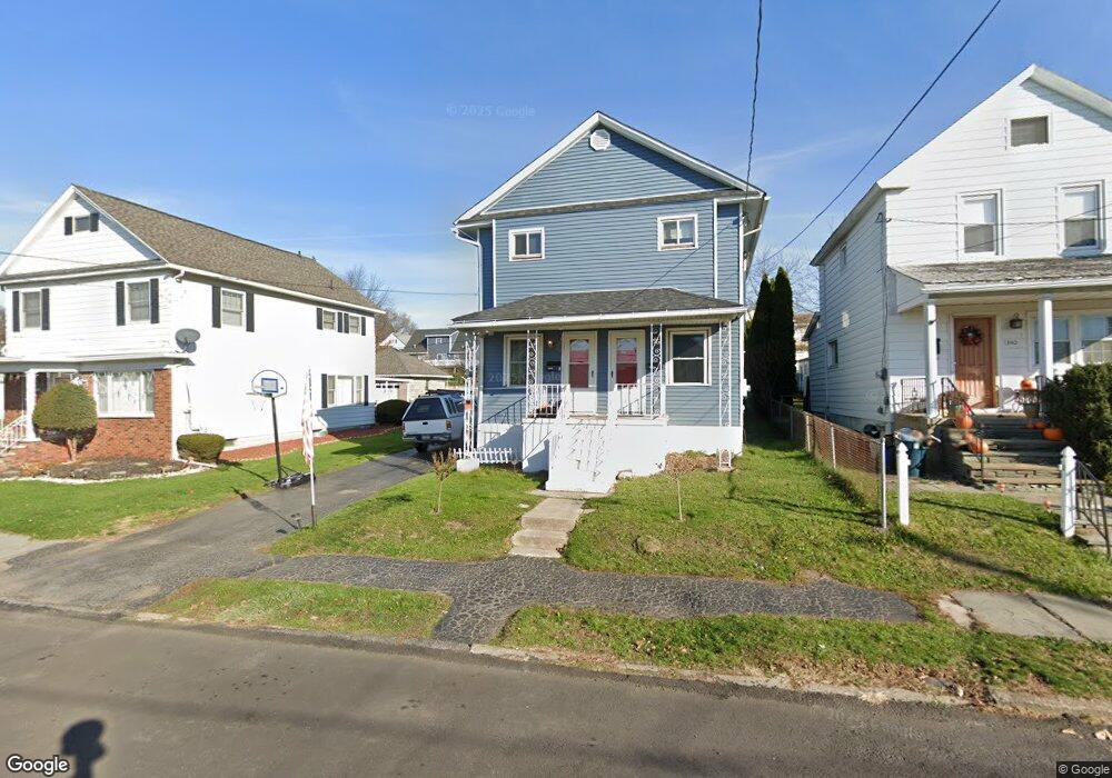
1342 Rundle St Unit 1344 Scranton, PA 18504
Hyde Park NeighborhoodEstimated Value: $164,218 - $368,000
--
Bed
--
Bath
--
Sq Ft
6,490
Sq Ft Lot
About This Home
This home is located at 1342 Rundle St Unit 1344, Scranton, PA 18504 and is currently estimated at $255,555. 1342 Rundle St Unit 1344 is a home located in Lackawanna County with nearby schools including Frances Willard School, West Scranton Intrmd School, and West Scranton High School.
Ownership History
Date
Name
Owned For
Owner Type
Purchase Details
Closed on
Jun 1, 2021
Sold by
Pietrzak Sylvia
Bought by
Prosper Abraham
Current Estimated Value
Purchase Details
Closed on
Mar 31, 2006
Sold by
Wall Thomas and Wall Robin N
Bought by
Pietrzak Sylvia A
Home Financials for this Owner
Home Financials are based on the most recent Mortgage that was taken out on this home.
Original Mortgage
$78,300
Interest Rate
11.02%
Mortgage Type
Commercial
Create a Home Valuation Report for This Property
The Home Valuation Report is an in-depth analysis detailing your home's value as well as a comparison with similar homes in the area
Home Values in the Area
Average Home Value in this Area
Purchase History
| Date | Buyer | Sale Price | Title Company |
|---|---|---|---|
| Prosper Abraham | $39,000 | None Available | |
| Pietrzak Sylvia A | $87,000 | None Available |
Source: Public Records
Mortgage History
| Date | Status | Borrower | Loan Amount |
|---|---|---|---|
| Previous Owner | Pietrzak Sylvia A | $78,300 |
Source: Public Records
Tax History Compared to Growth
Tax History
| Year | Tax Paid | Tax Assessment Tax Assessment Total Assessment is a certain percentage of the fair market value that is determined by local assessors to be the total taxable value of land and additions on the property. | Land | Improvement |
|---|---|---|---|---|
| 2025 | $2,298 | $7,000 | $1,350 | $5,650 |
| 2024 | $2,104 | $7,000 | $1,350 | $5,650 |
| 2023 | $2,104 | $7,000 | $1,350 | $5,650 |
| 2022 | $2,057 | $7,000 | $1,350 | $5,650 |
| 2021 | $2,057 | $7,000 | $1,350 | $5,650 |
| 2020 | $2,020 | $7,000 | $1,350 | $5,650 |
| 2019 | $1,901 | $7,000 | $1,350 | $5,650 |
| 2018 | $1,901 | $7,000 | $1,350 | $5,650 |
| 2017 | $1,868 | $7,000 | $1,350 | $5,650 |
| 2016 | $0 | $7,000 | $1,350 | $5,650 |
| 2015 | $1,410 | $7,000 | $1,350 | $5,650 |
| 2014 | -- | $7,000 | $1,350 | $5,650 |
Source: Public Records
Map
Nearby Homes
- 1411 Watson St
- LOT#15 Reynolds Ave
- 1301 Sloan St
- LOT#16 Reynolds Ave
- Lot# 7 Reynolds Ave
- 1449 Dartmouth St Unit 1449-51 L-13
- 1115 Watson St
- 1324 Dartmouth St
- 1106 Dartmouth St
- 924 S Main Ave
- 1105 W 05 1 2 Locust
- 1215 Eynon St
- 1223 Eynon St
- 1114 W Elm St
- 1114 W Elm St Unit L 6
- 1227-1229 Hampton St
- 1250 S 1252 6th
- 610 Landis St
- 1157-59 Hampton St
- 1009 1011 Acker Ave Unit L 109
- 1340 Rundle St
- 1348 Rundle St Unit 1350
- 1350 Rundle St
- 1336 Rear Rundle St
- 1336 Rundle St
- 1336 Rundle St Unit 1338
- 1334 Rundle St
- 1354 Rundle St
- 1330 Rundle St
- 1357 Watson St
- 1377 Watson St
- 1335 Watson St
- 1341 Rundle St
- 1339 Rundle St
- 1351 Rundle St
- 1335 Rundle St
- 1394 Rundle St
- 1328 Rundle St
- 1333 Rundle St
- 1325 Watson St