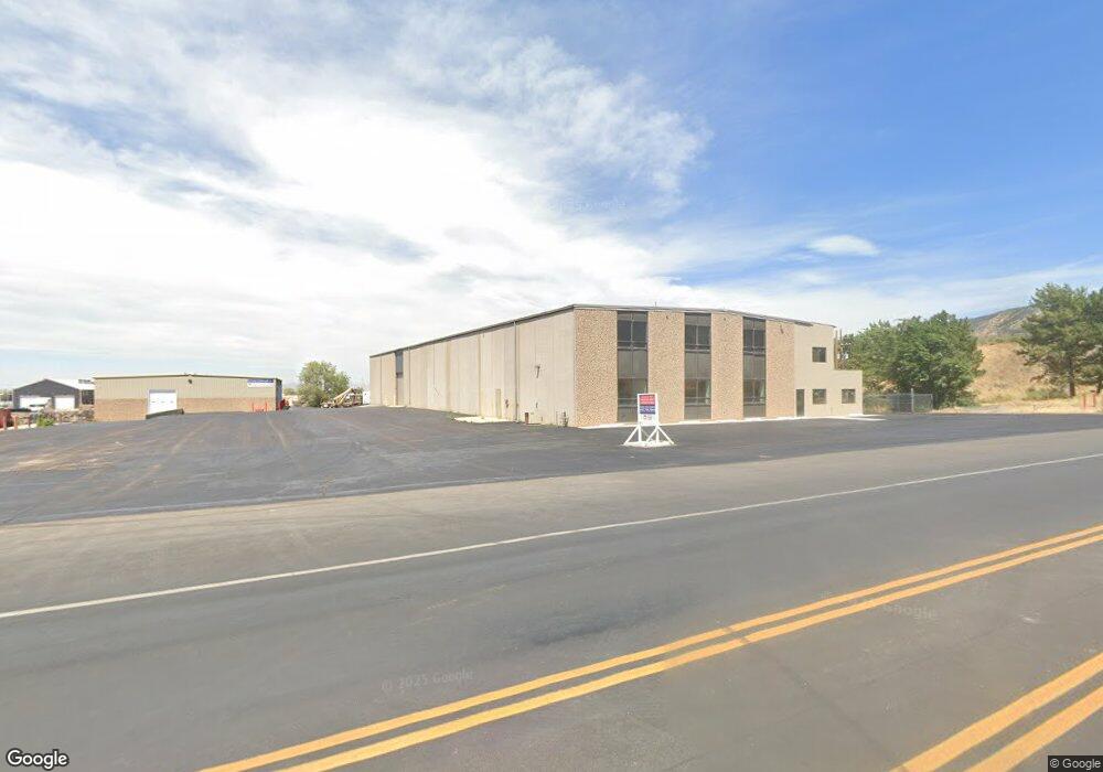
1342 W Industrial Rd Unit Building 2 Cedar City, UT 84721
--
Bed
--
Bath
9,600
Sq Ft
2.69
Acres
About This Home
This home is located at 1342 W Industrial Rd Unit Building 2, Cedar City, UT 84721. 1342 W Industrial Rd Unit Building 2 is a home located in Iron County with nearby schools including Cedar North School, Cedar Middle School, and Cedar City High School.
Ownership History
Date
Name
Owned For
Owner Type
Purchase Details
Closed on
Mar 5, 2025
Sold by
Truman Group Holdings Llc
Bought by
Vortex Warehousing Llc
Purchase Details
Closed on
Oct 8, 2024
Sold by
Destined Properties Llc
Bought by
Truman Group Holdings Llc
Purchase Details
Closed on
Apr 10, 2020
Sold by
Diamond Holdings Llc
Bought by
Destined Properties Llc
Home Financials for this Owner
Home Financials are based on the most recent Mortgage that was taken out on this home.
Original Mortgage
$990,000
Interest Rate
3.4%
Mortgage Type
Commercial
Purchase Details
Closed on
Jan 8, 2010
Sold by
Hardy Ronald L and Hardy Leslie E
Bought by
Diamond Holdings Llc
Create a Home Valuation Report for This Property
The Home Valuation Report is an in-depth analysis detailing your home's value as well as a comparison with similar homes in the area
Home Values in the Area
Average Home Value in this Area
Purchase History
| Date | Buyer | Sale Price | Title Company |
|---|---|---|---|
| Vortex Warehousing Llc | -- | Security Escrow & Title | |
| Vortex Warehousing Llc | -- | Security Escrow & Title | |
| Truman Group Holdings Llc | -- | Security Escrow & Title | |
| Destined Properties Llc | -- | Cedar Land Title Inc | |
| Diamond Holdings Llc | -- | -- |
Source: Public Records
Mortgage History
| Date | Status | Borrower | Loan Amount |
|---|---|---|---|
| Previous Owner | Destined Properties Llc | $990,000 |
Source: Public Records
Tax History Compared to Growth
Tax History
| Year | Tax Paid | Tax Assessment Tax Assessment Total Assessment is a certain percentage of the fair market value that is determined by local assessors to be the total taxable value of land and additions on the property. | Land | Improvement |
|---|---|---|---|---|
| 2025 | $14,012 | $1,801,464 | $309,653 | $1,491,811 |
| 2023 | $9,577 | $1,173,815 | $229,295 | $944,520 |
| 2022 | $10,377 | $1,128,835 | $229,295 | $899,540 |
| 2021 | $9,817 | $1,067,850 | $168,310 | $899,540 |
| 2020 | $9,855 | $950,520 | $168,310 | $782,210 |
| 2019 | $9,842 | $908,135 | $148,710 | $759,425 |
| 2018 | $10,176 | $908,135 | $148,710 | $759,425 |
| 2017 | $10,143 | $891,235 | $131,810 | $759,425 |
| 2016 | $10,048 | $822,200 | $131,810 | $690,390 |
| 2015 | $10,597 | $822,200 | $0 | $0 |
| 2014 | $15,965 | $1,158,570 | $0 | $0 |
Source: Public Records
Map
Nearby Homes
- 1120 Bulloch Cir
- 374 N 1500 W
- 364 N 1500 W
- 325 N 1500 W
- 6333 N 1600 W
- 0 1 Af Water (Wr # 73-999) Unit 25-265506
- 4961 N 900 W Unit lot 68
- 4973 N 900 W Unit lot 69
- 465 N 800 W Unit 3
- 465 N 800 W Unit 7
- 465 N 800 W Unit 2
- 73-4650 1 Acft
- 272 N 1500 W
- 240 N 1400 W
- 4.12 Acre Water Rights
- 2904 W Oak Springs Rd
- 147.9141 Acre Ft Water Right 73-1201
- 960 N 1400 W
- 495 N 2150 W
- 1.75 Acres 200 North Corner Lot Unit Zoned Commercial
- Un.23 Ph.2 1400 W Industrial Rd
- Un.4 Ph.1 1400 W Industrial Rd
- Un.22 Ph.2 1400 W Industrial Rd
- Un.16 Ph.2 1400 W Industrial Rd
- Un.8 Ph.2 1400 W Industrial Rd
- Un.6 Ph.2 1400 W Industrial Rd
- Un.3 Ph.1 1400 W Industrial Rd
- Un.5 Ph.2 1400 W Industrial Rd
- Un.15 Ph.2 1400 W Industrial Rd
- Un.7 Ph.2 1400 W Industrial Rd
- Un.14 Ph.2 1400 W Industrial Rd
- Un.20 Ph.2 1400 W Industrial Rd
- Un.19 Ph.2 1400 W Industrial Rd
- Un.10 Ph.2 1400 W Industrial Rd
- Un.17 Ph.2 1400 W Industrial Rd
- 576 N 1450 W
- 574 N 1450 W
- 574 N 1450 W
- Un.18 Ph.2 1400 W Industrial Rd
- 572 N 1450 W