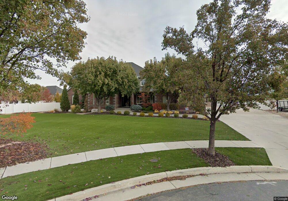
1342 White Sands Ln Syracuse, UT 84075
Estimated Value: $1,431,000 - $2,244,295
6
Beds
5
Baths
7,680
Sq Ft
$228/Sq Ft
Est. Value
About This Home
This home is located at 1342 White Sands Ln, Syracuse, UT 84075 and is currently estimated at $1,750,432, approximately $227 per square foot. 1342 White Sands Ln is a home located in Davis County with nearby schools including Bluff Ridge Elementary, Legacy Junior High School, and Clearfield High School.
Ownership History
Date
Name
Owned For
Owner Type
Purchase Details
Closed on
Aug 13, 2014
Sold by
Rich Doug and Rich Doug D
Bought by
Nance Scott G
Current Estimated Value
Home Financials for this Owner
Home Financials are based on the most recent Mortgage that was taken out on this home.
Original Mortgage
$630,000
Outstanding Balance
$478,971
Interest Rate
4.11%
Mortgage Type
New Conventional
Estimated Equity
$1,271,461
Purchase Details
Closed on
Dec 8, 2004
Sold by
Rich Homestead Llc
Bought by
Rich Doug
Purchase Details
Closed on
Jun 1, 2004
Sold by
International Commercial Properties Llc
Bought by
Rich Development Inc and Buy Direct Inc
Home Financials for this Owner
Home Financials are based on the most recent Mortgage that was taken out on this home.
Original Mortgage
$95,000
Interest Rate
5.92%
Mortgage Type
Purchase Money Mortgage
Purchase Details
Closed on
Mar 12, 2003
Sold by
Rich Douglas D and Rich Alicia
Bought by
Rich Homestead Llc
Purchase Details
Closed on
Oct 15, 2001
Sold by
Rainey Homes Inc
Bought by
Rich Douglas D and Rich Alicia
Home Financials for this Owner
Home Financials are based on the most recent Mortgage that was taken out on this home.
Original Mortgage
$72,335
Interest Rate
6.87%
Create a Home Valuation Report for This Property
The Home Valuation Report is an in-depth analysis detailing your home's value as well as a comparison with similar homes in the area
Home Values in the Area
Average Home Value in this Area
Purchase History
| Date | Buyer | Sale Price | Title Company |
|---|---|---|---|
| Nance Scott G | -- | Cottonwood Title | |
| Rich Doug | -- | -- | |
| Rich Development Inc | -- | Westland Title Insurance Age | |
| International Commercial Properties Llc | -- | Westland Title Insurance Age | |
| Rich Development Inc | -- | Westland Title Insurance Age | |
| Rich Homestead Llc | -- | -- | |
| Rich Douglas D | -- | Heritage West Title Insuranc |
Source: Public Records
Mortgage History
| Date | Status | Borrower | Loan Amount |
|---|---|---|---|
| Open | Nance Scott G | $630,000 | |
| Previous Owner | International Commercial Properties Llc | $95,000 | |
| Previous Owner | Rich Development Inc | $198,000 | |
| Previous Owner | Rich Douglas D | $72,335 | |
| Closed | Rich Douglas D | $23,750 | |
| Closed | International Commercial Properties Llc | $198,000 |
Source: Public Records
Tax History Compared to Growth
Tax History
| Year | Tax Paid | Tax Assessment Tax Assessment Total Assessment is a certain percentage of the fair market value that is determined by local assessors to be the total taxable value of land and additions on the property. | Land | Improvement |
|---|---|---|---|---|
| 2025 | $11,137 | $1,074,479 | $262,387 | $812,092 |
| 2024 | $10,473 | $1,017,264 | $249,744 | $767,520 |
| 2023 | $9,388 | $1,599,000 | $295,599 | $1,303,401 |
| 2022 | $8,633 | $796,400 | $172,299 | $624,101 |
| 2021 | $7,576 | $1,073,000 | $262,983 | $810,017 |
| 2020 | $6,182 | $846,000 | $209,589 | $636,411 |
| 2019 | $6,158 | $836,000 | $219,048 | $616,952 |
| 2018 | $5,266 | $707,000 | $197,416 | $509,584 |
| 2016 | $4,508 | $336,865 | $83,975 | $252,890 |
| 2015 | $4,783 | $340,385 | $83,975 | $256,410 |
| 2014 | $4,871 | $353,264 | $77,344 | $275,920 |
| 2013 | -- | $324,223 | $81,587 | $242,636 |
Source: Public Records
Map
Nearby Homes
- 1280 W 2800 S
- 2480 S 1150 W
- 1137 W 2500 S
- 2766 S 1200 W
- 1315 W 2325 S
- 1295 W 2325 S
- 1306 W 2325 S
- 1286 W 2325 S
- 2742 S Allison Way Unit 212
- 2355 S 1230 W
- 1196 W 2325 S
- 1156 W 2325 S
- 2958 S 1320 W
- 2734 S Allison Way Unit 213
- 1667 W 2770 S Unit 206
- 1116 W 2325 S
- 1137 2275 S
- 1137 W 2275 S
- 921 W 2700 S
- 2232 S 1000 W
- 1342 W 2615 S
- 1339 W 2615 S
- 1339 White Sands Ln
- 1378 W 2615 S
- 1378 W 2615 S Unit 9
- 1378 White Sands Ln
- 2543 S 1300 W
- 2543 S 1300 W Unit 30
- 2530 S 1375 W
- 2530 S 1375 W Unit 38
- 2532 S 1300 W
- 2532 S 1300 W Unit 31
- 2525 S 1375 W
- 2525 S 1375 W Unit 39
- 1377 White Sands Ln
- 1377 W 2615 S
- 1346 W 2700 S
- 1328 W 2700 S
- 1424 W 2615 S
- 2531 S 1300 W