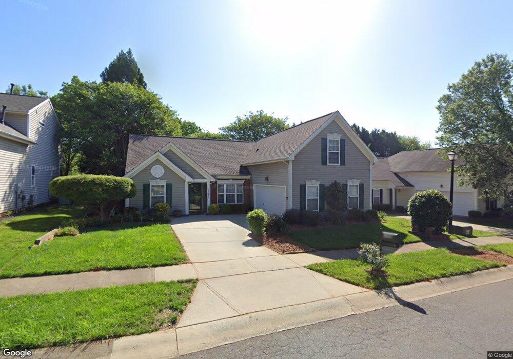
13420 Philip Michael Rd Huntersville, NC 28078
Estimated Value: $377,873 - $416,000
3
Beds
2
Baths
1,466
Sq Ft
$271/Sq Ft
Est. Value
About This Home
This home is located at 13420 Philip Michael Rd, Huntersville, NC 28078 and is currently estimated at $397,718, approximately $271 per square foot. 13420 Philip Michael Rd is a home located in Mecklenburg County with nearby schools including Torrence Creek Elementary School, Francis Bradley Middle School, and Hopewell High.
Ownership History
Date
Name
Owned For
Owner Type
Purchase Details
Closed on
Dec 30, 2005
Sold by
Sweet Susan E
Bought by
Flowers Emma
Current Estimated Value
Home Financials for this Owner
Home Financials are based on the most recent Mortgage that was taken out on this home.
Original Mortgage
$129,600
Outstanding Balance
$72,197
Interest Rate
6.12%
Mortgage Type
Fannie Mae Freddie Mac
Estimated Equity
$325,521
Purchase Details
Closed on
Feb 6, 2002
Sold by
Eastwood Construction Co Inc
Bought by
Sweet Susan E
Home Financials for this Owner
Home Financials are based on the most recent Mortgage that was taken out on this home.
Original Mortgage
$116,790
Interest Rate
7.16%
Purchase Details
Closed on
Jul 27, 2001
Sold by
Eastwood Development Corp
Bought by
Eastwood Construction Co Inc
Create a Home Valuation Report for This Property
The Home Valuation Report is an in-depth analysis detailing your home's value as well as a comparison with similar homes in the area
Home Values in the Area
Average Home Value in this Area
Purchase History
| Date | Buyer | Sale Price | Title Company |
|---|---|---|---|
| Flowers Emma | $162,000 | None Available | |
| Sweet Susan E | $157,000 | -- | |
| Eastwood Construction Co Inc | $137,500 | -- |
Source: Public Records
Mortgage History
| Date | Status | Borrower | Loan Amount |
|---|---|---|---|
| Open | Flowers Emma | $129,600 | |
| Previous Owner | Sweet Susan E | $116,790 |
Source: Public Records
Tax History Compared to Growth
Tax History
| Year | Tax Paid | Tax Assessment Tax Assessment Total Assessment is a certain percentage of the fair market value that is determined by local assessors to be the total taxable value of land and additions on the property. | Land | Improvement |
|---|---|---|---|---|
| 2025 | $2,674 | $347,600 | $75,000 | $272,600 |
| 2024 | $2,674 | $347,600 | $75,000 | $272,600 |
| 2023 | $2,455 | $347,600 | $75,000 | $272,600 |
| 2022 | $1,867 | $198,600 | $50,000 | $148,600 |
| 2021 | $1,850 | $198,600 | $50,000 | $148,600 |
| 2020 | $1,825 | $198,600 | $50,000 | $148,600 |
| 2019 | $1,819 | $198,600 | $50,000 | $148,600 |
| 2018 | $1,736 | $144,000 | $32,000 | $112,000 |
| 2017 | $1,710 | $144,000 | $32,000 | $112,000 |
| 2016 | $1,706 | $144,000 | $32,000 | $112,000 |
| 2015 | $1,703 | $144,000 | $32,000 | $112,000 |
| 2014 | $1,701 | $0 | $0 | $0 |
Source: Public Records
Map
Nearby Homes
- 15263 Eric Kyle Dr
- 13708 Huntson Park Ln
- 14658 Laura Michelle Rd
- 12047 Huntson Reserve Rd
- 13519 Huntson Park Ln
- 12019 Huntson Reserve Rd
- 15020 Ranson Rd
- 9534 Blossom Hill Dr
- Cambridge Plan at Rosedale
- Berkshire Plan at Rosedale
- Berkley Plan at Rosedale
- 9923 Ansonborough Square
- 9929 Ansonborough Square
- 9927 Ansonborough Square
- Shenandoah Plan at Roseshire Chase
- Voyageur Plan at Roseshire Chase
- 14917 Alexander Place Dr
- 14207 Hudson Park Ln
- 8515 Shadetree St
- 9969 Cask Way
- 13416 Philip Michael Rd
- 13424 Philip Michael Rd
- 15239 Eric Kyle Dr
- 15245 Eric Kyle Dr
- 13412 Philip Michael Rd
- 13504 Philip Michael Rd
- 15233 Eric Kyle Dr
- 13419 Philip Michael Rd
- 15251 Eric Kyle Dr
- 13425 Philip Michael Rd
- 13415 Philip Michael Rd
- 15227 Eric Kyle Dr
- 13508 Philip Michael Rd
- 13406 Philip Michael Rd
- 13505 Philip Michael Rd
- 13411 Philip Michael Rd
- 15257 Eric Kyle Dr
- 15221 Eric Kyle Dr
- 13509 Philip Michael Rd
- 13407 Philip Michael Rd