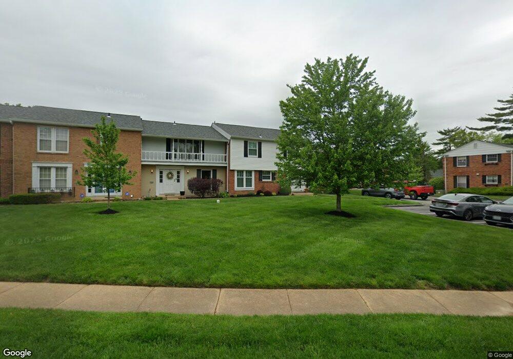
13423 Land O Woods Dr Unit 2A Saint Louis, MO 63141
Estimated Value: $237,776 - $258,000
3
Beds
3
Baths
1,769
Sq Ft
$139/Sq Ft
Est. Value
About This Home
This home is located at 13423 Land O Woods Dr Unit 2A, Saint Louis, MO 63141 and is currently estimated at $245,194, approximately $138 per square foot. 13423 Land O Woods Dr Unit 2A is a home located in St. Louis County with nearby schools including River Bend Elementary School, Parkway Central Middle School, and Parkway Central High School.
Ownership History
Date
Name
Owned For
Owner Type
Purchase Details
Closed on
Jun 9, 2025
Sold by
Collins Michael T and Collins Lorraine
Bought by
Lorraine And Michael Collins Revocable Living and Collins
Current Estimated Value
Purchase Details
Closed on
Mar 27, 2009
Sold by
Collins Michael T and Collins Lorraine
Bought by
Collins Michael T and Collins Lorraine
Home Financials for this Owner
Home Financials are based on the most recent Mortgage that was taken out on this home.
Original Mortgage
$144,791
Interest Rate
5.16%
Mortgage Type
Stand Alone Refi Refinance Of Original Loan
Purchase Details
Closed on
Oct 12, 2007
Sold by
The Heirs At Laws Or Devisees Of Katheri
Bought by
Collins Michael T
Home Financials for this Owner
Home Financials are based on the most recent Mortgage that was taken out on this home.
Original Mortgage
$138,800
Interest Rate
6.23%
Mortgage Type
Purchase Money Mortgage
Create a Home Valuation Report for This Property
The Home Valuation Report is an in-depth analysis detailing your home's value as well as a comparison with similar homes in the area
Home Values in the Area
Average Home Value in this Area
Purchase History
| Date | Buyer | Sale Price | Title Company |
|---|---|---|---|
| Lorraine And Michael Collins Revocable Living | -- | None Listed On Document | |
| Collins Michael T | -- | None Available | |
| Collins Michael T | $173,500 | Sec |
Source: Public Records
Mortgage History
| Date | Status | Borrower | Loan Amount |
|---|---|---|---|
| Previous Owner | Collins Michael T | $144,791 | |
| Previous Owner | Collins Michael T | $138,800 |
Source: Public Records
Tax History Compared to Growth
Tax History
| Year | Tax Paid | Tax Assessment Tax Assessment Total Assessment is a certain percentage of the fair market value that is determined by local assessors to be the total taxable value of land and additions on the property. | Land | Improvement |
|---|---|---|---|---|
| 2025 | $2,593 | $45,290 | $17,820 | $27,470 |
| 2024 | $2,593 | $38,990 | $7,390 | $31,600 |
| 2023 | $2,593 | $38,990 | $7,390 | $31,600 |
| 2022 | $2,299 | $32,760 | $11,100 | $21,660 |
| 2021 | $2,290 | $32,760 | $11,100 | $21,660 |
| 2020 | $2,155 | $29,590 | $8,400 | $21,190 |
| 2019 | $2,108 | $29,590 | $8,400 | $21,190 |
| 2018 | $1,934 | $25,140 | $4,710 | $20,430 |
| 2017 | $1,882 | $25,140 | $4,710 | $20,430 |
| 2016 | $1,902 | $24,150 | $5,380 | $18,770 |
| 2015 | $1,993 | $24,150 | $5,380 | $18,770 |
| 2014 | $1,690 | $21,850 | $5,050 | $16,800 |
Source: Public Records
Map
Nearby Homes
- 13430 Manorlac Dr
- 13449 Manorlac Dr Unit 9D
- 13489 Beaulac Dr
- 13417 Forestlac Dr
- 857 Coalport Dr
- 56 Forest Crest Dr
- 13314 Wood Chapel Dr
- 13312 Wood Chapel Dr
- 13573 Coliseum Dr
- 13579 Coliseum Dr Unit G
- 13555 Coliseum Dr Unit G
- 13515 Coliseum Dr Unit E
- 13515 Coliseum Dr Unit A
- 13503 Coliseum Dr
- 13232 Dartagnan Ct
- 1121 Matador Dr Unit 1
- 809 Aramis Dr
- 13209 Matador Dr Unit 3
- 1239 Creve Coeur Crossing Ln Unit C
- 1202 Creve Coeur Crossing Ln Unit G
- 13427 Land O Woods Dr Unit 2B
- 13431 Land O Woods Dr
- 13435 Land O Woods Dr
- 13416 Manorlac Dr Unit 10D
- 13428 Manorlac Dr
- 13420 Manorlac Dr
- 13424 Manorlac Dr Unit 10B
- 13447 Land O Woods Dr Unit 2B
- 13451 Land O Woods Dr Unit C
- 13443 Land O Woods Dr
- 13419 Land O Woods Dr Unit 7
- 13419 Land O Woods Dr Unit 6
- 13419 Land O Woods Dr Unit 8
- 13419 Land O Woods Dr Unit 4
- 13419 Land O Woods Dr Unit 1
- 13419 Land O Woods Dr Unit 2
- 13419 Land O Woods Dr Unit 5
- 13419 Land O Woods Dr Unit 3
- 13419 Land O Woods Dr Unit 3D
- 13415 Land O Woods Dr Unit 2