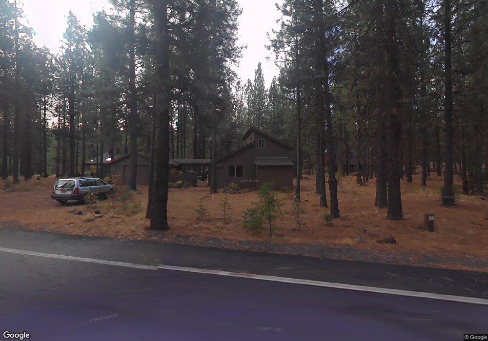
13427 Hawksbeard Rd Sisters, OR 97759
Estimated Value: $698,000 - $759,000
3
Beds
2
Baths
1,221
Sq Ft
$604/Sq Ft
Est. Value
About This Home
This home is located at 13427 Hawksbeard Rd, Sisters, OR 97759 and is currently estimated at $737,069, approximately $603 per square foot. 13427 Hawksbeard Rd is a home located in Deschutes County with nearby schools including Sisters Elementary School, Sisters Middle School, and Sisters High School.
Ownership History
Date
Name
Owned For
Owner Type
Purchase Details
Closed on
Sep 25, 2012
Sold by
Curran Daniel E
Bought by
Steeck Karl M and Steeck Janice Curran
Current Estimated Value
Purchase Details
Closed on
Sep 14, 2012
Sold by
Curran Patrick J
Bought by
Steeck Karl M and Steeck Janice Curran
Purchase Details
Closed on
Sep 12, 2012
Sold by
Mulqueen Judith H
Bought by
Steeck Karl M and Steeck Janice Curran
Purchase Details
Closed on
Apr 1, 2010
Sold by
Cieslinski Robert C
Bought by
Cieslinski James L and Valla Kathleen R
Purchase Details
Closed on
Feb 8, 2010
Sold by
Feltz Eugene E
Bought by
Curran Daniel Edward and Mulqueen Judith Helen
Create a Home Valuation Report for This Property
The Home Valuation Report is an in-depth analysis detailing your home's value as well as a comparison with similar homes in the area
Home Values in the Area
Average Home Value in this Area
Purchase History
| Date | Buyer | Sale Price | Title Company |
|---|---|---|---|
| Steeck Karl M | $9,523 | None Available | |
| Steeck Karl M | $9,523 | None Available | |
| Steeck Karl M | -- | None Available | |
| Steeck Karl M | $76,667 | None Available | |
| Steeck Karl M | $76,667 | None Available | |
| Steeck Karl M | $9,523 | None Available | |
| Cieslinski James L | -- | None Available | |
| Curran Daniel Edward | -- | None Available |
Source: Public Records
Tax History Compared to Growth
Tax History
| Year | Tax Paid | Tax Assessment Tax Assessment Total Assessment is a certain percentage of the fair market value that is determined by local assessors to be the total taxable value of land and additions on the property. | Land | Improvement |
|---|---|---|---|---|
| 2025 | $6,470 | $400,310 | -- | -- |
| 2024 | $6,123 | $388,660 | -- | -- |
| 2023 | $5,875 | $377,340 | $0 | $0 |
| 2022 | $5,456 | $355,680 | $0 | $0 |
| 2021 | $5,513 | $345,330 | $0 | $0 |
| 2020 | $5,232 | $345,330 | $0 | $0 |
| 2019 | $5,073 | $335,280 | $0 | $0 |
| 2018 | $4,935 | $325,520 | $0 | $0 |
| 2017 | $4,766 | $316,040 | $0 | $0 |
| 2016 | $4,682 | $306,840 | $0 | $0 |
| 2015 | $4,429 | $297,910 | $0 | $0 |
| 2014 | $4,271 | $289,240 | $0 | $0 |
Source: Public Records
Map
Nearby Homes
- 70780 Bitter Root
- 13579 Sundew Unit SM34
- 13584 Nine Bark
- 70948 Mules Ear
- 13251 Snowbrush Unit GH 266
- 13400 Foxtail Unit GCC 101
- 13400 Foxtail Unit GCC83
- 13400 Foxtail Unit 99
- 13582 Hollyhock Unit BBH13
- 13168 Hawks Beard Unit GH 133
- 70410 Mcallister Rd Unit 2060
- 71059 Bracken Ln Unit GH 91A
- 70661 Steeple Bush Unit SM202
- 70701 Pasque Flower Unit SM94
- 70786 Blazing Star Unit RR 64
- 70474 Alum Root
- 70440 Linnaea Borealis Unit GM395
- 70305 Arvensis Unit GM 348
- 70332 Sword Fern Unit GM 245
- 13699 Speedwell Unit GM90
- 13427 Hawks Beard - Sh8
- 13427 Hawks Beard Sh 8
- 70841 Hyacinth
- 70828 Purslane
- 70828-SH 7 Purslane
- 70828 Purslane Unit SH 7
- 70819 Hyacinth
- 70828 Purslane
- 70828 Purslane
- 70820 Purslane Unit SH6
- 70820 Purslane
- 70820 Purslane
- 70820 Purslane
- 13428 Hawks Beard
- 70848 Sego Lily
- 13436 Hawks Beard
- 13442 Hawks Beard
- 70820 Hyacinth
- 70815 Hyacinth Sh22
- 70815 Hyacinth Sh 22