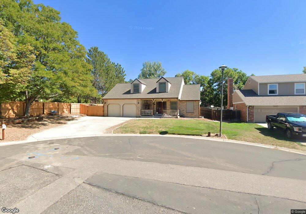
13428 Monroe Cir Thornton, CO 80241
Estimated Value: $525,205 - $588,000
3
Beds
3
Baths
1,904
Sq Ft
$286/Sq Ft
Est. Value
About This Home
This home is located at 13428 Monroe Cir, Thornton, CO 80241 and is currently estimated at $544,801, approximately $286 per square foot. 13428 Monroe Cir is a home located in Adams County with nearby schools including Tarver Elementary School, Century Middle School, and Horizon High School.
Ownership History
Date
Name
Owned For
Owner Type
Purchase Details
Closed on
Mar 27, 2015
Sold by
Dinges Randy James and Dinges Nanette S
Bought by
Dinges Family Living Trust
Current Estimated Value
Create a Home Valuation Report for This Property
The Home Valuation Report is an in-depth analysis detailing your home's value as well as a comparison with similar homes in the area
Home Values in the Area
Average Home Value in this Area
Purchase History
| Date | Buyer | Sale Price | Title Company |
|---|---|---|---|
| Dinges Family Living Trust | -- | None Available |
Source: Public Records
Tax History Compared to Growth
Tax History
| Year | Tax Paid | Tax Assessment Tax Assessment Total Assessment is a certain percentage of the fair market value that is determined by local assessors to be the total taxable value of land and additions on the property. | Land | Improvement |
|---|---|---|---|---|
| 2024 | $3,334 | $31,070 | $6,880 | $24,190 |
| 2023 | $3,300 | $35,920 | $6,900 | $29,020 |
| 2022 | $2,829 | $25,680 | $7,090 | $18,590 |
| 2021 | $2,923 | $25,680 | $7,090 | $18,590 |
| 2020 | $2,840 | $25,460 | $7,290 | $18,170 |
| 2019 | $2,846 | $25,460 | $7,290 | $18,170 |
| 2018 | $2,594 | $22,540 | $7,200 | $15,340 |
| 2017 | $2,358 | $22,540 | $7,200 | $15,340 |
| 2016 | $1,999 | $18,600 | $4,140 | $14,460 |
| 2015 | $1,996 | $18,600 | $4,140 | $14,460 |
| 2014 | $1,878 | $17,010 | $3,340 | $13,670 |
Source: Public Records
Map
Nearby Homes
- 13540 Detroit St
- 13080 Harrison Dr
- 13068 Harrison Dr
- 13606 Garfield St Unit E
- 2788 E 132nd Cir
- 3007 E 131st Way
- 13346 Birch Cir
- 13638 Garfield St Unit B
- 13638 Garfield St Unit C
- 2691 E 132nd Ave
- 13263 Clermont Cir
- 3022 E 137th Place
- 8346 E 135th Ct
- 2746 E 132nd Place
- 12814 Jackson Cir
- 2883 E 136th Place
- 13758 Cook St
- 13022 Bellaire St
- 3850 E 128th Way
- 13844 Jackson St
- 13418 Monroe Cir
- 13437 Monroe Cir
- 13425 Garfield Ct
- 13415 Garfield Ct
- 13408 Monroe Cir
- 13438 Monroe St
- 13427 Monroe Cir
- 13405 Garfield Ct
- 13434 Garfield Ct
- 3600 E 134th Dr
- 13417 Monroe Cir
- 13442 Monroe St
- 13447 Monroe St
- 13407 Monroe Cir
- 3608 E 134th Dr
- 13424 Garfield Ct
- 13414 Garfield Ct
- 3590 E 134th Dr
- 3604 E 134th Way
- 13449 Monroe St