Estimated Value: $737,000 - $782,000
4
Beds
3
Baths
2,907
Sq Ft
$259/Sq Ft
Est. Value
About This Home
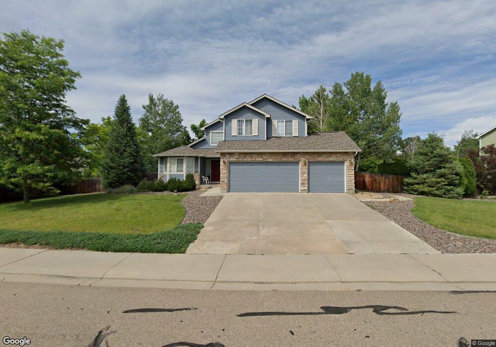
This home is located at 1343 Nonaham Ln, Erie, CO 80516 and is currently estimated at $751,729, approximately $258 per square foot. 1343 Nonaham Ln is a home located in Boulder County with nearby schools including Erie Elementary School, Erie Middle School, and Erie High School.
Ownership History
Date
Name
Owned For
Owner Type
Purchase Details
Closed on
Jan 25, 2012
Sold by
Bakke Paul S and Bakke Susan J
Bought by
Ludwig Eric
Current Estimated Value
Home Financials for this Owner
Home Financials are based on the most recent Mortgage that was taken out on this home.
Original Mortgage
$217,600
Outstanding Balance
$149,862
Interest Rate
4%
Mortgage Type
New Conventional
Estimated Equity
$601,867
Purchase Details
Closed on
Dec 27, 1999
Sold by
Carlson Daniel R and Carlson Shawna M
Bought by
Bakke Paul S
Home Financials for this Owner
Home Financials are based on the most recent Mortgage that was taken out on this home.
Original Mortgage
$193,600
Interest Rate
7.69%
Purchase Details
Closed on
Jul 12, 1999
Sold by
Melody Homes Inc
Bought by
Carlson Daniel R
Home Financials for this Owner
Home Financials are based on the most recent Mortgage that was taken out on this home.
Original Mortgage
$182,000
Interest Rate
7.39%
Create a Home Valuation Report for This Property
The Home Valuation Report is an in-depth analysis detailing your home's value as well as a comparison with similar homes in the area
Home Values in the Area
Average Home Value in this Area
Purchase History
| Date | Buyer | Sale Price | Title Company |
|---|---|---|---|
| Ludwig Eric | $272,000 | Fidelity National Title Insu | |
| Bakke Paul S | $242,000 | -- | |
| Carlson Daniel R | $216,675 | Land Title |
Source: Public Records
Mortgage History
| Date | Status | Borrower | Loan Amount |
|---|---|---|---|
| Open | Ludwig Eric | $217,600 | |
| Previous Owner | Bakke Paul S | $193,600 | |
| Previous Owner | Carlson Daniel R | $182,000 |
Source: Public Records
Tax History Compared to Growth
Tax History
| Year | Tax Paid | Tax Assessment Tax Assessment Total Assessment is a certain percentage of the fair market value that is determined by local assessors to be the total taxable value of land and additions on the property. | Land | Improvement |
|---|---|---|---|---|
| 2025 | $5,015 | $43,963 | $18,444 | $25,519 |
| 2024 | $5,015 | $43,963 | $18,444 | $25,519 |
| 2023 | $4,959 | $43,785 | $24,542 | $22,927 |
| 2022 | $4,186 | $35,361 | $15,526 | $19,835 |
| 2021 | $4,260 | $36,379 | $15,973 | $20,406 |
| 2020 | $3,932 | $33,655 | $10,010 | $23,645 |
| 2019 | $3,921 | $33,655 | $10,010 | $23,645 |
| 2018 | $3,562 | $30,514 | $14,040 | $16,474 |
| 2017 | $3,400 | $33,734 | $15,522 | $18,212 |
| 2016 | $3,308 | $28,982 | $21,014 | $7,968 |
| 2015 | $3,175 | $23,164 | $7,005 | $16,159 |
| 2014 | $2,594 | $23,164 | $7,005 | $16,159 |
Source: Public Records
Map
Nearby Homes
- 1166 St John St
- 1366 Padfield Place
- 1202 Allen Ave
- 1376 Banner Cir
- 1475 Davis Ct
- 1020 Village Cir Unit 1014
- 1183 Richards Ct
- 1309 Banner Cir
- 881 Meadowlark Dr
- 885 Delechant Dr
- 890 Meadowlark Dr
- 785 Delechant Dr
- 740 Meadowlark Dr
- 729 E County Line Rd
- 787 Turner St
- 781 Turner St
- 769 Turner St
- 751 Turner St
- 12640 Jay Rd
- 757 Cheesman St
- 1325 Nonaham Ln
- 1363 Nonaham Ln
- 1342 Kanemoto Ln
- 1330 Nonaham Ln
- 1346 Nonaham Ln
- 1302 Kanemoto Ln
- 1307 Nonaham Ln
- 1328 Kanemoto Ln
- 1314 Nonaham Ln
- 1362 Nonaham Ln
- 1298 Nonaham Ln
- 1316 Kanemoto Ln
- 1349 Kanemoto Ln
- 1365 Kanemoto Ln
- 1313 Kanemoto Way
- 1348 Kanemoto Way
- 1315 Kanemoto Ln
- 1332 Kanemoto Way
- 1285 Kanemoto Way
- 1419 Lombardi St