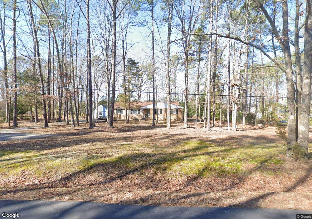
13430 Hensley Rd Midlothian, VA 23112
Estimated Value: $379,280 - $430,000
4
Beds
2
Baths
1,960
Sq Ft
$207/Sq Ft
Est. Value
About This Home
This home is located at 13430 Hensley Rd, Midlothian, VA 23112 and is currently estimated at $405,070, approximately $206 per square foot. 13430 Hensley Rd is a home located in Chesterfield County with nearby schools including Spring Run Elementary School, Bailey Bridge Middle School, and Manchester High.
Ownership History
Date
Name
Owned For
Owner Type
Purchase Details
Closed on
Jun 27, 2006
Sold by
Powers Harvey W
Bought by
Powers Harvey S
Current Estimated Value
Home Financials for this Owner
Home Financials are based on the most recent Mortgage that was taken out on this home.
Original Mortgage
$181,000
Outstanding Balance
$107,158
Interest Rate
6.6%
Mortgage Type
New Conventional
Estimated Equity
$297,912
Purchase Details
Closed on
Feb 15, 2002
Bought by
Powers Harvey W and Powers Lois P
Home Financials for this Owner
Home Financials are based on the most recent Mortgage that was taken out on this home.
Original Mortgage
$25,000
Interest Rate
7.14%
Mortgage Type
New Conventional
Create a Home Valuation Report for This Property
The Home Valuation Report is an in-depth analysis detailing your home's value as well as a comparison with similar homes in the area
Home Values in the Area
Average Home Value in this Area
Purchase History
| Date | Buyer | Sale Price | Title Company |
|---|---|---|---|
| Powers Harvey S | $240,000 | -- | |
| Powers Harvey W | -- | -- |
Source: Public Records
Mortgage History
| Date | Status | Borrower | Loan Amount |
|---|---|---|---|
| Open | Powers Harvey S | $181,000 | |
| Previous Owner | Powers Harvey W | $25,000 |
Source: Public Records
Tax History
| Year | Tax Paid | Tax Assessment Tax Assessment Total Assessment is a certain percentage of the fair market value that is determined by local assessors to be the total taxable value of land and additions on the property. | Land | Improvement |
|---|---|---|---|---|
| 2025 | $2,864 | $319,000 | $73,300 | $245,700 |
| 2024 | $2,864 | $307,400 | $70,300 | $237,100 |
| 2023 | $2,567 | $282,100 | $65,300 | $216,800 |
| 2022 | $2,473 | $268,800 | $60,300 | $208,500 |
| 2021 | $2,425 | $248,300 | $58,300 | $190,000 |
| 2020 | $2,297 | $241,800 | $58,300 | $183,500 |
| 2019 | $2,199 | $231,500 | $56,300 | $175,200 |
| 2018 | $2,157 | $227,000 | $56,300 | $170,700 |
| 2017 | $2,047 | $213,200 | $55,300 | $157,900 |
| 2016 | $1,969 | $205,100 | $54,300 | $150,800 |
| 2015 | $1,873 | $192,500 | $52,300 | $140,200 |
| 2014 | $1,851 | $190,200 | $50,300 | $139,900 |
Source: Public Records
Map
Nearby Homes
- 12900 Craftsbury Ct
- 9400 Kinnerton Dr
- 14225 Ashmill Dr
- 14537 Parracombe Ln
- 13924 Spyglass Hill Cir
- 10119 Cravensford Terrace
- 14001 Palomino Way
- 9024 Spyglass Hill Turn
- 10302 Teelin Ct
- 13306 Prince James Dr
- 13201 Derryveach Dr
- 16801 Copperland Ct
- 16807 Copperland Ct
- 16901 Farthing Ct
- 9013 Lavenham Place
- 13800 Summerlook Ln
- 9411 Poly Place
- 13619 Brandy Oaks Rd
- 7706 Northern Dancer Ct
- 8801 Thornton Heath Dr
- 13420 Hensley Rd
- 13440 Hensley Rd
- 10019 Craftsbury Dr
- 10024 Craftsbury Dr
- 10013 Craftsbury Dr
- 10018 Craftsbury Dr
- 13410 Hensley Rd
- 13019 Craftsbury Dr
- 12924 Craftsbury Ct
- 10007 Craftsbury Dr
- 12918 Craftsbury Ct
- 10012 Craftsbury Dr
- 9919 Maidstone Ct
- 9913 Maidstone Ct
- 12912 Craftsbury Ct
- 10006 Craftsbury Dr
- 13411 Hensley Rd
- 12925 Craftsbury Ct
- 13431 Hensley Rd
- 13450 Hensley Rd
Your Personal Tour Guide
Ask me questions while you tour the home.