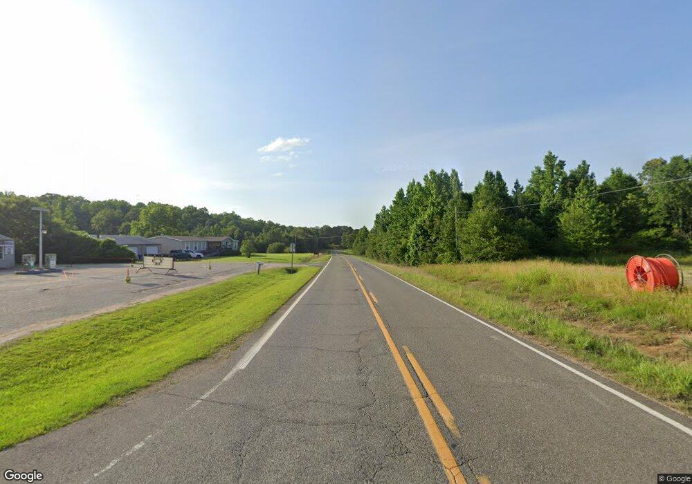
13439 Highway 69 N Northport, AL 35475
Estimated Value: $301,000 - $443,000
3
Beds
2
Baths
1,986
Sq Ft
$184/Sq Ft
Est. Value
About This Home
This home is located at 13439 Highway 69 N, Northport, AL 35475 and is currently estimated at $364,770, approximately $183 per square foot. 13439 Highway 69 N is a home located in Tuscaloosa County with nearby schools including Huntington Place Elementary School, Echols Middle School, and Tuscaloosa County High School.
Ownership History
Date
Name
Owned For
Owner Type
Purchase Details
Closed on
Aug 25, 2020
Sold by
Cabiness Billy J
Bought by
Cabiness Billy Joe and Billy Joe Cabiness Rev Trust
Current Estimated Value
Purchase Details
Closed on
Jul 12, 2011
Sold by
Hulsey James R
Bought by
Cabiness Lillian T and Cabiness Billy J
Home Financials for this Owner
Home Financials are based on the most recent Mortgage that was taken out on this home.
Original Mortgage
$326,000
Interest Rate
4.53%
Mortgage Type
Commercial
Purchase Details
Closed on
Oct 14, 2005
Sold by
Smith Jeffery W
Bought by
Cook Jack and Cook Phyllis
Create a Home Valuation Report for This Property
The Home Valuation Report is an in-depth analysis detailing your home's value as well as a comparison with similar homes in the area
Home Values in the Area
Average Home Value in this Area
Purchase History
| Date | Buyer | Sale Price | Title Company |
|---|---|---|---|
| Cabiness Billy Joe | $447,000 | -- | |
| Cabiness Lillian T | $295,000 | -- | |
| Cook Jack | $222,595 | -- |
Source: Public Records
Mortgage History
| Date | Status | Borrower | Loan Amount |
|---|---|---|---|
| Previous Owner | Cabiness Lillian T | $326,000 |
Source: Public Records
Tax History Compared to Growth
Tax History
| Year | Tax Paid | Tax Assessment Tax Assessment Total Assessment is a certain percentage of the fair market value that is determined by local assessors to be the total taxable value of land and additions on the property. | Land | Improvement |
|---|---|---|---|---|
| 2024 | $2,021 | $63,980 | $5,340 | $58,640 |
| 2023 | $2,021 | $59,180 | $5,340 | $53,840 |
| 2022 | $1,654 | $52,520 | $5,340 | $47,180 |
| 2021 | $1,534 | $49,200 | $8,040 | $41,160 |
| 2020 | $1,386 | $44,580 | $8,040 | $36,540 |
| 2019 | $1,413 | $45,420 | $8,040 | $37,380 |
| 2018 | $1,413 | $45,420 | $8,040 | $37,380 |
| 2017 | $1,270 | $0 | $0 | $0 |
| 2016 | $1,207 | $0 | $0 | $0 |
| 2015 | $1,228 | $0 | $0 | $0 |
| 2014 | $1,228 | $39,640 | $8,040 | $31,600 |
Source: Public Records
Map
Nearby Homes
- 11321 Belle Meade Way
- 11408 Belle Meade Way
- 1407 Belle Meade Blvd
- 11825 Belle Meade Cir
- 11220 Davis Place
- 11157 Davis Place
- 11151 Davis Place
- 11411 Stella Way
- 11264 Dooley Cir
- 11445 Canetuck Ln
- 11545 Howard Ave
- 10885 Landers Dr
- 13519 Margaret Way
- 13589 Margaret Way
- 13963 Prince William Way
- 13764 Charlotte Cir Unit 1-B
- 14029 Briar Meadow Ln
- 14041 Briar Meadow Ln
- 13822 Margaret Way
- 11291 Kindling Dr
- 13453 Highway 69 N
- 13481 Highway 69 N
- 13495 Highway 69 N
- 13391 Highway 69 N
- 13397 Highway 69 N
- 13387 Highway 69 N
- 1000 Belle Meade Blvd
- 1006 Belle Meade Blvd Unit 64
- 1006 Belle Meade Blvd
- 11507 Belle Meade Ave Unit 61
- 13365 Highway 69 N
- 1012 Belle Meade Blvd Unit 65
- 1012 Belle Meade Blvd
- 11501 Belle Meade Ave
- 1104 Belle Meade Blvd
- 11423 Belle Meade Ave
- 13371 Lakewood Loop
- 1110 Belle Meade Blvd
- 1005 Belle Meade Blvd Unit 56
- 1005 Belle Meade Blvd
