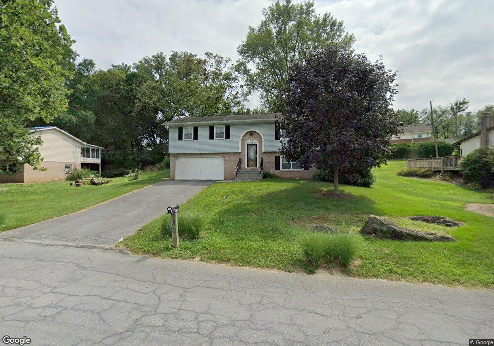
1344 Fieldstead Ln Lancaster, PA 17603
West Lancaster NeighborhoodEstimated Value: $303,231 - $374,000
3
Beds
2
Baths
1,138
Sq Ft
$298/Sq Ft
Est. Value
About This Home
This home is located at 1344 Fieldstead Ln, Lancaster, PA 17603 and is currently estimated at $339,058, approximately $297 per square foot. 1344 Fieldstead Ln is a home located in Lancaster County with nearby schools including Smith-Wade-El Elementary School, Wheatland Middle School, and McCaskey High School.
Ownership History
Date
Name
Owned For
Owner Type
Purchase Details
Closed on
Dec 1, 2006
Sold by
Mcfadden Ernest E and Mcfadden Dora L
Bought by
Werhel Sharon R
Current Estimated Value
Home Financials for this Owner
Home Financials are based on the most recent Mortgage that was taken out on this home.
Original Mortgage
$147,492
Outstanding Balance
$88,426
Interest Rate
6.36%
Mortgage Type
Purchase Money Mortgage
Estimated Equity
$250,632
Create a Home Valuation Report for This Property
The Home Valuation Report is an in-depth analysis detailing your home's value as well as a comparison with similar homes in the area
Home Values in the Area
Average Home Value in this Area
Purchase History
| Date | Buyer | Sale Price | Title Company |
|---|---|---|---|
| Werhel Sharon R | $161,300 | None Available |
Source: Public Records
Mortgage History
| Date | Status | Borrower | Loan Amount |
|---|---|---|---|
| Open | Werhel Sharon R | $147,492 |
Source: Public Records
Tax History Compared to Growth
Tax History
| Year | Tax Paid | Tax Assessment Tax Assessment Total Assessment is a certain percentage of the fair market value that is determined by local assessors to be the total taxable value of land and additions on the property. | Land | Improvement |
|---|---|---|---|---|
| 2025 | $3,934 | $136,400 | $50,100 | $86,300 |
| 2024 | $3,934 | $136,400 | $50,100 | $86,300 |
| 2023 | $3,843 | $136,400 | $50,100 | $86,300 |
| 2022 | $3,614 | $136,400 | $50,100 | $86,300 |
| 2021 | $3,505 | $136,400 | $50,100 | $86,300 |
| 2020 | $3,505 | $136,400 | $50,100 | $86,300 |
| 2019 | $3,430 | $136,400 | $50,100 | $86,300 |
| 2018 | $2,472 | $136,400 | $50,100 | $86,300 |
| 2017 | $3,756 | $114,900 | $35,800 | $79,100 |
| 2016 | $3,687 | $114,900 | $35,800 | $79,100 |
| 2015 | $498 | $114,900 | $35,800 | $79,100 |
| 2014 | $2,638 | $114,900 | $35,800 | $79,100 |
Source: Public Records
Map
Nearby Homes
- 1303 Cheves Place
- 506 Big Bend Rd
- 303 Perry Ave
- 1252 Elm Ave
- 515 Big Bend Rd
- 203 Greyfield Dr
- 105 School House Rd
- 102 Clearfield Ct E
- 1266 Wilson Ave
- 338 Atkins Ave
- 103 Jemfield Ct
- 115 Pheasant Ridge Cir
- 110 Clearfield Ct E
- 114 Pheasant Ridge Cir
- 80 School House Rd
- 215 Fawn Meadow Crossing
- 112 Harvard Ave
- 120 Atkins Ave
- 1011 Maple Ave
- 102 Arrowwood Ct
- 1342 Fieldstead Ln
- 1346 Fieldstead Ln
- 1515 Springside Dr
- 1513 Springside Dr
- 1517 Springside Dr
- 1337 Fieldstead Ln
- 1341 Fieldstead Ln
- 1511 Springside Dr
- 1331 Fieldstead Ln
- 1345 Fieldstead Ln
- 1329 Fieldstead Ln
- 1411 Fieldstead Ln
- 1509 Springside Dr
- 1359 Fieldstead Ln
- 1519 Springside Dr
- 1324 Belle Valley Rd
- 1512 Springside Dr
- 1326 Belle Valley Rd
- 1514 Springside Dr
- 1325 Fieldstead Ln