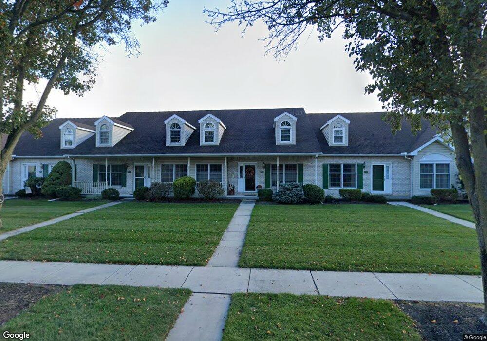
1344 Georgetown Cir Carlisle, PA 17013
Estimated Value: $331,000 - $384,000
2
Beds
2
Baths
1,882
Sq Ft
$188/Sq Ft
Est. Value
About This Home
This home is located at 1344 Georgetown Cir, Carlisle, PA 17013 and is currently estimated at $353,502, approximately $187 per square foot. 1344 Georgetown Cir is a home located in Cumberland County with nearby schools including Mooreland Elementary School, Lamberton Middle School, and Carlisle Area High School.
Ownership History
Date
Name
Owned For
Owner Type
Purchase Details
Closed on
Nov 1, 2001
Sold by
Huebner Fredrick G
Bought by
Boyle Joan D
Current Estimated Value
Home Financials for this Owner
Home Financials are based on the most recent Mortgage that was taken out on this home.
Original Mortgage
$50,000
Outstanding Balance
$19,686
Interest Rate
6.82%
Estimated Equity
$333,816
Create a Home Valuation Report for This Property
The Home Valuation Report is an in-depth analysis detailing your home's value as well as a comparison with similar homes in the area
Home Values in the Area
Average Home Value in this Area
Purchase History
| Date | Buyer | Sale Price | Title Company |
|---|---|---|---|
| Boyle Joan D | $169,900 | -- |
Source: Public Records
Mortgage History
| Date | Status | Borrower | Loan Amount |
|---|---|---|---|
| Open | Boyle Joan D | $50,000 |
Source: Public Records
Tax History Compared to Growth
Tax History
| Year | Tax Paid | Tax Assessment Tax Assessment Total Assessment is a certain percentage of the fair market value that is determined by local assessors to be the total taxable value of land and additions on the property. | Land | Improvement |
|---|---|---|---|---|
| 2025 | $5,421 | $230,200 | $45,400 | $184,800 |
| 2024 | $5,265 | $230,200 | $45,400 | $184,800 |
| 2023 | $5,025 | $230,200 | $45,400 | $184,800 |
| 2022 | $4,953 | $230,200 | $45,400 | $184,800 |
| 2021 | $4,882 | $230,200 | $45,400 | $184,800 |
| 2020 | $4,779 | $230,200 | $45,400 | $184,800 |
| 2019 | $4,679 | $230,200 | $45,400 | $184,800 |
| 2018 | $4,579 | $230,200 | $45,400 | $184,800 |
| 2017 | $4,488 | $230,200 | $45,400 | $184,800 |
| 2016 | -- | $230,200 | $45,400 | $184,800 |
| 2015 | -- | $230,200 | $45,400 | $184,800 |
| 2014 | -- | $230,200 | $45,400 | $184,800 |
Source: Public Records
Map
Nearby Homes
- 1339 Georgetown Cir
- 911 Walnut St
- 1215 Georgetown Cir
- 808 Walnut Ln
- 3 Baird Ct
- 500 Belvedere St
- 628 Yorkshire Dr
- 628 Belvedere St
- 670 W Louther St
- 901 Stratford Dr
- 124 Conway St
- 13 Shillington Ln
- 250 Mooreland Ave
- 412 W South St
- Carter Plan at Grange - Single Family
- Corby Plan at Grange - Single Family
- Arundel Plan at Grange - Single Family
- Royston Plan at Grange - Single Family
- Elgin Plan at Grange - Single Family
- Anders Plan at Grange - Single Family
- 1342 Georgetown Cir
- 1346 Georgetown Cir
- 1348 Georgetown Cir
- 1340 Georgetown Cir
- 1350 Georgetown Cir
- 1338 Georgetown Cir
- 1336 Georgetown Cir
- 1206 White Birch Ln
- 1208 White Birch Ln
- 1204 White Birch Ln
- 1202 White Birch Ln
- 1210 White Birch Ln
- 1334 Georgetown Cir
- 1200 White Birch Ln
- 1361 Georgetown Cir
- 1363 Georgetown Cir
- 1359 Georgetown Cir
- 1212 White Birch Ln
- 1365 Georgetown Cir
- 1357 Georgetown Cir