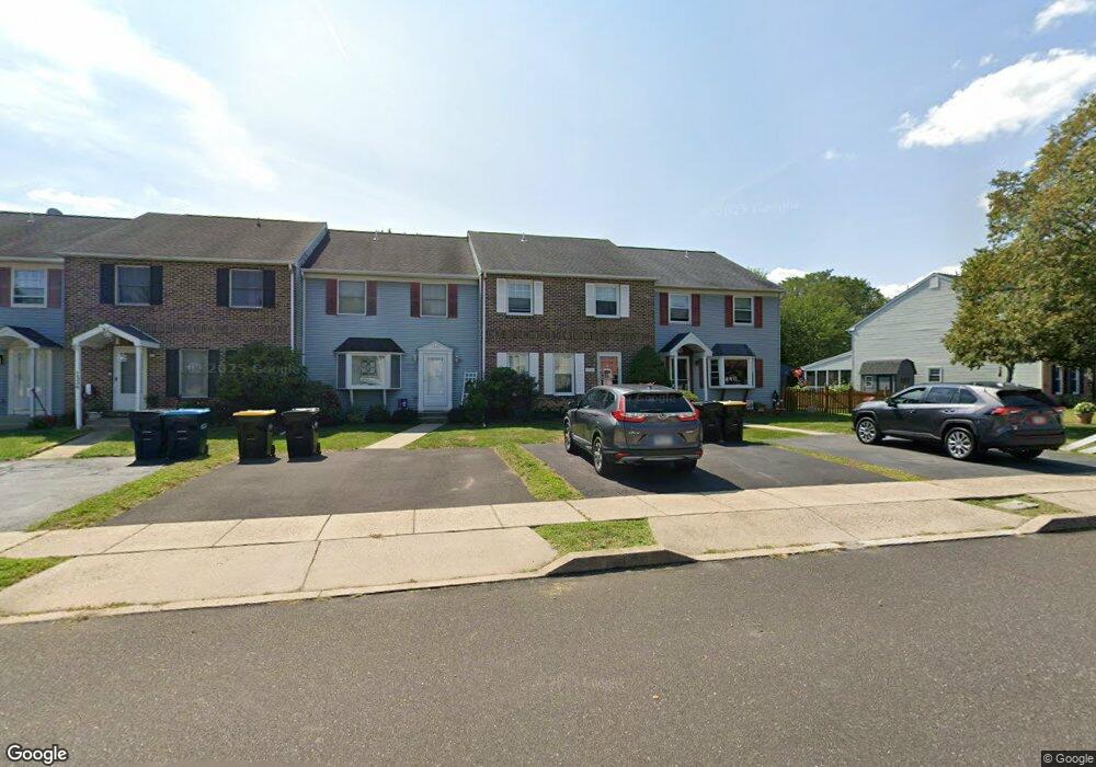
1344 Needham Cir Hatfield, PA 19440
Estimated Value: $360,000 - $380,000
3
Beds
2
Baths
1,672
Sq Ft
$221/Sq Ft
Est. Value
About This Home
This home is located at 1344 Needham Cir, Hatfield, PA 19440 and is currently estimated at $368,891, approximately $220 per square foot. 1344 Needham Cir is a home located in Montgomery County with nearby schools including A. M. Kulp Elementary School, Pennfield Middle School, and North Penn Senior High School.
Ownership History
Date
Name
Owned For
Owner Type
Purchase Details
Closed on
Sep 24, 2007
Sold by
Serianni Gloria A
Bought by
Alam Mohammed and Farhana Mehedi
Current Estimated Value
Home Financials for this Owner
Home Financials are based on the most recent Mortgage that was taken out on this home.
Original Mortgage
$25,000
Outstanding Balance
$15,917
Interest Rate
6.59%
Estimated Equity
$352,974
Purchase Details
Closed on
Apr 30, 1997
Sold by
Stevens Raymond J
Bought by
Serianni Gloria A
Create a Home Valuation Report for This Property
The Home Valuation Report is an in-depth analysis detailing your home's value as well as a comparison with similar homes in the area
Home Values in the Area
Average Home Value in this Area
Purchase History
| Date | Buyer | Sale Price | Title Company |
|---|---|---|---|
| Alam Mohammed | $227,000 | None Available | |
| Serianni Gloria A | $110,000 | -- |
Source: Public Records
Mortgage History
| Date | Status | Borrower | Loan Amount |
|---|---|---|---|
| Open | Alam Mohammed | $25,000 | |
| Open | Alam Mohammed | $179,300 |
Source: Public Records
Tax History
| Year | Tax Paid | Tax Assessment Tax Assessment Total Assessment is a certain percentage of the fair market value that is determined by local assessors to be the total taxable value of land and additions on the property. | Land | Improvement |
|---|---|---|---|---|
| 2025 | $4,287 | $107,060 | $13,420 | $93,640 |
| 2024 | $4,287 | $107,060 | $13,420 | $93,640 |
| 2023 | $4,103 | $107,060 | $13,420 | $93,640 |
| 2022 | $3,969 | $107,060 | $13,420 | $93,640 |
| 2021 | $3,856 | $107,060 | $13,420 | $93,640 |
| 2020 | $3,765 | $107,060 | $13,420 | $93,640 |
| 2019 | $3,702 | $107,060 | $13,420 | $93,640 |
Source: Public Records
Map
Nearby Homes
- 1148 Independence Way
- 15 Maple Ave
- 4595 County Line Rd
- 2732 Valley Woods Rd
- 331 Village Way
- 2296 Bramble Gate Dr
- 0 Fairmount St
- 1695 Latch String Ln
- 1943 Linden Ln
- 165 Township Line Rd
- 2092 Hawthorne Ln
- 722 Hilltown Pike
- 2331 Cambridge Cir
- 52 Arbor Cir
- 83 Bethlehem Pike Unit 1306- HAMILTON PLAN
- 83 Bethlehem Pike Unit 1405
- 83 Bethlehem Pike Unit 1111
- 83 Bethlehem Pike Unit 1213 FIRESTONE
- 83 Bethlehem Pike Unit 1106- MADISON PLAN
- 83 Bethlehem Pike Unit 1102- IVY FLOORPLAN
- 1340 Needham Cir
- 1348 Needham Cir
- 1336 Needham Cir
- 1332 Needham Cir
- 1372 Needham Cir
- 1376 Needham Cir
- 1376 Needham Cir Unit 1376
- 1380 Needham Cir
- 1470 Needham Cir
- 1474 Needham Cir
- 1466 Needham Cir
- 1276 Needham Cir
- 1482 Needham Cir
- 1462 Needham Cir
- 1268 Needham Cir
- 1384 Needham Cir
- 1260 Needham Cir
- 1343 Needham Cir
- 1347 Needham Cir
- 1252 Needham Cir
Your Personal Tour Guide
Ask me questions while you tour the home.