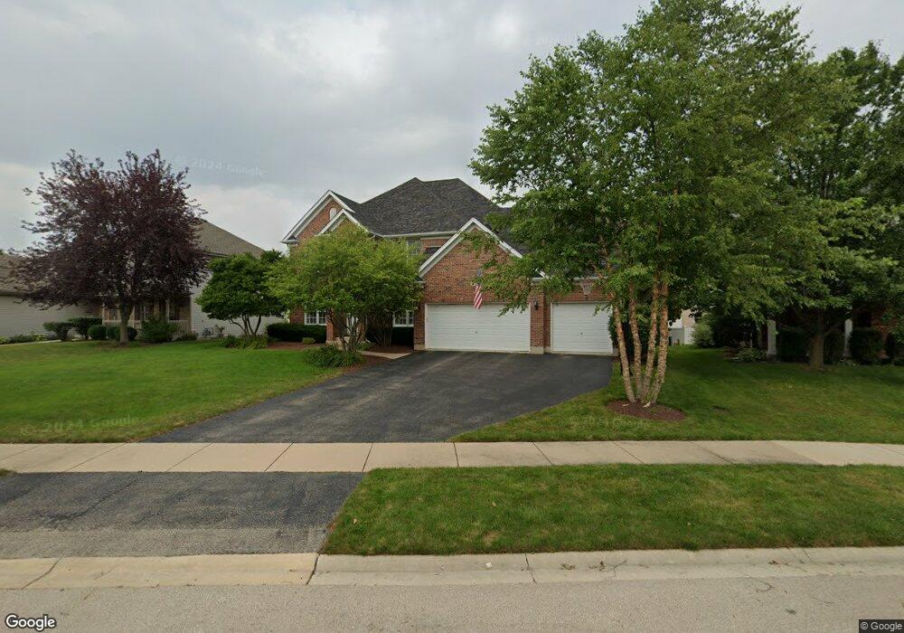
13445 Blackstone Ln Plainfield, IL 60585
North Plainfield NeighborhoodEstimated Value: $558,784 - $589,000
4
Beds
3
Baths
3,052
Sq Ft
$188/Sq Ft
Est. Value
About This Home
This home is located at 13445 Blackstone Ln, Plainfield, IL 60585 and is currently estimated at $574,196, approximately $188 per square foot. 13445 Blackstone Ln is a home located in Will County with nearby schools including Eagle Pointe Elementary School, Heritage Grove Middle School, and Plainfield North High School.
Ownership History
Date
Name
Owned For
Owner Type
Purchase Details
Closed on
Jul 20, 2005
Sold by
Gabryszewski Jerry J and Gabryszewski Robyn L
Bought by
Eller Nicholas J and Eller Theresa M
Current Estimated Value
Purchase Details
Closed on
Mar 10, 2004
Sold by
First Midwest Bank
Bought by
Gabryszewski Jerry J and Conway Robyn L
Home Financials for this Owner
Home Financials are based on the most recent Mortgage that was taken out on this home.
Original Mortgage
$305,438
Interest Rate
3.5%
Mortgage Type
Purchase Money Mortgage
Create a Home Valuation Report for This Property
The Home Valuation Report is an in-depth analysis detailing your home's value as well as a comparison with similar homes in the area
Home Values in the Area
Average Home Value in this Area
Purchase History
| Date | Buyer | Sale Price | Title Company |
|---|---|---|---|
| Eller Nicholas J | $395,000 | Ticor Title Insurance Compan | |
| Gabryszewski Jerry J | $382,000 | Chicago Title Insurance Co |
Source: Public Records
Mortgage History
| Date | Status | Borrower | Loan Amount |
|---|---|---|---|
| Previous Owner | Gabryszewski Jerry J | $305,438 |
Source: Public Records
Tax History
| Year | Tax Paid | Tax Assessment Tax Assessment Total Assessment is a certain percentage of the fair market value that is determined by local assessors to be the total taxable value of land and additions on the property. | Land | Improvement |
|---|---|---|---|---|
| 2024 | $12,279 | $176,717 | $36,830 | $139,887 |
| 2023 | $12,279 | $156,110 | $32,535 | $123,575 |
| 2022 | $10,484 | $136,819 | $30,778 | $106,041 |
| 2021 | $10,099 | $130,303 | $29,312 | $100,991 |
| 2020 | $10,092 | $128,239 | $28,848 | $99,391 |
| 2019 | $9,941 | $124,625 | $28,035 | $96,590 |
| 2018 | $9,150 | $112,995 | $27,418 | $85,577 |
| 2017 | $9,904 | $119,238 | $26,710 | $92,528 |
| 2016 | $9,928 | $116,671 | $26,135 | $90,536 |
| 2015 | $10,393 | $112,184 | $25,130 | $87,054 |
| 2014 | $10,393 | $117,622 | $25,130 | $92,492 |
| 2013 | $10,393 | $117,622 | $25,130 | $92,492 |
Source: Public Records
Map
Nearby Homes
- 13066 S Sydney Cir
- 25004 Chelsea Ln
- 24331 Norwood Dr
- 24535 W Beckham Cir
- 12854 S Sydney Cir
- 2912 Savana Dr
- 2921 Savana Dr
- 2915 Savana Dr
- 2908 Savana Dr
- 2916 Savana Dr
- 2917 Savana Dr
- 13018 S Sydney Cir
- 12966 S Twin Pines Ln
- 12938 S Beckham Dr
- 12901 S Twin Pines Ln
- 12950 S Twin Pines Ln
- 24650 W Adalyn Ct
- 12942 S Sydney Cir
- 12946 S Sydney Cir
- 12913 Waterford Ct Unit 1
- 13437 Blackstone Ln
- 13453 Blackstone Ln
- 13406 Millbank Dr
- 13414 Millbank Dr
- 13429 Blackstone Ln
- 13461 Blackstone Ln
- 13446 Blackstone Ln
- 13356 Millbank Dr Unit 2
- 13438 Blackstone Ln
- 13462 Blackstone Ln Unit 2
- 13422 Millbank Dr Unit 2
- 13454 Blackstone Ln
- 13430 Blackstone Ln Unit 2
- 13422 Blackstone Ln
- 13413 Blackstone Ln
- 13430 Millbank Dr Unit 2
- 13421 Millbank Dr Unit 2
- 13429 Millbank Dr
- 13413 Millbank Dr
- 13340 Millbank Dr Unit 2
Your Personal Tour Guide
Ask me questions while you tour the home.