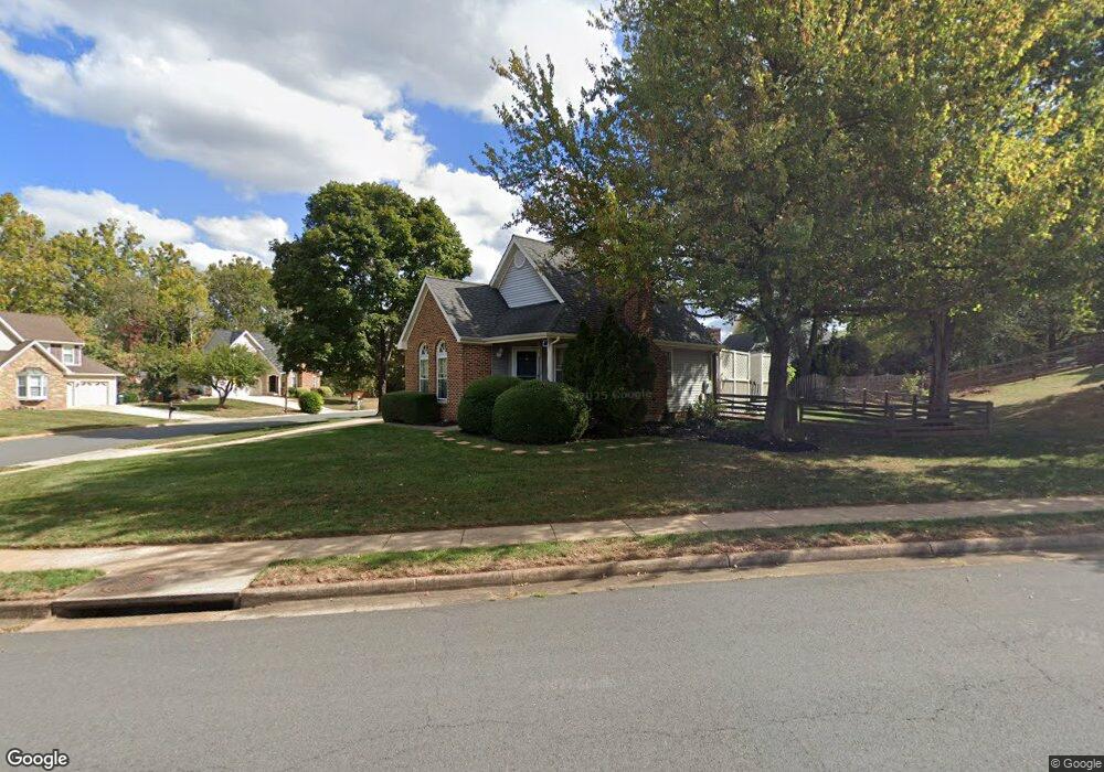
13446 Muirkirk Ln Herndon, VA 20171
Oak Hill NeighborhoodEstimated Value: $771,000 - $846,000
3
Beds
3
Baths
1,405
Sq Ft
$573/Sq Ft
Est. Value
About This Home
This home is located at 13446 Muirkirk Ln, Herndon, VA 20171 and is currently estimated at $804,996, approximately $572 per square foot. 13446 Muirkirk Ln is a home located in Fairfax County with nearby schools including Oak Hill Elementary School, Franklin Middle, and Chantilly High School.
Ownership History
Date
Name
Owned For
Owner Type
Purchase Details
Closed on
Jul 14, 2006
Sold by
Pflugrath Michael A
Bought by
Verme Dante A
Current Estimated Value
Home Financials for this Owner
Home Financials are based on the most recent Mortgage that was taken out on this home.
Original Mortgage
$384,000
Outstanding Balance
$228,726
Interest Rate
6.71%
Mortgage Type
New Conventional
Estimated Equity
$576,270
Purchase Details
Closed on
Dec 18, 1995
Sold by
Todd Allan G
Bought by
Morrow Thomas E
Home Financials for this Owner
Home Financials are based on the most recent Mortgage that was taken out on this home.
Original Mortgage
$137,600
Interest Rate
7.43%
Create a Home Valuation Report for This Property
The Home Valuation Report is an in-depth analysis detailing your home's value as well as a comparison with similar homes in the area
Home Values in the Area
Average Home Value in this Area
Purchase History
| Date | Buyer | Sale Price | Title Company |
|---|---|---|---|
| Verme Dante A | $494,800 | -- | |
| Morrow Thomas E | $172,000 | -- |
Source: Public Records
Mortgage History
| Date | Status | Borrower | Loan Amount |
|---|---|---|---|
| Open | Verme Dante A | $384,000 | |
| Previous Owner | Morrow Thomas E | $137,600 | |
| Closed | Morrow Thomas E | $17,200 |
Source: Public Records
Tax History Compared to Growth
Tax History
| Year | Tax Paid | Tax Assessment Tax Assessment Total Assessment is a certain percentage of the fair market value that is determined by local assessors to be the total taxable value of land and additions on the property. | Land | Improvement |
|---|---|---|---|---|
| 2025 | $8,203 | $766,180 | $325,000 | $441,180 |
| 2024 | $8,203 | $708,090 | $300,000 | $408,090 |
| 2023 | $8,215 | $727,980 | $300,000 | $427,980 |
| 2022 | $7,547 | $660,000 | $270,000 | $390,000 |
| 2021 | $7,010 | $597,390 | $250,000 | $347,390 |
| 2020 | $6,730 | $568,670 | $240,000 | $328,670 |
| 2019 | $6,489 | $548,270 | $235,000 | $313,270 |
| 2018 | $6,155 | $535,180 | $230,000 | $305,180 |
| 2017 | $6,213 | $535,180 | $230,000 | $305,180 |
| 2016 | $6,200 | $535,180 | $230,000 | $305,180 |
| 2015 | $5,713 | $511,890 | $220,000 | $291,890 |
| 2014 | $5,508 | $494,680 | $210,000 | $284,680 |
Source: Public Records
Map
Nearby Homes
- 3220 Kinross Cir
- 13486 Foxlease Ct
- 3252 Tayloe Ct
- 3256 Tayloe Ct
- 3025 Hughsmith Ct
- 3350 Stone Heather Ct
- 2969 Mother Well Ct
- 3001 Mcmaster Ct
- 2913 Mother Well Ct
- 13607 Soft Breeze Ct
- 13430 Hidden Meadow Ct
- 13723 Neil Armstrong Ave Unit 503
- 13408 Hidden Meadow Ct
- 3559 Plum Dale Dr
- 13019 Bankfoot Ct
- 3055 Alan Shepard St
- 13132 Bradley Farm Dr
- 13621 Old Chatwood Place
- 13405 Virginia Willow Dr
- 13371 Teaberry Ct
- 13442 Muirkirk Ln
- 3195 Kinbrace Rd
- 3194 Kinbrace Rd
- 13447 Muirkirk Ln
- 13438 Muirkirk Ln
- 13445 Muirkirk Ln
- 13449 Muirkirk Ln
- 13443 Muirkirk Ln
- 3196 Kinbrace Rd
- 3197 Kinbrace Rd
- 13432 Muirkirk Ln
- 13441 Muirkirk Ln
- 13452 Muirkirk Ln
- 13430 Muirkirk Ln
- 13439 Muirkirk Ln
- 3249 Kinross Cir
- 3247 Kinross Cir
- 3251 Kinross Cir
- 13437 Muirkirk Ln
- 13454 Muirkirk Ln