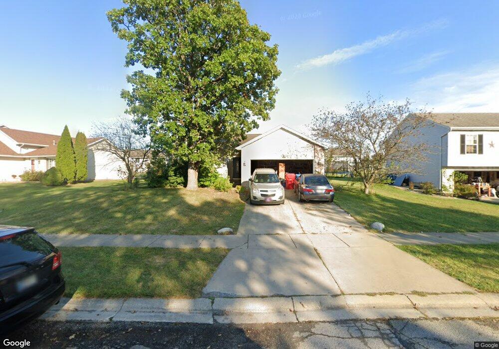
13449 Robin Dr Cedar Lake, IN 46303
Estimated Value: $262,544 - $310,000
3
Beds
2
Baths
1,226
Sq Ft
$241/Sq Ft
Est. Value
About This Home
This home is located at 13449 Robin Dr, Cedar Lake, IN 46303 and is currently estimated at $294,886, approximately $240 per square foot. 13449 Robin Dr is a home located in Lake County with nearby schools including Douglas MacArthur Elementary School, Robert Taft Middle School, and Crown Point High School.
Ownership History
Date
Name
Owned For
Owner Type
Purchase Details
Closed on
Nov 16, 2006
Sold by
Burriss Shannon L and Burriss Michelle L
Bought by
Williamson Brian and Williamson Sylvia D
Current Estimated Value
Home Financials for this Owner
Home Financials are based on the most recent Mortgage that was taken out on this home.
Original Mortgage
$167,275
Outstanding Balance
$100,053
Interest Rate
6.41%
Mortgage Type
FHA
Estimated Equity
$194,833
Create a Home Valuation Report for This Property
The Home Valuation Report is an in-depth analysis detailing your home's value as well as a comparison with similar homes in the area
Home Values in the Area
Average Home Value in this Area
Purchase History
| Date | Buyer | Sale Price | Title Company |
|---|---|---|---|
| Williamson Brian | -- | Chicago Title Insurance Co |
Source: Public Records
Mortgage History
| Date | Status | Borrower | Loan Amount |
|---|---|---|---|
| Open | Williamson Brian | $167,275 |
Source: Public Records
Tax History Compared to Growth
Tax History
| Year | Tax Paid | Tax Assessment Tax Assessment Total Assessment is a certain percentage of the fair market value that is determined by local assessors to be the total taxable value of land and additions on the property. | Land | Improvement |
|---|---|---|---|---|
| 2024 | $5,562 | $218,800 | $42,800 | $176,000 |
| 2023 | $2,146 | $199,900 | $42,800 | $157,100 |
| 2022 | $2,147 | $194,900 | $42,800 | $152,100 |
| 2021 | $1,877 | $184,200 | $30,700 | $153,500 |
| 2020 | $1,810 | $173,700 | $30,700 | $143,000 |
| 2019 | $1,822 | $169,900 | $30,700 | $139,200 |
| 2018 | $1,790 | $163,200 | $30,700 | $132,500 |
| 2017 | $1,692 | $153,400 | $30,700 | $122,700 |
| 2016 | $1,753 | $152,800 | $30,700 | $122,100 |
| 2014 | $1,617 | $152,200 | $30,600 | $121,600 |
| 2013 | $1,660 | $151,900 | $30,600 | $121,300 |
Source: Public Records
Map
Nearby Homes
- 6101 W 135th Place
- 6201 W 136th Place
- 6711 W 134th Place
- 13526 Superior Ln
- 13520 Hobart St
- 5925 W 135th Place
- 13443 Superior Ln
- 5874 W 135th Place
- 13512 Lakeside Blvd
- The Powell II Plan at Lakeside
- The Alverstone Plan at Lakeside
- The Monarch Plan at Lakeside
- The Capital Plan at Lakeside
- The Hayes Plan at Lakeside
- The Bennett Plan at Lakeside
- The Princeton Plan at Lakeside
- The Elbert Plan at Lakeside
- The Rainier Plan at Lakeside
- The Torbet Plan at Lakeside
- The Sopris Plan at Lakeside
- 13443 Robin Dr
- 13455 Robin Dr
- 13448 Finch Ct
- 13437 Robin Dr
- 13454 Finch Ct
- 13442 Finch Ct
- 6306 W 135th Ave
- 13433 Robin Dr
- 13446 Robin Dr
- 13440 Robin Dr
- 6241 W 135th Ave
- 6233 W 135th Ave
- 13427 Robin Dr
- 6233 W 135th Ave
- 6314 W 135th Ave
- 13436 Robin Dr
- 6225 W 135th Ave
- 6307 W 135th Ave
- 13449 Finch Ct
- 13455 Finch Ct