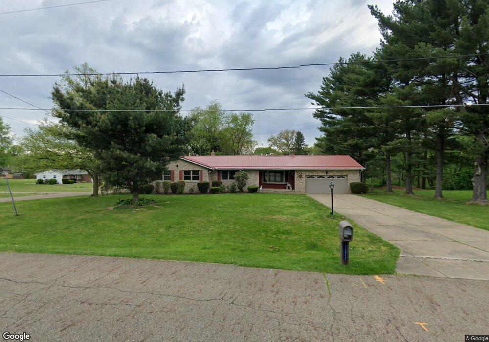
13449 Virginia Ave NW Uniontown, OH 44685
Estimated Value: $277,000 - $324,000
3
Beds
3
Baths
1,590
Sq Ft
$184/Sq Ft
Est. Value
About This Home
This home is located at 13449 Virginia Ave NW, Uniontown, OH 44685 and is currently estimated at $292,082, approximately $183 per square foot. 13449 Virginia Ave NW is a home located in Stark County with nearby schools including Lake Middle/High School, Lake Center Christian School, and Chapel Hill Christian School-Green Campus.
Ownership History
Date
Name
Owned For
Owner Type
Purchase Details
Closed on
Aug 23, 1999
Sold by
Chadock Wilma M
Bought by
Mckita Douglas D and Mckita Kimberly S
Current Estimated Value
Home Financials for this Owner
Home Financials are based on the most recent Mortgage that was taken out on this home.
Original Mortgage
$92,000
Outstanding Balance
$26,355
Interest Rate
7.61%
Mortgage Type
Purchase Money Mortgage
Estimated Equity
$265,727
Purchase Details
Closed on
May 6, 1999
Sold by
Chadock Wilma Marie
Bought by
Chadock Wilma Marie and The Chadock Family Trust
Create a Home Valuation Report for This Property
The Home Valuation Report is an in-depth analysis detailing your home's value as well as a comparison with similar homes in the area
Home Values in the Area
Average Home Value in this Area
Purchase History
| Date | Buyer | Sale Price | Title Company |
|---|---|---|---|
| Mckita Douglas D | $135,800 | -- | |
| Chadock Wilma Marie | -- | -- |
Source: Public Records
Mortgage History
| Date | Status | Borrower | Loan Amount |
|---|---|---|---|
| Open | Mckita Douglas D | $92,000 |
Source: Public Records
Tax History Compared to Growth
Tax History
| Year | Tax Paid | Tax Assessment Tax Assessment Total Assessment is a certain percentage of the fair market value that is determined by local assessors to be the total taxable value of land and additions on the property. | Land | Improvement |
|---|---|---|---|---|
| 2025 | -- | $97,380 | $20,760 | $76,620 |
| 2024 | -- | $97,380 | $20,760 | $76,620 |
| 2023 | $4,601 | $78,300 | $15,580 | $62,720 |
| 2022 | $2,752 | $78,300 | $15,580 | $62,720 |
| 2021 | $2,788 | $78,300 | $15,580 | $62,720 |
| 2020 | $4,452 | $66,400 | $13,440 | $52,960 |
| 2019 | $4,421 | $66,920 | $13,440 | $53,480 |
| 2018 | $4,456 | $66,920 | $13,440 | $53,480 |
| 2017 | $4,547 | $63,320 | $11,970 | $51,350 |
| 2016 | $4,555 | $63,320 | $11,970 | $51,350 |
| 2015 | $4,553 | $63,320 | $11,970 | $51,350 |
| 2014 | $112 | $57,790 | $10,920 | $46,870 |
| 2013 | $2,056 | $57,790 | $10,920 | $46,870 |
Source: Public Records
Map
Nearby Homes
- 3100 Linden St NW
- 3310 Linden St NW
- 2944 Pontius St NW
- 13792 Amodio Ave NW
- 0 Pine St NW
- 13341 Sugar Bush Ave NW
- 3796 Sweitzer St NW
- 91 Pontius Rd
- 2498 Foxfire St NW
- 3885 Hugh St NW
- 13025 Sunset Cir NW
- 2025 Portage Line Rd
- 3979 Northdale St NW
- 2693 Ledgestone Dr NW
- 835 Brodie Ct
- 843 Brodie Ct
- 12494 Bridgemont Ave NW
- 0 Pontius Rd Unit 5163828
- 3221 Killian Rd
- 2399 Ledgestone Dr NW
- 3177 Oaklynn St NW
- 13415 Virginia Ave NW
- 3126 Oaklynn St NW
- 13493 Virginia Ave NW
- 3180 Oaklynn St NW
- 3207 Oaklynn St NW
- 13395 Virginia Ave NW
- 3131 Lori St NW
- 13470 Virginia Ave NW
- 3102 Oaklynn St NW
- 3200 Oaklynn St NW
- 13523 Virginia Ave NW
- 3105 Lori St NW
- 13500 Virginia Ave NW
- 13500 Virginia Ave NW
- 3151 Broad Vista St NW
- 3173 Broad Vista St NW
- 3222 Oaklynn St NW
- 3076 Oaklynn St NW
- 13543 Virginia Ave NW