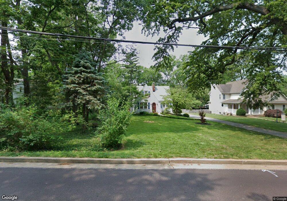
1345 Grant Rd Saint Louis, MO 63119
Estimated Value: $343,579 - $410,000
3
Beds
2
Baths
1,344
Sq Ft
$283/Sq Ft
Est. Value
About This Home
This home is located at 1345 Grant Rd, Saint Louis, MO 63119 and is currently estimated at $379,895, approximately $282 per square foot. 1345 Grant Rd is a home located in St. Louis County with nearby schools including Clark Elementary School, Hixson Middle School, and Webster Groves High School.
Ownership History
Date
Name
Owned For
Owner Type
Purchase Details
Closed on
Jul 21, 2021
Sold by
Keeven Gene and Keeven Leslie
Bought by
Keeven Leslie
Current Estimated Value
Home Financials for this Owner
Home Financials are based on the most recent Mortgage that was taken out on this home.
Original Mortgage
$184,000
Outstanding Balance
$165,661
Interest Rate
2.96%
Mortgage Type
New Conventional
Estimated Equity
$214,234
Purchase Details
Closed on
Jun 30, 1998
Sold by
Chalet Home Inc
Bought by
Keeven Gene
Home Financials for this Owner
Home Financials are based on the most recent Mortgage that was taken out on this home.
Original Mortgage
$146,700
Interest Rate
9.65%
Purchase Details
Closed on
Jan 7, 1998
Sold by
Pearl Rex L and Pearl Barbara L
Bought by
Pearl Rex L and Pearl Barbara L
Create a Home Valuation Report for This Property
The Home Valuation Report is an in-depth analysis detailing your home's value as well as a comparison with similar homes in the area
Home Values in the Area
Average Home Value in this Area
Purchase History
| Date | Buyer | Sale Price | Title Company |
|---|---|---|---|
| Keeven Leslie | -- | Solidifi Title & Closing Llc | |
| Keeven Leslie | -- | Solidifi Title & Closing | |
| Keeven Gene | -- | -- | |
| Keeven Gene | -- | -- | |
| Pearl Rex L | -- | -- | |
| Pearl Rex L | -- | -- |
Source: Public Records
Mortgage History
| Date | Status | Borrower | Loan Amount |
|---|---|---|---|
| Open | Keeven Leslie | $184,000 | |
| Closed | Keeven Leslie | $184,000 | |
| Previous Owner | Keeven Gene | $146,700 |
Source: Public Records
Tax History
| Year | Tax Paid | Tax Assessment Tax Assessment Total Assessment is a certain percentage of the fair market value that is determined by local assessors to be the total taxable value of land and additions on the property. | Land | Improvement |
|---|---|---|---|---|
| 2025 | $3,923 | $68,380 | $46,420 | $21,960 |
| 2024 | $3,923 | $56,240 | $33,000 | $23,240 |
| 2023 | $3,923 | $56,240 | $33,000 | $23,240 |
| 2022 | $3,888 | $48,470 | $28,900 | $19,570 |
| 2021 | $3,585 | $48,470 | $28,900 | $19,570 |
| 2020 | $3,257 | $40,950 | $27,550 | $13,400 |
| 2019 | $3,262 | $40,950 | $27,550 | $13,400 |
| 2018 | $3,321 | $37,040 | $19,860 | $17,180 |
| 2017 | $3,298 | $37,040 | $19,860 | $17,180 |
| 2016 | $2,764 | $29,660 | $14,080 | $15,580 |
| 2015 | $2,769 | $29,660 | $14,080 | $15,580 |
| 2014 | $2,498 | $26,010 | $14,480 | $11,530 |
Source: Public Records
Map
Nearby Homes
- 638 Conover Ln
- 450 Forest Green Dr
- 689 Conover Ln
- 1048 Diversey Dr
- 14 Armin Ln
- 904 Liggett Ave
- 1139 Hawken Place Unit 6
- 401 Reavis Place Unit 29
- 649 S Sappington Rd
- 55 W Drake Ave
- 618 S Rock Hill Rd
- 1412 Gardenia Dr
- 9 Holly Dr
- 0 Unknown Unit MIS25067424
- 0 Unknown Unit MIS25078799
- 0 Unknown Unit MIS26007827
- 319 Baker Ave
- 1116 S Elm Ave
- 106 S Brent Ave
- 1330 Drayton Ave
- 1349 Grant Rd
- 1351 Grant Rd
- 606 Grant Ct
- 710 Crompton Ct
- 712 Crompton Ct
- 703 Denton Ct
- 708 Crompton Ct
- 540 Webster Forest Dr
- 1359 Grant Rd
- 701 Denton Ct
- 705 Denton Ct
- 704 Crompton Ct
- 714 Crompton Ct
- 544 Webster Forest Dr
- 536 Webster Forest Dr
- 700 Denton Ct
- 614 Grant Ct
- 707 Denton Ct
- 601 Grant Ct
- 1363 Grant Rd
Your Personal Tour Guide
Ask me questions while you tour the home.