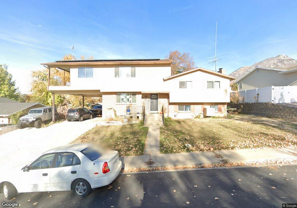
1345 Navajo Dr Pleasant Grove, UT 84062
Estimated Value: $603,096 - $639,000
4
Beds
5
Baths
2,124
Sq Ft
$294/Sq Ft
Est. Value
About This Home
This home is located at 1345 Navajo Dr, Pleasant Grove, UT 84062 and is currently estimated at $624,274, approximately $293 per square foot. 1345 Navajo Dr is a home located in Utah County with nearby schools including Valley View Elementary, Central Elementary School, and Oak Canyon Junior High School.
Ownership History
Date
Name
Owned For
Owner Type
Purchase Details
Closed on
Sep 2, 2014
Sold by
Baker L Bonnie and Baker Family Trust
Bought by
Baker Robert Lee and Baker Lisa K
Current Estimated Value
Home Financials for this Owner
Home Financials are based on the most recent Mortgage that was taken out on this home.
Original Mortgage
$92,999
Interest Rate
4.25%
Mortgage Type
FHA
Create a Home Valuation Report for This Property
The Home Valuation Report is an in-depth analysis detailing your home's value as well as a comparison with similar homes in the area
Home Values in the Area
Average Home Value in this Area
Purchase History
| Date | Buyer | Sale Price | Title Company |
|---|---|---|---|
| Baker Robert Lee | -- | Utah First Title Ins Ag |
Source: Public Records
Mortgage History
| Date | Status | Borrower | Loan Amount |
|---|---|---|---|
| Closed | Baker Robert Lee | $92,999 |
Source: Public Records
Tax History Compared to Growth
Tax History
| Year | Tax Paid | Tax Assessment Tax Assessment Total Assessment is a certain percentage of the fair market value that is determined by local assessors to be the total taxable value of land and additions on the property. | Land | Improvement |
|---|---|---|---|---|
| 2025 | $2,535 | $328,350 | $213,600 | $383,400 |
| 2024 | $2,535 | $302,445 | $0 | $0 |
| 2023 | $2,445 | $298,760 | $0 | $0 |
| 2022 | $2,482 | $301,675 | $0 | $0 |
| 2021 | $2,145 | $397,000 | $153,200 | $243,800 |
| 2020 | $1,975 | $358,400 | $136,800 | $221,600 |
| 2019 | $1,805 | $338,700 | $125,700 | $213,000 |
| 2018 | $1,803 | $319,900 | $122,000 | $197,900 |
| 2017 | $1,722 | $162,690 | $0 | $0 |
| 2016 | $1,505 | $137,280 | $0 | $0 |
| 2015 | $1,437 | $124,135 | $0 | $0 |
| 2014 | -- | $123,695 | $0 | $0 |
Source: Public Records
Map
Nearby Homes
- 1172 E Murdock Dr
- 1515 E 720 S
- 745 S 1500 St E
- 935 S 1500 E
- 650 S 1600 E
- 778 S 1100 E
- 521 S 1660 E
- 286 S 1150 E
- 177 S 1150 E
- 630 S Loader Dr
- 897 Cherokee Dr
- Prelude Plan at Blossom Hill
- Treble Plan at Blossom Hill
- Browning Plan at Blossom Hill
- Cantata Plan at Blossom Hill
- 176 S 1150 E
- Accord Plan at Blossom Hill
- Canon Plan at Blossom Hill
- Trio Plan at Blossom Hill
- Harrison Plan at Blossom Hill
- 1355 Navajo Dr
- 1325 Navajo Dr
- 1280 Mohican Cir
- 1278 Mohican Cir
- 1365 Navajo Dr
- 1340 Navajo Dr
- 1270 Mohican Cir
- 1305 Navajo Dr
- 640 Mohawk Ave
- 1315 Navajo Dr
- 640 E 1200 N
- 1330 Navajo Dr
- 1290 Mohican Cir
- 1264 Mohican Cir
- 1264 Mohican Cir S Unit 14
- 1320 E Navajo Dr
- 1320 Navajo Dr
- 635 E 1200 N
- 1265 Mohican Cir
- 635 Mohawk Ave