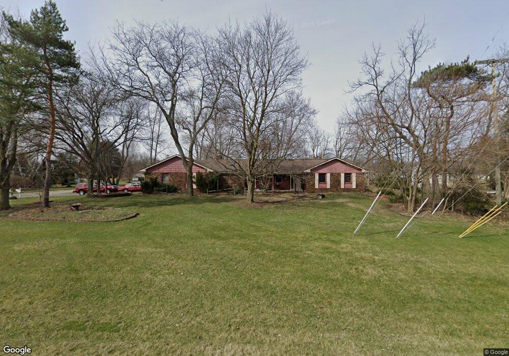
13459 10 Mile Rd South Lyon, MI 48178
Estimated Value: $399,000 - $470,000
5
Beds
3
Baths
1,822
Sq Ft
$239/Sq Ft
Est. Value
About This Home
This home is located at 13459 10 Mile Rd, South Lyon, MI 48178 and is currently estimated at $435,409, approximately $238 per square foot. 13459 10 Mile Rd is a home located in Livingston County with nearby schools including William A. Brummer Elementary School, Centennial Middle School, and South Lyon High School.
Ownership History
Date
Name
Owned For
Owner Type
Purchase Details
Closed on
Dec 15, 2016
Sold by
Rickett Gordon and Rickett Ii Gordon R
Bought by
Rickett Ii Gordon R and Gordon Rickett Revocable Trust
Current Estimated Value
Purchase Details
Closed on
Aug 11, 1999
Sold by
White Evelyn G and White Evelyn
Bought by
Russell Daniel and Weber Cathy
Home Financials for this Owner
Home Financials are based on the most recent Mortgage that was taken out on this home.
Original Mortgage
$172,800
Interest Rate
7.59%
Purchase Details
Closed on
Jun 25, 1993
Sold by
Lelko Jerome T and Lelko Marie J
Bought by
Porath William F and Porath Rosemary
Create a Home Valuation Report for This Property
The Home Valuation Report is an in-depth analysis detailing your home's value as well as a comparison with similar homes in the area
Home Values in the Area
Average Home Value in this Area
Purchase History
| Date | Buyer | Sale Price | Title Company |
|---|---|---|---|
| Rickett Ii Gordon R | -- | None Available | |
| Russell Daniel | $216,000 | -- | |
| Porath William F | $27,000 | American Title Ins Co |
Source: Public Records
Mortgage History
| Date | Status | Borrower | Loan Amount |
|---|---|---|---|
| Previous Owner | Russell Daniel | $172,800 |
Source: Public Records
Tax History Compared to Growth
Tax History
| Year | Tax Paid | Tax Assessment Tax Assessment Total Assessment is a certain percentage of the fair market value that is determined by local assessors to be the total taxable value of land and additions on the property. | Land | Improvement |
|---|---|---|---|---|
| 2025 | $4,242 | $189,300 | $0 | $0 |
| 2024 | $2,858 | $202,300 | $0 | $0 |
| 2023 | $2,726 | $191,600 | $0 | $0 |
| 2022 | $3,447 | $142,500 | $0 | $0 |
| 2021 | $3,447 | $160,900 | $0 | $0 |
| 2020 | $3,447 | $150,600 | $0 | $0 |
| 2019 | $3,481 | $142,500 | $0 | $0 |
| 2018 | $3,433 | $130,900 | $0 | $0 |
| 2017 | $3,487 | $129,300 | $0 | $0 |
| 2016 | $3,538 | $128,200 | $0 | $0 |
| 2014 | $3,296 | $111,100 | $0 | $0 |
| 2012 | $3,296 | $103,200 | $0 | $0 |
Source: Public Records
Map
Nearby Homes
- 13428 Sequoia Ln
- 9859 Aylebury Dr
- 9851 Atwood Dr
- 13708 Monarch Dr
- 9607 Larch Ln
- 13802 Forest Ridge Cir
- 124 Shannon Partin Ct
- 667 Allegheny Dr
- Bradford Plan at Charleston Park
- Bradford with Second Floor Plan at Charleston Park
- Bartelle Plan at Charleston Park
- Upton Plan at Charleston Park
- Westford Plan at Charleston Park
- Addison Plan at Charleston Park
- Madison Plan at Charleston Park
- Nantucket Plan at Charleston Park
- Preston Plan at Charleston Park
- Rockport II Plan at Charleston Park
- Remington Plan at Charleston Park
- 174 Singh Blvd
- 9917 Ponderosa Dr
- 13490 10 Mile Rd
- 13672 Windmoor Dr
- 13439 10 Mile Rd
- 13472 10 Mile Rd
- 9895 Ponderosa Dr
- 13510 10 Mile Rd
- 13680 Windmoor Dr
- 13664 Windmoor Dr
- 13419 10 Mile Rd
- 13416 Sequoia Ln
- 9873 Ponderosa Dr
- 10046 Borden Ln
- 13688 Windmoor Dr
- 9874 Ponderosa Dr
- 13656 Windmoor Dr
- 13401 10 Mile Rd
- 13679 Windmoor Dr
- 13667 Windmoor Dr
- 9891 Atwood Dr