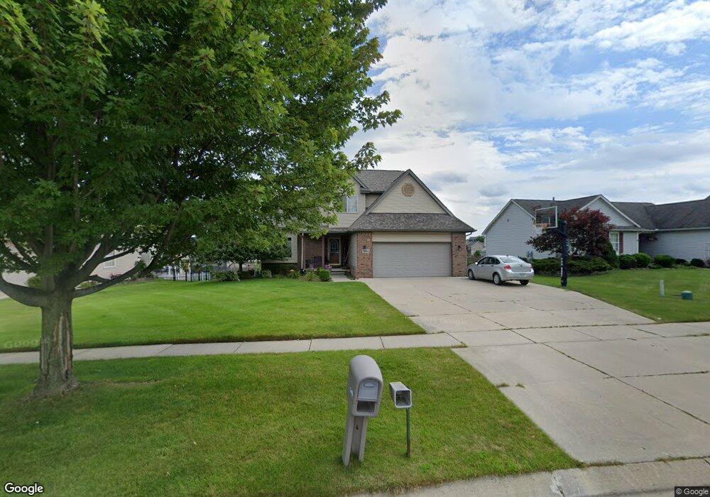
1346 Maple Leaf Ln Unit 57 Howell, MI 48843
Estimated Value: $364,000 - $412,000
--
Bed
2
Baths
1,760
Sq Ft
$223/Sq Ft
Est. Value
About This Home
This home is located at 1346 Maple Leaf Ln Unit 57, Howell, MI 48843 and is currently estimated at $392,346, approximately $222 per square foot. 1346 Maple Leaf Ln Unit 57 is a home located in Livingston County with nearby schools including Northwest Elementary School, Highlander Way Middle School, and Howell High School.
Ownership History
Date
Name
Owned For
Owner Type
Purchase Details
Closed on
Feb 20, 2003
Sold by
Sanzica Building Inc
Bought by
Kraft David Joseph and Kraft Kelli A
Current Estimated Value
Home Financials for this Owner
Home Financials are based on the most recent Mortgage that was taken out on this home.
Original Mortgage
$174,000
Outstanding Balance
$75,172
Interest Rate
6.07%
Estimated Equity
$317,174
Create a Home Valuation Report for This Property
The Home Valuation Report is an in-depth analysis detailing your home's value as well as a comparison with similar homes in the area
Home Values in the Area
Average Home Value in this Area
Purchase History
| Date | Buyer | Sale Price | Title Company |
|---|---|---|---|
| Kraft David Joseph | $217,500 | American Title Co Of Livings |
Source: Public Records
Mortgage History
| Date | Status | Borrower | Loan Amount |
|---|---|---|---|
| Open | Kraft David Joseph | $174,000 | |
| Closed | Kraft David Joseph | $10,875 |
Source: Public Records
Tax History Compared to Growth
Tax History
| Year | Tax Paid | Tax Assessment Tax Assessment Total Assessment is a certain percentage of the fair market value that is determined by local assessors to be the total taxable value of land and additions on the property. | Land | Improvement |
|---|---|---|---|---|
| 2025 | $1,729 | $187,000 | $0 | $0 |
| 2024 | $1,680 | $179,200 | $0 | $0 |
| 2023 | $1,604 | $152,700 | $0 | $0 |
| 2022 | $745 | $127,400 | $0 | $0 |
| 2021 | $2,223 | $133,600 | $0 | $0 |
| 2020 | $2,248 | $127,400 | $0 | $0 |
| 2019 | $2,216 | $119,200 | $0 | $0 |
| 2018 | $2,194 | $108,800 | $0 | $0 |
| 2017 | $2,181 | $106,500 | $0 | $0 |
| 2016 | $2,148 | $103,300 | $0 | $0 |
| 2014 | $2,421 | $88,700 | $0 | $0 |
| 2012 | $2,421 | $83,600 | $0 | $0 |
Source: Public Records
Map
Nearby Homes
- 1400 Oakcrest Rd
- 1633 Frech Ln
- 1570 Princewood Blvd
- 2511 Kerria Dr Unit 42
- 3040 Bogues View Dr
- 475 Cannonade Loop
- 571 Cannonade Loop
- 523 Cannonade Loop
- 583 Cannonade Loop
- 559 Cannonade Loop
- 3224 Waverly Woods Ln
- 3227 Waverly Woods Ln
- The Austin Plan at Broadmoor
- The Charlotte Plan at Broadmoor
- The Harrison Plan at Broadmoor
- The Bloomington Plan at Broadmoor
- The Columbia Plan at Broadmoor
- VACANT LOT Thompson Shore Dr
- 2653 Ravine Side N
- 2700 Court Ln N
- 1328 Maple Leaf Ln
- 1364 Maple Leaf Ln Unit 56
- 2756 Laurel Ridge Ln
- 1310 Maple Leaf Ln Unit 59
- 2774 Laurel Ridge Ln
- 2761 Autumn Creek Ln Unit 60
- 1353 Maple Leaf Ln Unit 88
- 1335 Maple Leaf Ln
- 1317 Maple Leaf Ln
- 1371 Maple Leaf Ln Unit 89
- 2792 Laurel Ridge Ln
- 2775 Autumn Creek Ln
- 1299 Maple Leaf Ln Unit 85
- 2749 Laurel Ridge Ln
- 2731 Laurel Ridge Ln
- 2767 Laurel Ridge Ln
- 2715 Laurel Ridge Ln
- 1268 Maple Leaf Ln
- 2810 Laurel Ridge Ln
- 1281 Maple Leaf Ln