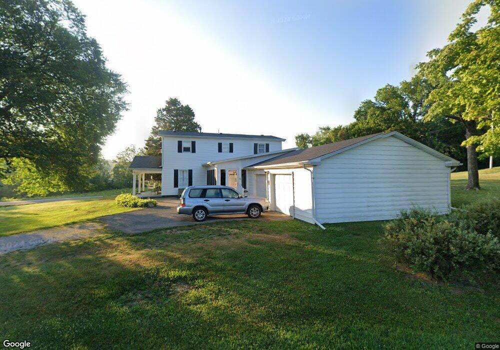
1346 Morrison Rd Chillicothe, OH 45601
Estimated Value: $309,859 - $377,000
4
Beds
2
Baths
1,968
Sq Ft
$172/Sq Ft
Est. Value
About This Home
This home is located at 1346 Morrison Rd, Chillicothe, OH 45601 and is currently estimated at $339,465, approximately $172 per square foot. 1346 Morrison Rd is a home located in Ross County with nearby schools including Unioto Elementary School, Unioto Middle School, and Unioto High School.
Ownership History
Date
Name
Owned For
Owner Type
Purchase Details
Closed on
Nov 22, 2021
Sold by
Carter Karen L and Wise Karen L
Bought by
Wise Karen L C and Wise Todd S
Current Estimated Value
Home Financials for this Owner
Home Financials are based on the most recent Mortgage that was taken out on this home.
Original Mortgage
$173,992
Outstanding Balance
$159,654
Interest Rate
3.09%
Mortgage Type
FHA
Estimated Equity
$179,811
Purchase Details
Closed on
Feb 11, 2013
Sold by
Dowler Ralph Thomas and Dowler Jean
Bought by
Carter Karen L
Home Financials for this Owner
Home Financials are based on the most recent Mortgage that was taken out on this home.
Original Mortgage
$152,040
Interest Rate
3.3%
Mortgage Type
New Conventional
Create a Home Valuation Report for This Property
The Home Valuation Report is an in-depth analysis detailing your home's value as well as a comparison with similar homes in the area
Home Values in the Area
Average Home Value in this Area
Purchase History
| Date | Buyer | Sale Price | Title Company |
|---|---|---|---|
| Wise Karen L C | -- | World Class Title | |
| Carter Karen L | $149,000 | Attorney |
Source: Public Records
Mortgage History
| Date | Status | Borrower | Loan Amount |
|---|---|---|---|
| Open | Wise Karen L C | $173,992 | |
| Closed | Carter Karen L | $152,040 |
Source: Public Records
Tax History Compared to Growth
Tax History
| Year | Tax Paid | Tax Assessment Tax Assessment Total Assessment is a certain percentage of the fair market value that is determined by local assessors to be the total taxable value of land and additions on the property. | Land | Improvement |
|---|---|---|---|---|
| 2024 | $1,916 | $55,500 | $7,470 | $48,030 |
| 2023 | $1,916 | $55,500 | $7,470 | $48,030 |
| 2022 | $1,958 | $55,500 | $7,470 | $48,030 |
| 2021 | $1,607 | $42,620 | $6,150 | $36,470 |
| 2020 | $1,616 | $42,620 | $6,150 | $36,470 |
| 2019 | $1,616 | $42,620 | $6,150 | $36,470 |
| 2018 | $1,542 | $39,860 | $5,820 | $34,040 |
| 2017 | $1,544 | $39,860 | $5,820 | $34,040 |
| 2016 | $1,505 | $39,860 | $5,820 | $34,040 |
| 2015 | $1,412 | $37,080 | $5,820 | $31,260 |
| 2014 | $1,378 | $37,080 | $5,820 | $31,260 |
| 2013 | $1,059 | $37,080 | $5,820 | $31,260 |
Source: Public Records
Map
Nearby Homes
- 11303 County Road 550
- 435 Mount Carmel Rd
- 2391 Simmons Rd
- 420 Steiner Rd
- 365 Golfview Dr
- 559 Golfview Dr
- 54 Moccasin Dr
- 313 Goodale Dr
- 12690 Pleasant Valley Rd
- 18 Sarah Ct
- 265 Brookside Dr
- 2153 Egypt Pike
- 1036 Clinton Rd
- 25 Woodland Way
- 13223 Pleasant Valley Rd
- 2719 Sulphur Lick Rd
- 45 Custer Dr
- 102 Franklin Cir
- 2083 Anderson Station Rd
- 500 Old Elm Rd
- 1018 Cattail Rd
- 36 Clearview Rd
- 1032 Cattail Rd
- 1066 Cattail Rd
- 72 Clearview Rd
- 823 Cattail Rd
- 140 Clearview Rd
- 142 Clearview Rd
- 1094 Cattail Rd
- 114 Clearview Rd
- 1114 Cattail Rd
- 208 Clearview Rd
- 763 Cattail Rd
- 1144 Cattail Rd
- 1162 Cattail Rd
- 254 Clearview Rd
- 254 Clearview Rd
- 679 Cattail Rd
- 1202 Cattail Rd
- 298 Clearview Rd