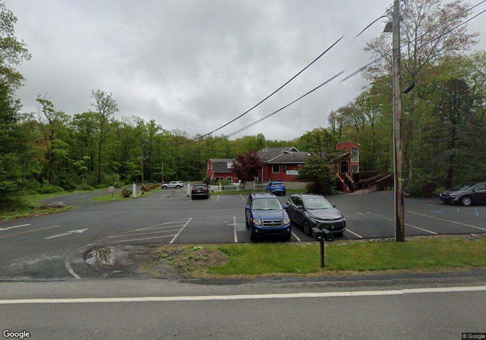
1346 Route 739 Dingmans Ferry, PA 18328
Estimated Value: $773,196
--
Bed
4
Baths
9,790
Sq Ft
$79/Sq Ft
Est. Value
About This Home
This home is located at 1346 Route 739, Dingmans Ferry, PA 18328 and is currently estimated at $773,196, approximately $78 per square foot. 1346 Route 739 is a home located in Pike County with nearby schools including Delaware Valley High School.
Ownership History
Date
Name
Owned For
Owner Type
Purchase Details
Closed on
Aug 19, 2024
Sold by
Hubpro Inc
Bought by
Lt Legacy Llc
Current Estimated Value
Home Financials for this Owner
Home Financials are based on the most recent Mortgage that was taken out on this home.
Original Mortgage
$600,000
Outstanding Balance
$593,236
Interest Rate
6.89%
Mortgage Type
New Conventional
Estimated Equity
$179,960
Purchase Details
Closed on
Jan 8, 2010
Sold by
Hubpro Inc
Bought by
Hubpro Inc
Create a Home Valuation Report for This Property
The Home Valuation Report is an in-depth analysis detailing your home's value as well as a comparison with similar homes in the area
Home Values in the Area
Average Home Value in this Area
Purchase History
| Date | Buyer | Sale Price | Title Company |
|---|---|---|---|
| Lt Legacy Llc | $750,000 | Investors Real Estate Services | |
| Hubpro Inc | -- | None Available |
Source: Public Records
Mortgage History
| Date | Status | Borrower | Loan Amount |
|---|---|---|---|
| Open | Lt Legacy Llc | $600,000 |
Source: Public Records
Tax History Compared to Growth
Tax History
| Year | Tax Paid | Tax Assessment Tax Assessment Total Assessment is a certain percentage of the fair market value that is determined by local assessors to be the total taxable value of land and additions on the property. | Land | Improvement |
|---|---|---|---|---|
| 2025 | $14,361 | $95,060 | $6,030 | $89,030 |
| 2024 | $14,361 | $95,060 | $6,030 | $89,030 |
| 2023 | $14,147 | $95,060 | $6,030 | $89,030 |
| 2022 | $13,768 | $95,060 | $6,030 | $89,030 |
| 2021 | $13,626 | $95,060 | $6,030 | $89,030 |
| 2020 | $13,558 | $95,060 | $6,030 | $89,030 |
| 2019 | $13,090 | $95,060 | $6,030 | $89,030 |
| 2018 | $13,090 | $95,060 | $6,030 | $89,030 |
| 2017 | $12,736 | $95,060 | $6,030 | $89,030 |
| 2016 | $0 | $95,060 | $6,030 | $89,030 |
| 2015 | -- | $95,060 | $6,030 | $89,030 |
| 2014 | -- | $95,060 | $6,030 | $89,030 |
Source: Public Records
Map
Nearby Homes
- 0 Route 739 Unit PWBPW235327
- 0 Redwood Lot 53 Rd Unit PWBPW252492
- 0 Cottonwood Ct
- 16/9 Cottonwood Ct
- 3 Bond Ct
- 110 Gold Key Rd
- Lot #97 Nichecronk Rd
- 0 Butternut Rd
- 163 Butternut Rd
- 0 Route 739 Unit PWBPW250980
- 0 Route 739 Unit 19-5204
- Lot 28 N Forrest Dr
- Lot 34 Walnut Rd
- 135 N Forrest Dr
- 0 Butternut & Walnut Corner Unit PWBPW252500
- 507 Log Tavern Rd
- Lot 17 Hartman Hill Rd
- 1558 Pa-739
- 263 Gold Key Rd
- 348 Gold Key Rd
- 1400 Route 739
- 1402 Pennsylvania 739
- 0 Route 739 Unit 19088871
- 0 Route 739 Unit 3-7083
- 0 Route 739 Unit 6-2027
- 0 Route 739 Unit 13058
- 0 Route 739 Unit 7-11134
- 0 Route 739 Unit 4-5019
- 0 Route 739 Unit PWBPW243748
- 0 Route 739 Unit PWB052062
- 0 Route 739 Unit PWB062619
- 0 Route 739 Unit PWB065993
- 0 Route 739 Unit PWB131405
- 0 Route 739 Unit PM-12109
- 0 Route 739 Unit 12-5250
- 0 Route 739 Unit 20-3786
- 0 Route 739 Unit 21-7
- Lot 302 Pennsylvania 739
- 24 Pennsylvania 739
- 0 Pa 739 & Log Tavern Rd Unit 22-3734