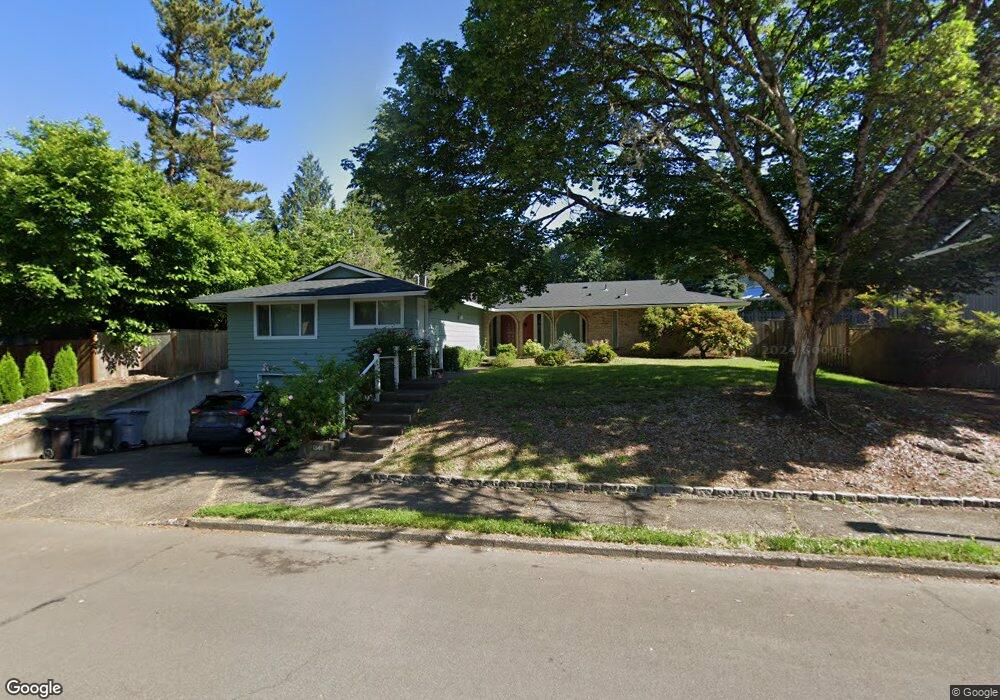
1346 Tamarisk Dr West Linn, OR 97068
Willamette NeighborhoodEstimated Value: $672,000 - $740,439
3
Beds
2
Baths
2,380
Sq Ft
$298/Sq Ft
Est. Value
About This Home
This home is located at 1346 Tamarisk Dr, West Linn, OR 97068 and is currently estimated at $709,110, approximately $297 per square foot. 1346 Tamarisk Dr is a home located in Clackamas County with nearby schools including Willamette Primary School, Athey Creek Middle School, and West Linn High School.
Ownership History
Date
Name
Owned For
Owner Type
Purchase Details
Closed on
Oct 4, 2004
Sold by
Quinn Linda L
Bought by
Stellebreit Llc
Current Estimated Value
Purchase Details
Closed on
Apr 8, 2004
Sold by
Quinn Linda L and Quinn Linda Lee
Bought by
Quinn Linda L
Home Financials for this Owner
Home Financials are based on the most recent Mortgage that was taken out on this home.
Original Mortgage
$122,000
Interest Rate
5.56%
Mortgage Type
Stand Alone Refi Refinance Of Original Loan
Purchase Details
Closed on
May 22, 2001
Sold by
Jeli Quinn Linda L and Quinn Linda Lee
Bought by
Quinn Linda Lee
Home Financials for this Owner
Home Financials are based on the most recent Mortgage that was taken out on this home.
Original Mortgage
$124,400
Interest Rate
7.06%
Create a Home Valuation Report for This Property
The Home Valuation Report is an in-depth analysis detailing your home's value as well as a comparison with similar homes in the area
Home Values in the Area
Average Home Value in this Area
Purchase History
| Date | Buyer | Sale Price | Title Company |
|---|---|---|---|
| Stellebreit Llc | -- | Ticor Title Insurance Compan | |
| Quinn Linda L | -- | Ticor Title | |
| Quinn Linda Lee | -- | First American |
Source: Public Records
Mortgage History
| Date | Status | Borrower | Loan Amount |
|---|---|---|---|
| Previous Owner | Quinn Linda L | $122,000 | |
| Previous Owner | Quinn Linda Lee | $124,400 |
Source: Public Records
Tax History Compared to Growth
Tax History
| Year | Tax Paid | Tax Assessment Tax Assessment Total Assessment is a certain percentage of the fair market value that is determined by local assessors to be the total taxable value of land and additions on the property. | Land | Improvement |
|---|---|---|---|---|
| 2025 | $7,386 | $383,253 | -- | -- |
| 2024 | $7,109 | $372,091 | -- | -- |
| 2023 | $7,109 | $361,254 | $0 | $0 |
| 2022 | $6,710 | $350,733 | $0 | $0 |
| 2021 | $5,476 | $292,718 | $0 | $0 |
| 2020 | $5,513 | $284,193 | $0 | $0 |
| 2019 | $5,257 | $275,916 | $0 | $0 |
| 2018 | $5,023 | $267,880 | $0 | $0 |
| 2017 | $4,828 | $260,078 | $0 | $0 |
| 2016 | $4,703 | $252,503 | $0 | $0 |
| 2015 | $4,390 | $245,149 | $0 | $0 |
| 2014 | $4,183 | $238,009 | $0 | $0 |
Source: Public Records
Map
Nearby Homes
- 2584 Wisteria Ct
- 2492 Donegal Ct
- 2420 Margery St
- 2485 Tipperary Ct
- 2540 Kilkenny Ct
- 1332 S Woodbine Rd
- 1640 Village Park Place
- 2050 Alpine Dr
- 22998 Bland Cir
- 22994 Bland Cir
- 22990 Bland Cir
- 1101 Ryan Ct
- 2134 Eleanor Rd
- 3135 Summerlinn Dr Unit 40
- Allstone Plan at Savannah Summit
- Milton Plan at Savannah Summit
- 3395 Summerlinn Dr Unit 24
- 23000 Bland Cir
- 6840 Summerlinn Way Unit 93
- 640 Springtree Ln