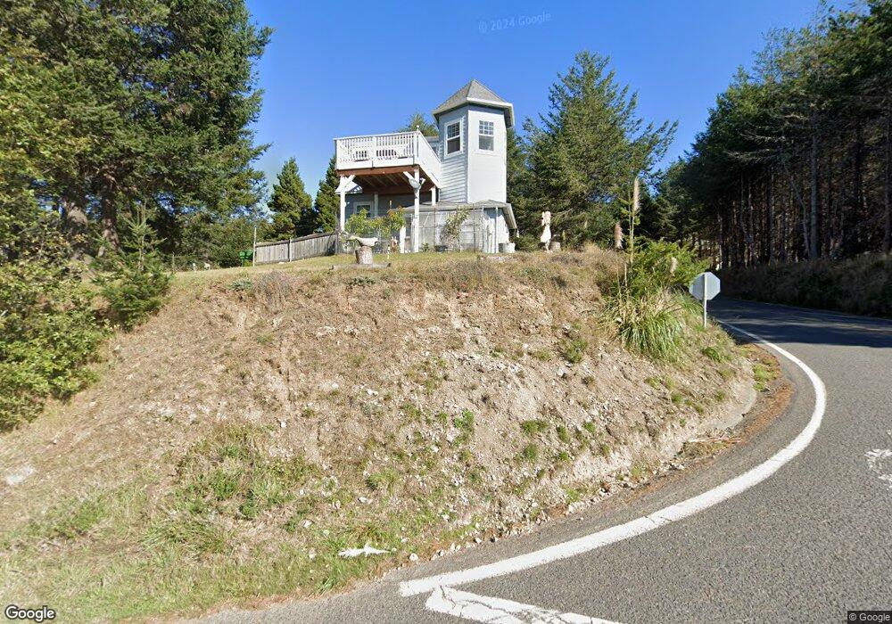
1346 Upper Pacific Dr Whitethorn, CA 95589
Shelter Cove AreaEstimated Value: $361,000 - $496,000
About This Home
This home is located at 1346 Upper Pacific Dr, Whitethorn, CA 95589 and is currently estimated at $438,169, approximately $298 per square foot. 1346 Upper Pacific Dr is a home located in Humboldt County.
Ownership History
We collect this data history from publicly available records. To have your information removed, we recommend requesting removal directly through your county’s website.
Purchase Details
Home Financials for this Owner
Home Financials are based on the most recent Mortgage that was taken out on this home.Purchase Details
Home Financials for this Owner
Home Financials are based on the most recent Mortgage that was taken out on this home.Purchase Details
Home Financials for this Owner
Home Financials are based on the most recent Mortgage that was taken out on this home.Purchase Details
Home Financials for this Owner
Home Financials are based on the most recent Mortgage that was taken out on this home.Purchase Details
Purchase Details
Purchase Details
Home Values in the Area
Average Home Value in this Area
Purchase History
We collect this data history from publicly available records. To have your information removed, we recommend requesting removal directly through your county’s website.
| Date | Buyer | Sale Price | Title Company |
|---|---|---|---|
| $340,000 | Humboldt Land Title | ||
| -- | Inter County Title Co Of El | ||
| -- | None Available | ||
| -- | Inter County Title Co | ||
| -- | None Available | ||
| $37,500 | Fidelity National | ||
| $40,000 | First American Title Co |
Mortgage History
We collect this data history from publicly available records. To have your information removed, we recommend requesting removal directly through your county’s website.
| Date | Status | Borrower | Loan Amount |
|---|---|---|---|
| Open | $328,000 | ||
| Closed | $333,841 | ||
| Previous Owner | $276,300 | ||
| Previous Owner | $304,800 | ||
| Previous Owner | $300,000 | ||
| Previous Owner | $100,000 |
Tax History
We collect this data history from publicly available records. To have your information removed, we recommend requesting removal directly through your county’s website.
| Year | Tax Paid | Tax Assessment Tax Assessment Total Assessment is a certain percentage of the fair market value that is determined by local assessors to be the total taxable value of land and additions on the property. | Land | Improvement |
|---|---|---|---|---|
| 2025 | $4,234 | $379,272 | $111,550 | $267,722 |
| 2024 | $4,234 | $371,836 | $109,363 | $262,473 |
| 2023 | $4,249 | $364,546 | $107,219 | $257,327 |
| 2022 | $4,184 | $357,399 | $105,117 | $252,282 |
| 2021 | $4,032 | $350,392 | $103,056 | $247,336 |
| 2020 | $4,054 | $346,800 | $102,000 | $244,800 |
| 2019 | $4,254 | $360,365 | $48,680 | $311,685 |
| 2018 | $4,185 | $353,300 | $47,726 | $305,574 |
| 2017 | $4,009 | $346,374 | $46,791 | $299,583 |
| 2016 | $3,986 | $339,583 | $45,874 | $293,709 |
| 2015 | $3,966 | $334,483 | $45,185 | $289,298 |
| 2014 | $3,795 | $327,932 | $44,300 | $283,632 |
Map
- 16 Bambi Dr
- 36 Bambi Dr
- 134 Spruce Rd
- 22 Spruce Ct
- 60 Spruce Rd
- 82 Fawn Dr
- 90 Fawn Dr
- 190 Shaker Rd
- 974 Lower Pacific Dr
- 806 Lower Pacific Dr
- 58 Lower Pacific Dr
- 75 Neptune Rd
- 126 Neptune Dr
- 8 Buckhorn Ct
- 5 Antler Ct
- 210 Seafoam Rd
- 794 & 806 Lower Pacific Dr
- 23 Steelhead Ct
- 88 Shaker Rd
- 27 Buckhorn Ct
- 9487 Shelter Cove Rd
- 1345 Upper Pacific Dr
- 1320 Upper Pacific Dr
- 1390 Upper Pacific Dr
- 16 Bambi Ct
- 1397 Upper Pacific Dr
- 1325&1335 Upper Pacific Dr
- 1312 Upper Pacific Dr
- 1312 -1330 Upper Pacific Dr
- 16 Bambi Rd
- 19 Bambi Dr
- 1390 Upper Pacific Dr
- 1390 Upper Pacific Dr
- 1375 Upper Pacific Dr
- 1387 Upper Pacific Dr
- 1330 Upper Pacific Dr
- 6 Fawn Dr
- 46 Bambi Dr
- 1412 1422 Upper Pacific Dr
- 16 Fawn Dr
Ask me questions while you tour the home.