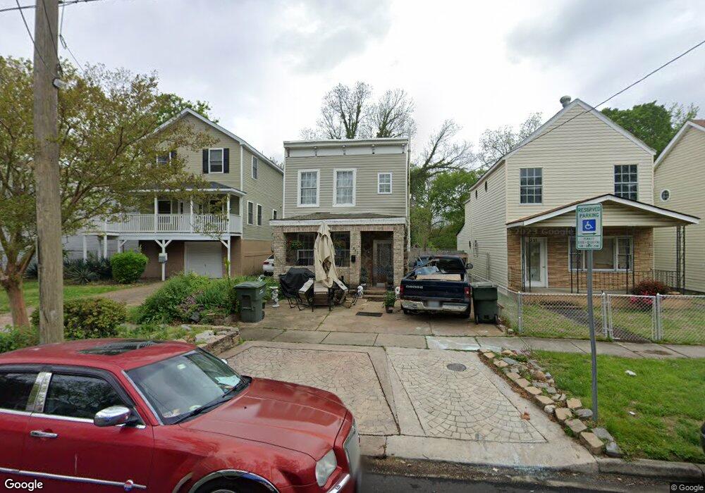
1347 Bolton St Norfolk, VA 23504
Olde Huntersville NeighborhoodEstimated Value: $147,000 - $199,000
3
Beds
2
Baths
1,342
Sq Ft
$126/Sq Ft
Est. Value
About This Home
This home is located at 1347 Bolton St, Norfolk, VA 23504 and is currently estimated at $168,709, approximately $125 per square foot. 1347 Bolton St is a home located in Norfolk City with nearby schools including Jacox Elementary School, Ruffner Middle School, and B.T. Washington High School.
Ownership History
Date
Name
Owned For
Owner Type
Purchase Details
Closed on
Dec 6, 2019
Sold by
1347 Bolton Street Llc
Bought by
Lyles Roberta
Current Estimated Value
Purchase Details
Closed on
Mar 16, 2011
Sold by
Smith Keenan L and Smith Keenan Lenell
Bought by
1347 Bolton Street Llc
Home Financials for this Owner
Home Financials are based on the most recent Mortgage that was taken out on this home.
Original Mortgage
$29,925
Interest Rate
4.84%
Mortgage Type
Purchase Money Mortgage
Create a Home Valuation Report for This Property
The Home Valuation Report is an in-depth analysis detailing your home's value as well as a comparison with similar homes in the area
Home Values in the Area
Average Home Value in this Area
Purchase History
| Date | Buyer | Sale Price | Title Company |
|---|---|---|---|
| Lyles Roberta | -- | None Available | |
| 1347 Bolton Street Llc | $13,986 | Fidelity Natl Title Ins Co |
Source: Public Records
Mortgage History
| Date | Status | Borrower | Loan Amount |
|---|---|---|---|
| Previous Owner | 1347 Bolton Street Llc | $29,925 |
Source: Public Records
Tax History Compared to Growth
Tax History
| Year | Tax Paid | Tax Assessment Tax Assessment Total Assessment is a certain percentage of the fair market value that is determined by local assessors to be the total taxable value of land and additions on the property. | Land | Improvement |
|---|---|---|---|---|
| 2025 | $1,861 | $148,900 | $36,500 | $112,400 |
| 2024 | $1,733 | $138,600 | $36,500 | $102,100 |
| 2023 | $1,665 | $133,200 | $36,500 | $96,700 |
| 2022 | $1,425 | $114,000 | $25,200 | $88,800 |
| 2021 | $1,288 | $103,000 | $21,000 | $82,000 |
| 2020 | $1,288 | $103,000 | $21,000 | $82,000 |
| 2019 | $1,160 | $92,800 | $21,000 | $71,800 |
| 2018 | $1,125 | $90,000 | $21,000 | $69,000 |
| 2017 | $1,026 | $89,200 | $21,000 | $68,200 |
| 2016 | $986 | $79,600 | $19,600 | $60,000 |
| 2015 | $915 | $79,600 | $19,600 | $60,000 |
| 2014 | $915 | $79,600 | $19,600 | $60,000 |
Source: Public Records
Map
Nearby Homes
- 979 Denhart St
- 1456 Calhoun St
- 1005 Saint Julian Ave
- 962 Saint Julian Ave
- 1429 Chapel St
- 1447 Dungee St
- 1032 Anderson St
- 1815 Tidewater Dr
- 1825 Tidewater Dr
- 1256 Maltby Ave
- 1827 Carswell St
- 2220 Hanson Ave
- 859 Lexington St
- 1814 Bracey St
- 2229 Maltby Ave
- 702 Howard Place
- 1350 Marshall Ave
- 835 Fremont St
- 893 A Ave
- 833 Fremont St
- 1351 Bolton St
- 1339 Bolton St
- 1355 Bolton St
- 1020 Dunbar St
- 1335 Bolton St
- 1359 Bolton St
- 1026 Dunbar St
- 1016 Dunbar St
- 1363 Bolton St
- 1367 Bolton St
- 1327 Bolton St
- 1014 Dunbar St
- 1007 Denhart St
- 1003 Denhart St
- 1371 Bolton St
- 1344 Bolton St
- 1340 Bolton St
- 1346 Bolton St
- 1336 Bolton St
- 1001 Denhart St