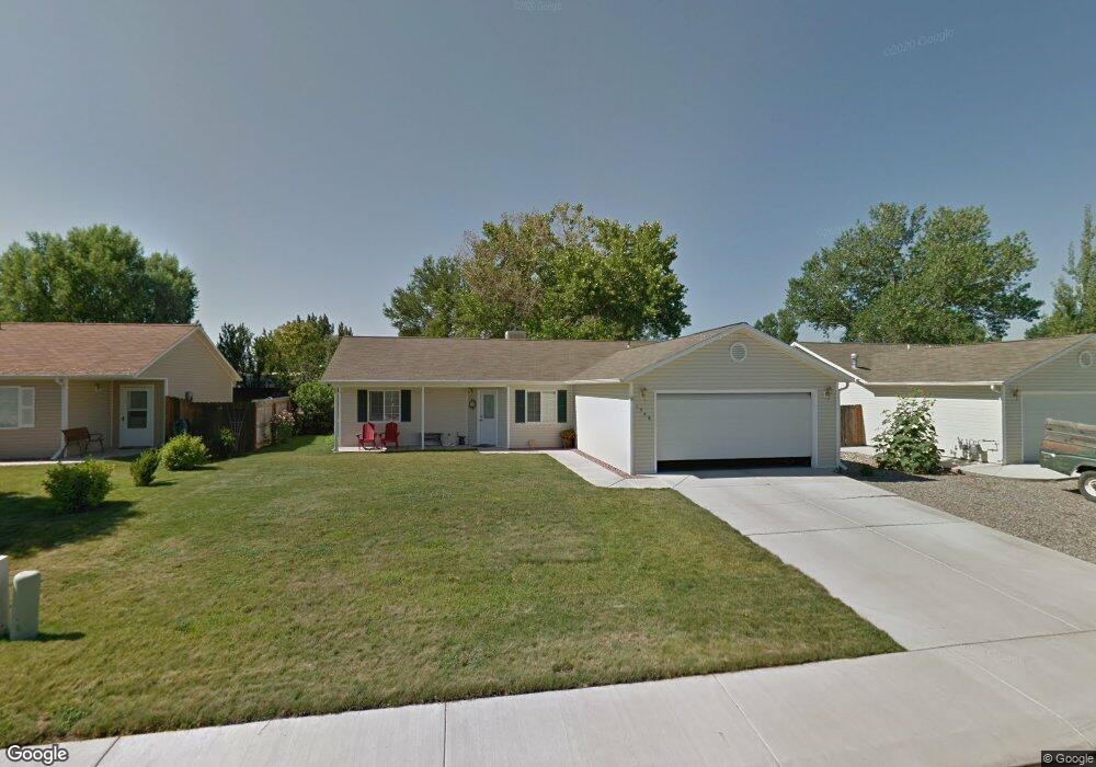
1348 Powell St Fruita, CO 81521
Estimated Value: $353,233 - $387,000
3
Beds
2
Baths
1,196
Sq Ft
$315/Sq Ft
Est. Value
About This Home
This home is located at 1348 Powell St, Fruita, CO 81521 and is currently estimated at $376,558, approximately $314 per square foot. 1348 Powell St is a home located in Mesa County with nearby schools including Monument Ridge Elementary School, Fruita Middle School, and Fruita 8/9 School.
Ownership History
Date
Name
Owned For
Owner Type
Purchase Details
Closed on
Feb 25, 2005
Sold by
Griffiths Erik C and Rich Nicole R
Bought by
Crosby Thomas W and Crosby Gail J
Current Estimated Value
Home Financials for this Owner
Home Financials are based on the most recent Mortgage that was taken out on this home.
Original Mortgage
$113,900
Outstanding Balance
$57,323
Interest Rate
5.5%
Mortgage Type
Unknown
Estimated Equity
$319,235
Purchase Details
Closed on
Jun 10, 2002
Sold by
Shadowfax Properties Inc
Bought by
Griffiths Erik C and Rich Nicole R
Home Financials for this Owner
Home Financials are based on the most recent Mortgage that was taken out on this home.
Original Mortgage
$109,650
Interest Rate
6.89%
Mortgage Type
FHA
Create a Home Valuation Report for This Property
The Home Valuation Report is an in-depth analysis detailing your home's value as well as a comparison with similar homes in the area
Home Values in the Area
Average Home Value in this Area
Purchase History
| Date | Buyer | Sale Price | Title Company |
|---|---|---|---|
| Crosby Thomas W | $145,900 | Meridian Land Title Llc | |
| Griffiths Erik C | $110,656 | Meridian Land Title Llc |
Source: Public Records
Mortgage History
| Date | Status | Borrower | Loan Amount |
|---|---|---|---|
| Open | Crosby Thomas W | $113,900 | |
| Previous Owner | Griffiths Erik C | $109,650 |
Source: Public Records
Tax History
| Year | Tax Paid | Tax Assessment Tax Assessment Total Assessment is a certain percentage of the fair market value that is determined by local assessors to be the total taxable value of land and additions on the property. | Land | Improvement |
|---|---|---|---|---|
| 2024 | $1,024 | $19,260 | $3,940 | $15,320 |
| 2023 | $1,024 | $19,260 | $3,940 | $15,320 |
| 2022 | $835 | $17,020 | $3,820 | $13,200 |
| 2021 | $841 | $17,510 | $3,930 | $13,580 |
| 2020 | $596 | $14,640 | $3,580 | $11,060 |
| 2019 | $568 | $14,640 | $3,580 | $11,060 |
| 2018 | $514 | $12,510 | $3,240 | $9,270 |
| 2017 | $494 | $12,510 | $3,240 | $9,270 |
| 2016 | $465 | $13,050 | $3,580 | $9,470 |
Source: Public Records
Map
Nearby Homes
- 1148 Powell St
- 1403 Oak Creek Ave
- 1123 Sprocket Ct
- 812 Alyssum Ct
- 351 Mee Canyon Cir
- 1152 Cherrywood Ave
- 1121 & 392 Hatchet Canyon Cir
- 1113 & 1115 Hatchet Canyon Cir
- 376 Hatchet Canyon Cir
- 376 Toms Canyon Dr
- 1107 & 1109 Mee Canyon Cir
- 1660 Powis Ln
- 1111 Sprocket Ct
- 1178 Primrose Ln
- 921 Caledonia Ct
- 1112 Sprocket Ct
- 362 Toms Canyon Dr
- 370 Toms Canyon Dr
- 1026 Lone Tree Ct
- 1107 Mee Canyon Cir
- 1350 Powell St
- 1336 Powell St
- 1345 Aquarius Ave
- 1347 Aquarius Ave
- 1362 Powell St
- 1324 Powell St
- 1343 Aquarius Ave
- 1351 Aquarius Ave
- 642 Corona Ct
- 1341 Aquarius Ave
- 1401 Aquarius Ave
- 631 Capricorn Ave
- 1374 Powell St
- 1312 Powell St
- 1339 Aquarius Ave
- 641 Corona Ct
- 1405 Aquarius Ave
- 1344 Aquarius Ave
- 1337 Aquarius Ave
- 1409 Aquarius Ave
Your Personal Tour Guide
Ask me questions while you tour the home.