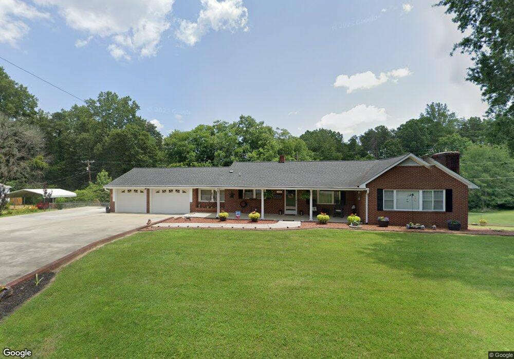
1348 Power Dam Rd Walnut Cove, NC 27052
Estimated Value: $252,000 - $351,000
3
Beds
2
Baths
1,536
Sq Ft
$186/Sq Ft
Est. Value
About This Home
This home is located at 1348 Power Dam Rd, Walnut Cove, NC 27052 and is currently estimated at $285,128, approximately $185 per square foot. 1348 Power Dam Rd is a home located in Stokes County with nearby schools including Walnut Cove Elementary School, Southeastern Stokes Middle School, and South Stokes High.
Ownership History
Date
Name
Owned For
Owner Type
Purchase Details
Closed on
Dec 7, 2015
Sold by
Johnson Patsy Ann Mabe and Johnson Donald G
Bought by
Johnson Ronald G and Johnson Pamela C
Current Estimated Value
Home Financials for this Owner
Home Financials are based on the most recent Mortgage that was taken out on this home.
Original Mortgage
$65,000
Interest Rate
3.83%
Mortgage Type
New Conventional
Create a Home Valuation Report for This Property
The Home Valuation Report is an in-depth analysis detailing your home's value as well as a comparison with similar homes in the area
Home Values in the Area
Average Home Value in this Area
Purchase History
| Date | Buyer | Sale Price | Title Company |
|---|---|---|---|
| Johnson Ronald G | $110,000 | Attorney |
Source: Public Records
Mortgage History
| Date | Status | Borrower | Loan Amount |
|---|---|---|---|
| Closed | Johnson Ronald G | $65,000 |
Source: Public Records
Tax History Compared to Growth
Tax History
| Year | Tax Paid | Tax Assessment Tax Assessment Total Assessment is a certain percentage of the fair market value that is determined by local assessors to be the total taxable value of land and additions on the property. | Land | Improvement |
|---|---|---|---|---|
| 2025 | $1,580 | $221,000 | $26,500 | $194,500 |
| 2024 | $1,580 | $153,200 | $21,500 | $131,700 |
| 2023 | $1,241 | $153,200 | $21,500 | $131,700 |
| 2022 | $1,134 | $153,200 | $21,500 | $131,700 |
| 2021 | $1,011 | $153,200 | $21,500 | $131,700 |
| 2020 | $901 | $136,500 | $20,500 | $116,000 |
| 2019 | $1,010 | $136,500 | $20,500 | $116,000 |
| 2018 | $1,010 | $136,500 | $20,500 | $116,000 |
| 2017 | $1,003 | $136,500 | $20,500 | $116,000 |
| 2016 | $958 | $130,300 | $20,500 | $109,800 |
| 2015 | $951 | $130,300 | $20,500 | $109,800 |
| 2014 | $940 | $130,300 | $20,500 | $109,800 |
Source: Public Records
Map
Nearby Homes
- Lot 3 Bunker Hill Rd
- Lot 6 Ralph Tuttle Rd
- 3C Jimmie Bullins Rd
- 4D Jimmie Bullins Rd
- 1040 Pink Smith Rd
- 2447 Piney Mountain Rd
- 0 Baileytown Church Rd
- 1010 Saint Charles Way
- 0 Dodgetown Rd
- 1283 Gene Martin Rd
- 1125 N Main St
- 1031 Red Oak Dr
- 1833 Piney Mountain Rd
- 0 Mary Ann Rd
- 0000 Augusta Hicks Rd
- 1075 Augusta Hicks Rd
- 1012 Oldtown Rd
- 1095 Piney Meadows Dr
- 000 Wellhouse Dr
- 1090 Tree Haven Ln
- 1362 Power Dam Rd
- 1347 Power Dam Rd
- 1318 Power Dam Rd
- 1323 Power Dam Rd
- 1371 Power Dam Rd
- 1359 Power Dam Rd
- 1294 Power Dam Rd
- 1080 Foxy Ln
- 1115 Foxy Ln
- 1235 Power Dam Rd
- 1464 Power Dam Rd
- 1093 Tilley Rd
- 1234 Power Dam Rd
- 1476 Power Dam Rd
- 1114 Tilley Rd
- 1119 Tilley Rd
- 1041 Logan Acres Rd
- 1168 Old Tilley Rd
- 1149 Tilley Rd
- 1128 Old Tilley Rd