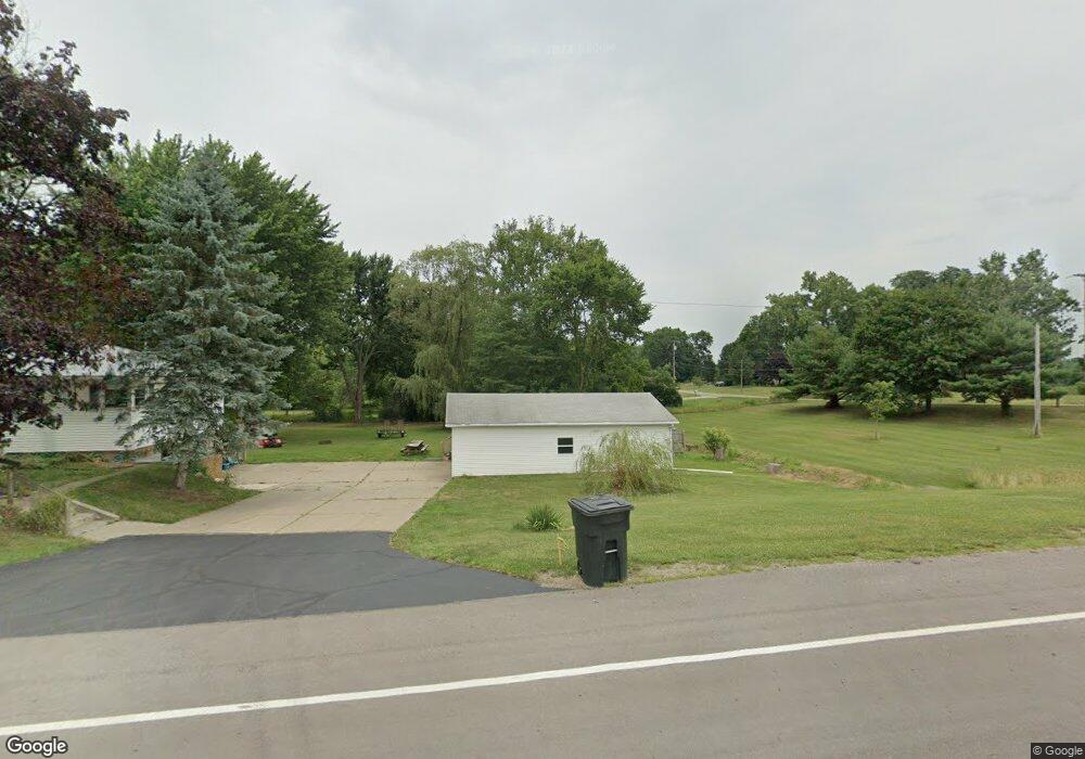
13483 Beeson St NE Alliance, OH 44601
Estimated Value: $215,592 - $222,000
3
Beds
2
Baths
1,232
Sq Ft
$177/Sq Ft
Est. Value
About This Home
This home is located at 13483 Beeson St NE, Alliance, OH 44601 and is currently estimated at $218,648, approximately $177 per square foot. 13483 Beeson St NE is a home located in Stark County with nearby schools including Marlington High School and Regina Coeli/St Joseph School.
Ownership History
Date
Name
Owned For
Owner Type
Purchase Details
Closed on
Feb 28, 2014
Sold by
Mitchell Kimberly and Mitchell Stephen
Bought by
S & K Mitchell Properties Llc
Current Estimated Value
Purchase Details
Closed on
Jan 3, 2006
Sold by
Weston Paula S
Bought by
Mitchell Stephen R and Mitchell Kimberly K
Home Financials for this Owner
Home Financials are based on the most recent Mortgage that was taken out on this home.
Original Mortgage
$133,000
Interest Rate
7.75%
Mortgage Type
Fannie Mae Freddie Mac
Purchase Details
Closed on
Apr 10, 1997
Sold by
Dewell Gary A
Bought by
Weston Paula S
Home Financials for this Owner
Home Financials are based on the most recent Mortgage that was taken out on this home.
Original Mortgage
$73,600
Interest Rate
7.74%
Mortgage Type
New Conventional
Purchase Details
Closed on
Sep 8, 1992
Create a Home Valuation Report for This Property
The Home Valuation Report is an in-depth analysis detailing your home's value as well as a comparison with similar homes in the area
Home Values in the Area
Average Home Value in this Area
Purchase History
| Date | Buyer | Sale Price | Title Company |
|---|---|---|---|
| S & K Mitchell Properties Llc | -- | None Available | |
| Mitchell Stephen R | $133,000 | -- | |
| Weston Paula S | $92,000 | -- | |
| -- | $66,000 | -- |
Source: Public Records
Mortgage History
| Date | Status | Borrower | Loan Amount |
|---|---|---|---|
| Previous Owner | Mitchell Stephen R | $133,000 | |
| Previous Owner | Weston Paula S | $73,600 |
Source: Public Records
Tax History Compared to Growth
Tax History
| Year | Tax Paid | Tax Assessment Tax Assessment Total Assessment is a certain percentage of the fair market value that is determined by local assessors to be the total taxable value of land and additions on the property. | Land | Improvement |
|---|---|---|---|---|
| 2025 | -- | $57,060 | $27,830 | $29,230 |
| 2024 | -- | $57,060 | $27,830 | $29,230 |
| 2023 | $1,606 | $44,560 | $14,810 | $29,750 |
| 2022 | $1,612 | $44,560 | $14,810 | $29,750 |
| 2021 | $1,624 | $44,770 | $14,810 | $29,960 |
| 2020 | $1,576 | $38,710 | $12,740 | $25,970 |
| 2019 | $1,567 | $38,730 | $12,750 | $25,980 |
| 2018 | $1,570 | $38,730 | $12,750 | $25,980 |
| 2017 | $1,545 | $35,680 | $12,120 | $23,560 |
| 2016 | $1,495 | $34,520 | $11,450 | $23,070 |
| 2015 | $1,429 | $34,520 | $11,450 | $23,070 |
| 2014 | $888 | $28,780 | $9,560 | $19,220 |
| 2013 | $442 | $28,780 | $9,560 | $19,220 |
Source: Public Records
Map
Nearby Homes
- 13334 Cindy St NE
- 0 Meadow St NE
- 0 W Main St Unit 5090123
- 10666 Wilma Ave NE
- 11480 Aebi Ave NE
- 000 Klinger Ave
- 432 Johnson Ave
- 1430 Westwood Ave
- 2081 Marwood Cir
- 0 Klinger Ave NE
- 000 Meadowbrook Ave
- 565 W Broadway St
- 1201 Overlook Dr
- 0 Meadowbrook Ave
- 1038 Fairview Place
- 0 Johnson Ave NE Unit 5142926
- 0 Homestead Ave NE
- 520 W Cambridge St
- 734 Parkway Blvd
- 14422 Sturbridge Rd NE
- 0 Beeson St NE Unit 3398938
- 0 Beeson St NE Unit 3467574
- 0 Beeson St NE Unit 3642527
- 0 Beeson St NE Unit 3921428
- 0 Beeson St NE Unit 4436878
- 13445 Beeson St NE
- 10585 Nellabrook Ave NE
- 13555 Beeson St NE
- 10505 Nellabrook Ave NE
- 10580 Heltman Ave NE
- 10578 Nellabrook Ave NE
- 10635 Nellabrook Ave NE
- 10616 Heltman Ave NE
- 13363 Beeson St NE
- 10628 Nellabrook Ave NE
- 10571 Heltman Ave NE
- 10595 Heltman Ave NE
- 10655 Nellabrook Ave NE
- 10656 Nellabrook Ave NE
- 10654 Heltman Ave NE