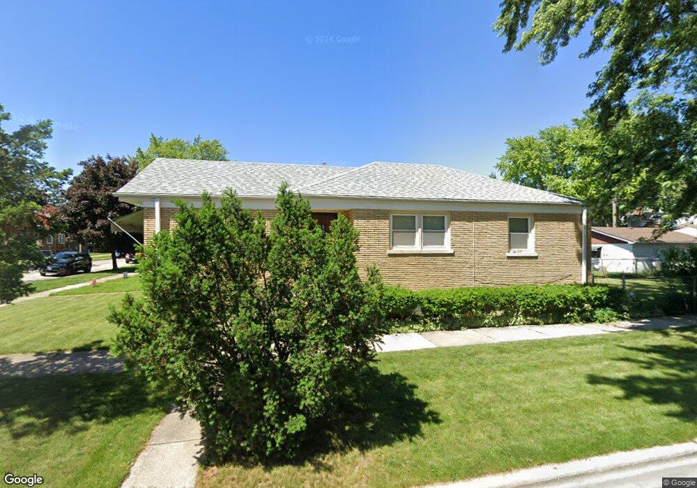
1349 Wenonah Ave Berwyn, IL 60402
Estimated Value: $294,000 - $325,000
3
Beds
1
Bath
1,028
Sq Ft
$299/Sq Ft
Est. Value
About This Home
This home is located at 1349 Wenonah Ave, Berwyn, IL 60402 and is currently estimated at $306,934, approximately $298 per square foot. 1349 Wenonah Ave is a home located in Cook County with nearby schools including Jefferson Elementary School, Lincoln Middle School, and J Sterling Morton West High School.
Ownership History
Date
Name
Owned For
Owner Type
Purchase Details
Closed on
Jun 26, 2007
Sold by
Trotta Judith and Tellone Rose L
Bought by
Garcia Jose T and Garcia Miguel Claudia
Current Estimated Value
Home Financials for this Owner
Home Financials are based on the most recent Mortgage that was taken out on this home.
Original Mortgage
$207,100
Outstanding Balance
$131,925
Interest Rate
6.87%
Mortgage Type
Unknown
Estimated Equity
$175,009
Create a Home Valuation Report for This Property
The Home Valuation Report is an in-depth analysis detailing your home's value as well as a comparison with similar homes in the area
Home Values in the Area
Average Home Value in this Area
Purchase History
| Date | Buyer | Sale Price | Title Company |
|---|---|---|---|
| Garcia Jose T | $218,000 | Executive Land Title |
Source: Public Records
Mortgage History
| Date | Status | Borrower | Loan Amount |
|---|---|---|---|
| Open | Garcia Jose T | $207,100 |
Source: Public Records
Tax History Compared to Growth
Tax History
| Year | Tax Paid | Tax Assessment Tax Assessment Total Assessment is a certain percentage of the fair market value that is determined by local assessors to be the total taxable value of land and additions on the property. | Land | Improvement |
|---|---|---|---|---|
| 2024 | $5,560 | $21,000 | $4,624 | $16,376 |
| 2023 | $6,055 | $21,000 | $4,624 | $16,376 |
| 2022 | $6,055 | $18,528 | $4,007 | $14,521 |
| 2021 | $5,801 | $18,528 | $4,007 | $14,521 |
| 2020 | $5,734 | $18,528 | $4,007 | $14,521 |
| 2019 | $4,834 | $15,149 | $3,596 | $11,553 |
| 2018 | $4,641 | $15,149 | $3,596 | $11,553 |
| 2017 | $4,521 | $15,149 | $3,596 | $11,553 |
| 2016 | $3,687 | $11,213 | $2,979 | $8,234 |
| 2015 | $3,565 | $11,213 | $2,979 | $8,234 |
| 2014 | $3,488 | $11,213 | $2,979 | $8,234 |
| 2013 | $3,805 | $13,238 | $2,979 | $10,259 |
Source: Public Records
Map
Nearby Homes
- 1329 Wisconsin Ave
- 1324 Clinton Ave
- 1216 Wenonah Ave
- 1341 Kenilworth Ave
- 1531 Wenonah Ave
- 7011 Roosevelt Rd
- 1336 Grove Ave
- 1409 Harlem Ave
- 1327 Harlem Ave
- 1227 S Harlem Ave Unit 512
- 1227 S Harlem Ave Unit 208
- 1227 S Harlem Ave Unit 307
- 1227 S Harlem Ave Unit 514
- 1227 S Harlem Ave Unit 510
- 1227 S Harlem Ave Unit 415
- 1547 Clinton Ave
- 1615 Wenonah Ave
- 1320 Oak Park Ave
- 1618 Wenonah Ave
- 1224 Elgin Ave
- 1345 Wenonah Ave
- 1343 Wenonah Ave
- 1401 Wenonah Ave
- 1339 Wenonah Ave
- 1339 Wenonah Ave Unit 2
- 1403 Wenonah Ave Unit S
- 1405 Wenonah Ave
- 1335 Wenonah Ave
- 1344 Home Ave
- 1342 Home Ave
- 1340 Home Ave
- 1400 Home Ave
- 1409 Wenonah Ave
- 1338 Home Ave
- 1402 Home Ave
- 1331 Wenonah Ave
- 1346 Wenonah Ave
- 1334 Home Ave
- 1406 Home Ave
- 1342 Wenonah Ave