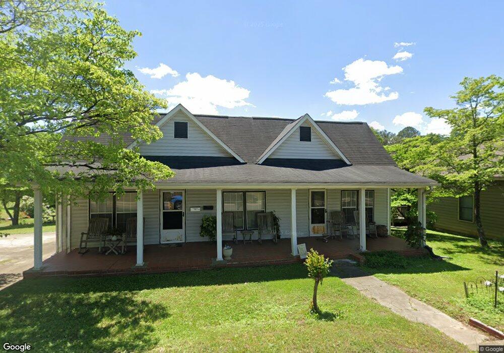
135 A W Roberts Dr Ball Ground, GA 30107
Estimated Value: $356,808 - $440,000
2
Beds
1
Bath
2,068
Sq Ft
$201/Sq Ft
Est. Value
About This Home
This home is located at 135 A W Roberts Dr, Ball Ground, GA 30107 and is currently estimated at $416,452, approximately $201 per square foot. 135 A W Roberts Dr is a home located in Cherokee County with nearby schools including Ball Ground Elementary School, Creekland Middle School, and Creekview High School.
Ownership History
Date
Name
Owned For
Owner Type
Purchase Details
Closed on
Sep 17, 2021
Sold by
Disharoon Ralph M
Bought by
Alvarez Jorge Samuel De La Ve
Current Estimated Value
Purchase Details
Closed on
Aug 31, 2021
Sold by
Disharoon Ralph M
Bought by
Hampel Christian Daniel and Hampel John Edward
Purchase Details
Closed on
Aug 3, 2021
Sold by
Disharoon Margie
Bought by
Disharoon Ralph M
Purchase Details
Closed on
May 23, 2008
Sold by
Disharoon Ralph M
Bought by
Disharoon Margie
Create a Home Valuation Report for This Property
The Home Valuation Report is an in-depth analysis detailing your home's value as well as a comparison with similar homes in the area
Home Values in the Area
Average Home Value in this Area
Purchase History
| Date | Buyer | Sale Price | Title Company |
|---|---|---|---|
| Alvarez Jorge Samuel De La Ve | $260,000 | -- | |
| Hampel Christian Daniel | $259,000 | -- | |
| Disharoon Ralph M | -- | -- | |
| Disharoon Margie | $40,000 | -- |
Source: Public Records
Tax History Compared to Growth
Tax History
| Year | Tax Paid | Tax Assessment Tax Assessment Total Assessment is a certain percentage of the fair market value that is determined by local assessors to be the total taxable value of land and additions on the property. | Land | Improvement |
|---|---|---|---|---|
| 2025 | $728 | $89,640 | $31,200 | $58,440 |
| 2024 | $732 | $82,360 | $31,200 | $51,160 |
| 2023 | $594 | $85,560 | $31,200 | $54,360 |
| 2022 | $718 | $77,400 | $31,200 | $46,200 |
| 2021 | $643 | $57,560 | $24,000 | $33,560 |
| 2020 | $604 | $50,520 | $17,280 | $33,240 |
| 2019 | $543 | $45,120 | $17,280 | $27,840 |
| 2018 | $516 | $39,840 | $15,600 | $24,240 |
| 2017 | $468 | $87,900 | $14,400 | $20,760 |
| 2016 | $387 | $71,200 | $9,600 | $18,880 |
| 2015 | $374 | $66,900 | $9,600 | $17,160 |
| 2014 | $367 | $64,700 | $9,600 | $16,280 |
Source: Public Records
Map
Nearby Homes
- 155 Strippling St
- 125 Stripling St
- 256 Cartersville St
- 318 Cottage Ct
- 115 Dixie Ln
- 107 Tanya Way
- 105 Tanya Way
- 128 Tanya Way
- 165 Blackwell St
- 548 Old Canton Rd
- 127 Mills Ln
- 286 Lowry St
- 277 Reese Way
- 326 Reese Way
- 549 Groover St
- 557 Groover St
- 239 Northridge Rd
- 533 Groover St
- 553 Groover St
- 113 Covington Dr
- 125 A W Roberts Dr
- 110 Strippling St
- 110 Stripling St
- 145 Cartersville St
- 116 Strippling St
- 105 A W Roberts Dr
- 115 A W Roberts Dr
- 153 A W Roberts Dr
- A A W Roberts Dr
- 120 Strippling St
- 26 River Trail
- 27 River Trail
- 111 Drive
- 170 Strippling St
- 155 A W Roberts Dr
- 111 Strippling St
- 174 Strippling St
- 176 Lyons Ave
- 00 Stripling St
- 145 Lyons Ave