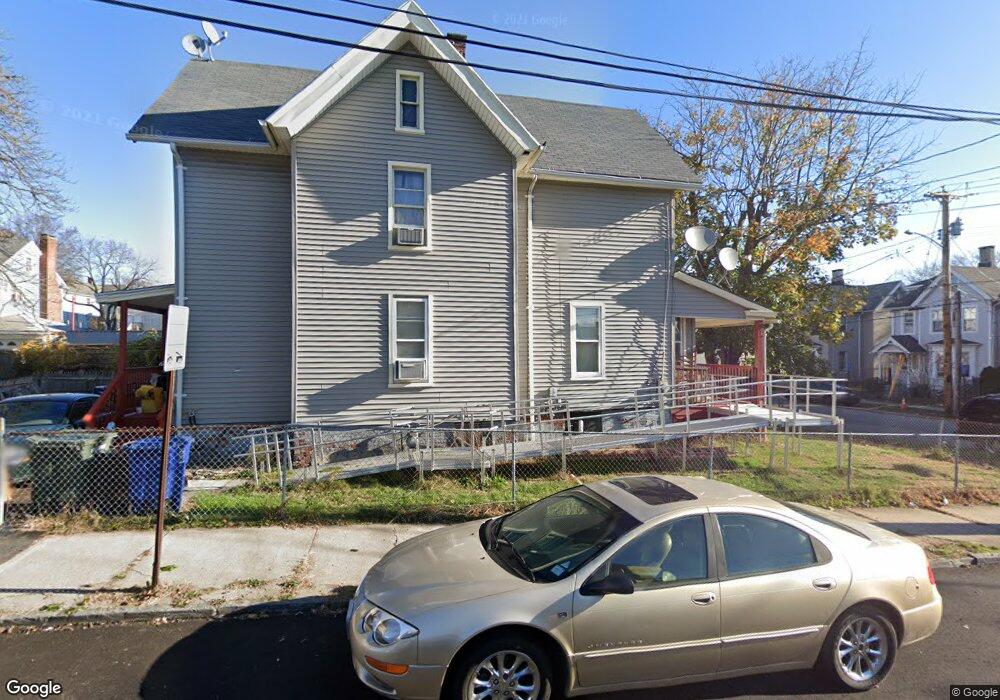
135 Benham Ave Bridgeport, CT 06605
West End-West Side NeighborhoodEstimated Value: $339,000 - $438,000
3
Beds
2
Baths
1,498
Sq Ft
$245/Sq Ft
Est. Value
About This Home
This home is located at 135 Benham Ave, Bridgeport, CT 06605 and is currently estimated at $366,438, approximately $244 per square foot. 135 Benham Ave is a home located in Fairfield County with nearby schools including James J. Curiale School, Bassick High School, and Catholic Academy of Bridgeport-St. Raphael Academy.
Ownership History
Date
Name
Owned For
Owner Type
Purchase Details
Closed on
Sep 3, 1996
Sold by
135 Benham Avenue Llc
Bought by
Mooney Edgar
Current Estimated Value
Home Financials for this Owner
Home Financials are based on the most recent Mortgage that was taken out on this home.
Original Mortgage
$48,977
Interest Rate
8.18%
Mortgage Type
Unknown
Purchase Details
Closed on
Jul 19, 1995
Sold by
Sakakini Imad H
Bought by
135 Benham Ave Llc
Purchase Details
Closed on
Jul 19, 1994
Sold by
Union Trust Co
Bought by
Sakakini Imad H
Purchase Details
Closed on
Aug 18, 1988
Sold by
Jones Theresa
Bought by
Hoyt Barbara
Create a Home Valuation Report for This Property
The Home Valuation Report is an in-depth analysis detailing your home's value as well as a comparison with similar homes in the area
Home Values in the Area
Average Home Value in this Area
Purchase History
| Date | Buyer | Sale Price | Title Company |
|---|---|---|---|
| Mooney Edgar | $49,900 | -- | |
| Mooney Edgar | $49,900 | -- | |
| 135 Benham Ave Llc | $12,000 | -- | |
| 135 Benham Ave Llc | $12,000 | -- | |
| Sakakini Imad H | $12,000 | -- | |
| Sakakini Imad H | $12,000 | -- | |
| Hoyt Barbara | $62,900 | -- |
Source: Public Records
Mortgage History
| Date | Status | Borrower | Loan Amount |
|---|---|---|---|
| Open | Hoyt Barbara | $50,000 | |
| Closed | Hoyt Barbara | $48,977 |
Source: Public Records
Tax History
| Year | Tax Paid | Tax Assessment Tax Assessment Total Assessment is a certain percentage of the fair market value that is determined by local assessors to be the total taxable value of land and additions on the property. | Land | Improvement |
|---|---|---|---|---|
| 2025 | $5,625 | $129,470 | $44,460 | $85,010 |
| 2024 | $5,625 | $129,470 | $44,460 | $85,010 |
| 2023 | $5,625 | $129,470 | $44,460 | $85,010 |
| 2022 | $5,625 | $129,470 | $44,460 | $85,010 |
| 2021 | $5,625 | $129,470 | $44,460 | $85,010 |
| 2020 | $5,999 | $111,120 | $26,950 | $84,170 |
| 2019 | $5,999 | $111,120 | $26,950 | $84,170 |
| 2018 | $6,042 | $111,120 | $26,950 | $84,170 |
| 2017 | $6,042 | $111,120 | $26,950 | $84,170 |
| 2016 | $6,042 | $111,120 | $26,950 | $84,170 |
| 2015 | $6,030 | $142,890 | $40,770 | $102,120 |
| 2014 | $6,030 | $142,890 | $40,770 | $102,120 |
Source: Public Records
Map
Nearby Homes
- 60 Olive St
- 391 Coleman St
- 41 Washington Terrace
- 1146 Iranistan Ave Unit 1148
- 393 Laurel Ave Unit 203
- 700 Laurel Ave
- 30 Pacific St Unit 32
- 697 Laurel Ave
- 357 Norman St
- 49 Elmwood Place
- 120 Milne St Unit 122
- 100 Lorraine St
- 57 Milne St Unit 59
- 1522 North Ave
- 865 Iranistan Ave
- 1285 Norman St
- 41 Hanover St
- 162 Cottage St
- 150 Clinton Ave
- 318 Center St
- 141 Benham Ave
- 147 Benham Ave
- 24 Brothwell St Unit 26
- 115 Benham Ave Unit 117
- 34 Brothwell St
- 136 Benham Ave Unit 138
- 109 Benham Ave Unit 2
- 155 Benham Ave
- 756 Norman St Unit 756
- 754 Norman St Unit 756
- 754 Norman St Unit 754
- 754 Norman St Unit 754-756
- 754 Norman St Unit 1
- 128 Benham Ave Unit 134
- 762 Norman St
- 142 Benham Ave
- 107 Benham Ave Unit 109
- 107 Benham Ave Unit 1
- 768 Norman St Unit 770
- 768 Norman St Unit 1
Your Personal Tour Guide
Ask me questions while you tour the home.