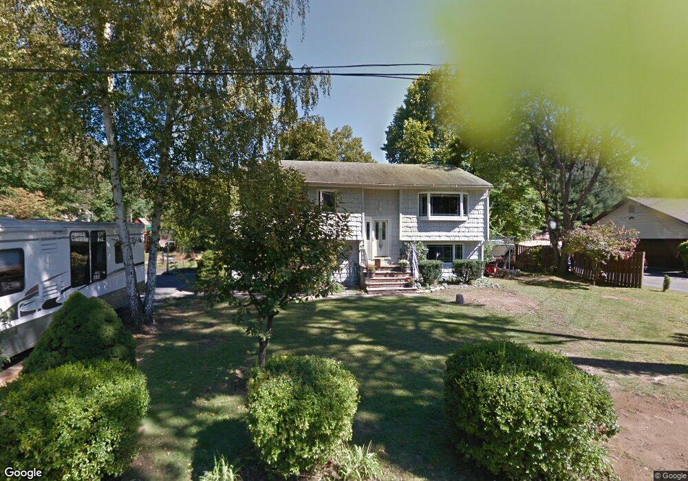
135 Broad Ave Palisades, NY 10964
Estimated Value: $721,309 - $832,000
3
Beds
2
Baths
1,191
Sq Ft
$641/Sq Ft
Est. Value
About This Home
This home is located at 135 Broad Ave, Palisades, NY 10964 and is currently estimated at $763,327, approximately $640 per square foot. 135 Broad Ave is a home located in Rockland County with nearby schools including William O Schaefer Elementary School, Cottage Lane Elementary School, and South Orangetown Middle School.
Ownership History
Date
Name
Owned For
Owner Type
Purchase Details
Closed on
May 16, 2002
Sold by
Berger Mante Michele and Mante Peter
Bought by
Berger Mante Michele and Mante Peter
Current Estimated Value
Home Financials for this Owner
Home Financials are based on the most recent Mortgage that was taken out on this home.
Original Mortgage
$201,500
Outstanding Balance
$84,906
Interest Rate
6.9%
Estimated Equity
$678,421
Purchase Details
Closed on
May 11, 2000
Sold by
Kim Daniel and Kim Eunice
Bought by
Mante Peter and Berger Mante Michele
Home Financials for this Owner
Home Financials are based on the most recent Mortgage that was taken out on this home.
Original Mortgage
$200,000
Interest Rate
8.21%
Purchase Details
Closed on
Jan 22, 1997
Sold by
Mossey Shelly
Bought by
Kim Daniel and Kim Eunice
Home Financials for this Owner
Home Financials are based on the most recent Mortgage that was taken out on this home.
Original Mortgage
$192,000
Interest Rate
7.57%
Mortgage Type
Construction
Create a Home Valuation Report for This Property
The Home Valuation Report is an in-depth analysis detailing your home's value as well as a comparison with similar homes in the area
Home Values in the Area
Average Home Value in this Area
Purchase History
| Date | Buyer | Sale Price | Title Company |
|---|---|---|---|
| Berger Mante Michele | -- | -- | |
| Mante Peter | $280,000 | -- | |
| Kim Daniel | $203,000 | -- |
Source: Public Records
Mortgage History
| Date | Status | Borrower | Loan Amount |
|---|---|---|---|
| Open | Berger Mante Michele | $201,500 | |
| Closed | Mante Peter | $200,000 | |
| Previous Owner | Kim Daniel | $192,000 |
Source: Public Records
Tax History Compared to Growth
Tax History
| Year | Tax Paid | Tax Assessment Tax Assessment Total Assessment is a certain percentage of the fair market value that is determined by local assessors to be the total taxable value of land and additions on the property. | Land | Improvement |
|---|---|---|---|---|
| 2024 | $13,591 | $177,400 | $63,800 | $113,600 |
| 2023 | $13,591 | $177,400 | $63,800 | $113,600 |
| 2022 | $4,915 | $177,400 | $63,800 | $113,600 |
| 2021 | $10,991 | $177,400 | $63,800 | $113,600 |
| 2020 | $10,977 | $177,400 | $63,800 | $113,600 |
| 2019 | $4,604 | $177,400 | $63,800 | $113,600 |
| 2018 | $10,253 | $177,400 | $63,800 | $113,600 |
| 2017 | $9,895 | $177,400 | $63,800 | $113,600 |
| 2016 | $9,623 | $177,400 | $63,800 | $113,600 |
| 2015 | -- | $177,400 | $63,800 | $113,600 |
| 2014 | -- | $177,400 | $63,800 | $113,600 |
Source: Public Records
Map
Nearby Homes
- 4 Iroquois Ave
- 516 Oak Tree Rd
- 173 Oak Tree Rd
- 12 Blair Ct
- 58 Lexington Rd
- 1 Kopac Ln
- 215 Washington St Unit 19
- 149 Washington Spring Rd
- 40 Delongis Ct
- 219 Route 9w
- 175 Walnut St
- 326 Bradley Ave
- 188 Scharer Ave
- 26 Van Terrace
- 141 Washington Spring Rd
- 314 Lambert Ave
- 312 Lambert Ave
- 21 Woods Rd
- 78 Main St
- 28 Ludlow Ln
- 168 Morningside Ave
- 130 Broad Ave
- 125 Broad Ave
- 145 Broad Ave
- 164 Morningside Ave
- 172 Morningside Ave
- 120 Broad Ave
- 171 Morningside Ave
- 135 Park Ave
- 173 Morningside Ave
- 150 Broad Ave
- 155 Broad Ave
- 175 Morningside Ave
- 125 Park Ave
- 162 Morningside Ave
- 169 Morningside Ave
- 178 Morningside Ave
- 145 Park Ave
- 177 Morningside Ave
- 796 Route 340