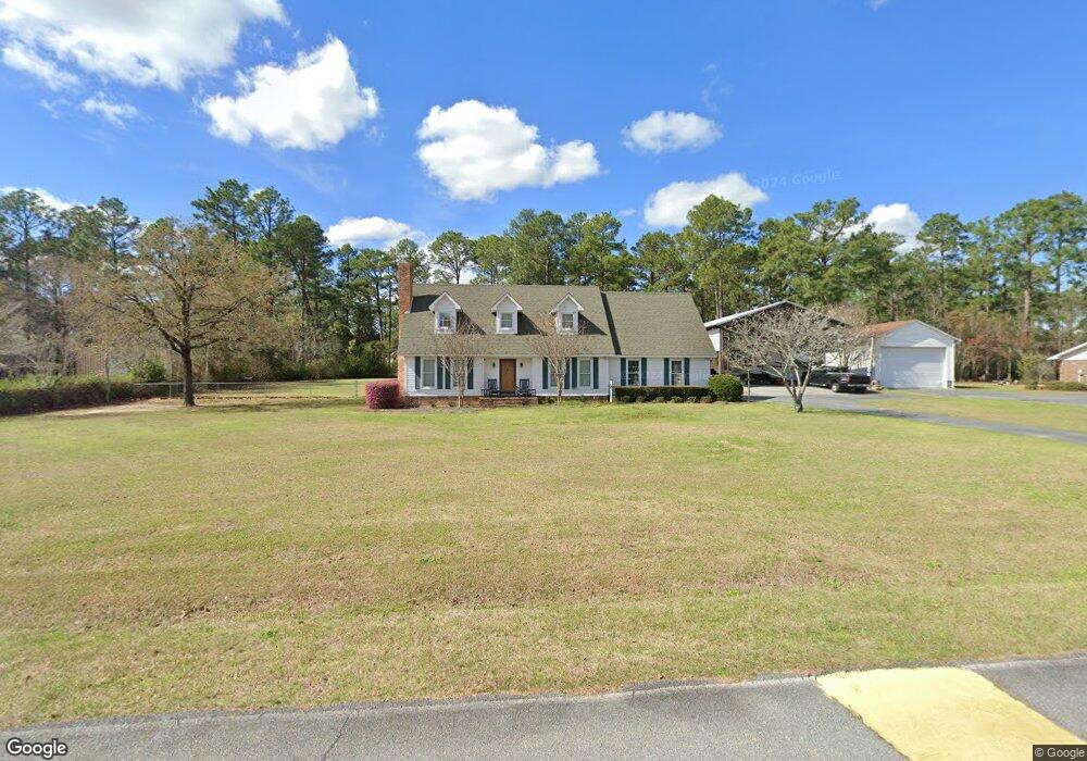
135 Carol Dr Cochran, GA 31014
Estimated Value: $213,000 - $271,000
3
Beds
2
Baths
1,833
Sq Ft
$127/Sq Ft
Est. Value
About This Home
This home is located at 135 Carol Dr, Cochran, GA 31014 and is currently estimated at $232,782, approximately $126 per square foot. 135 Carol Dr is a home located in Bleckley County with nearby schools including Bleckley County Primary School, Bleckley County Elementary School, and Bleckley Middle School.
Ownership History
Date
Name
Owned For
Owner Type
Purchase Details
Closed on
Dec 15, 2017
Sold by
Henson Avery Lee L
Bought by
Dupree Stephen Todd
Current Estimated Value
Home Financials for this Owner
Home Financials are based on the most recent Mortgage that was taken out on this home.
Original Mortgage
$118,750
Outstanding Balance
$99,533
Interest Rate
3.95%
Mortgage Type
New Conventional
Estimated Equity
$133,249
Purchase Details
Closed on
Oct 10, 2014
Sold by
Larsen Donna C
Bought by
Henson Avery Lee L
Purchase Details
Closed on
Aug 18, 1975
Bought by
Larsen Jens E
Create a Home Valuation Report for This Property
The Home Valuation Report is an in-depth analysis detailing your home's value as well as a comparison with similar homes in the area
Home Values in the Area
Average Home Value in this Area
Purchase History
| Date | Buyer | Sale Price | Title Company |
|---|---|---|---|
| Dupree Stephen Todd | $125,000 | -- | |
| Henson Avery Lee L | -- | -- | |
| Larsen Jens E | -- | -- |
Source: Public Records
Mortgage History
| Date | Status | Borrower | Loan Amount |
|---|---|---|---|
| Open | Dupree Stephen Todd | $118,750 |
Source: Public Records
Tax History
| Year | Tax Paid | Tax Assessment Tax Assessment Total Assessment is a certain percentage of the fair market value that is determined by local assessors to be the total taxable value of land and additions on the property. | Land | Improvement |
|---|---|---|---|---|
| 2025 | $1,984 | $74,320 | $8,640 | $65,680 |
| 2024 | $1,911 | $71,440 | $5,760 | $65,680 |
| 2023 | $1,982 | $71,440 | $5,760 | $65,680 |
| 2022 | $1,739 | $63,920 | $5,760 | $58,160 |
| 2021 | $1,459 | $50,120 | $5,760 | $44,360 |
| 2020 | $1,459 | $50,120 | $5,760 | $44,360 |
| 2019 | $1,252 | $42,936 | $4,000 | $38,936 |
| 2018 | $1,263 | $42,936 | $4,000 | $38,936 |
| 2017 | $1,058 | $42,936 | $4,000 | $38,936 |
| 2016 | $1,207 | $47,952 | $4,000 | $43,952 |
| 2015 | -- | $47,952 | $4,000 | $43,952 |
| 2014 | -- | $47,952 | $4,000 | $43,952 |
| 2013 | -- | $47,952 | $4,000 | $43,952 |
Source: Public Records
Map
Nearby Homes
- RV Park Mac Thompson Rd
- Land Mac Thompson Rd
- 119 Moll Dr
- 111 Marie Dr
- 0 Willow Creek Run
- 0 Mac Thompson Rd Unit 260249
- 0 Mac Thompson Rd Unit 16072590
- 0 Mac Thompson Rd Unit 261700
- 159 Jockey Ln
- 0 Wood Oak Cir Unit 233873
- 0 Wood Oak Cir Unit 9278951
- 175 Wood Oak Cir
- 116 Pecan St
- 118 Pecan St
- 112 Pecan St
- 134 Easy St
- 140 Racetrack Dr
- 116 W Lewis St
- 0 Limestone Rd Unit 25839040
- 0 Limestone Rd Unit 10659326
Your Personal Tour Guide
Ask me questions while you tour the home.