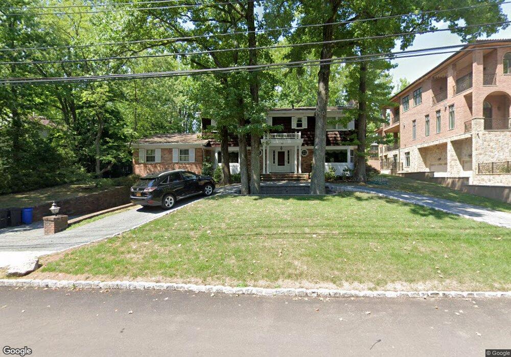
135 Circle Rd Staten Island, NY 10304
Todt Hill NeighborhoodEstimated Value: $1,778,031 - $2,619,000
--
Bed
4
Baths
3,104
Sq Ft
$670/Sq Ft
Est. Value
About This Home
This home is located at 135 Circle Rd, Staten Island, NY 10304 and is currently estimated at $2,078,344, approximately $669 per square foot. 135 Circle Rd is a home located in Richmond County with nearby schools including P.S. 11 Thomas Dongan School, Myra S. Barnes Intermediate School 24, and Susan E Wagner High School.
Ownership History
Date
Name
Owned For
Owner Type
Purchase Details
Closed on
Dec 22, 2004
Sold by
Master Daniel L and Florence R Master
Bought by
Master Jr Daniel L and Master Angie
Current Estimated Value
Home Financials for this Owner
Home Financials are based on the most recent Mortgage that was taken out on this home.
Original Mortgage
$350,000
Interest Rate
4.61%
Mortgage Type
Purchase Money Mortgage
Create a Home Valuation Report for This Property
The Home Valuation Report is an in-depth analysis detailing your home's value as well as a comparison with similar homes in the area
Home Values in the Area
Average Home Value in this Area
Purchase History
| Date | Buyer | Sale Price | Title Company |
|---|---|---|---|
| Master Jr Daniel L | $750,000 | Ticor Title Insurance Co |
Source: Public Records
Mortgage History
| Date | Status | Borrower | Loan Amount |
|---|---|---|---|
| Closed | Master Jr Daniel L | $350,000 |
Source: Public Records
Tax History Compared to Growth
Tax History
| Year | Tax Paid | Tax Assessment Tax Assessment Total Assessment is a certain percentage of the fair market value that is determined by local assessors to be the total taxable value of land and additions on the property. | Land | Improvement |
|---|---|---|---|---|
| 2025 | $15,522 | $72,360 | $39,192 | $33,168 |
| 2024 | $15,522 | $77,280 | $39,874 | $37,406 |
| 2023 | $17,054 | $83,971 | $32,129 | $51,842 |
| 2022 | $15,815 | $91,260 | $34,620 | $56,640 |
| 2021 | $15,728 | $81,780 | $34,620 | $47,160 |
| 2020 | $15,523 | $90,360 | $34,620 | $55,740 |
| 2019 | $15,224 | $98,040 | $34,620 | $63,420 |
| 2018 | $13,967 | $69,976 | $21,638 | $48,338 |
| 2017 | $13,158 | $66,016 | $19,808 | $46,208 |
| 2016 | $12,141 | $62,280 | $22,787 | $39,493 |
| 2015 | $11,557 | $62,280 | $20,024 | $42,256 |
| 2014 | $11,557 | $61,812 | $22,864 | $38,948 |
Source: Public Records
Map
Nearby Homes
- 68 Circle Rd
- 44 Annfield Ct
- 46 Buttonwood Rd
- 26 Highpoint Rd
- 125 Benedict Rd
- 61 Woodhaven Ave
- 14 Merrick Ave
- 72 Dalemere Rd
- 176 Benedict Rd
- 42 Elmhurst Ave
- 55 Whitlock Ave
- 200 Ocean Terrace
- 45 Old Farmers Ln
- 367 Ocean Terrace
- 289 Ocean Terrace
- 373 Ocean Terrace
- 75 Utopia Ct
- 1 Utopia Ct
- 25 Coverly Ave
- 134 Ridge Ave