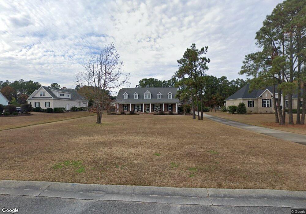
135 Crown Pointe Dr Hampstead, NC 28443
Estimated Value: $718,000 - $901,622
4
Beds
4
Baths
3,364
Sq Ft
$247/Sq Ft
Est. Value
About This Home
This home is located at 135 Crown Pointe Dr, Hampstead, NC 28443 and is currently estimated at $830,656, approximately $246 per square foot. 135 Crown Pointe Dr is a home with nearby schools including North Topsail Elementary School, Topsail Middle School, and Topsail High School.
Ownership History
Date
Name
Owned For
Owner Type
Purchase Details
Closed on
Dec 16, 2022
Sold by
Bailey Randy William and Bailey Susan Melissa
Bought by
Weigle John K and Weigle Stacie
Current Estimated Value
Home Financials for this Owner
Home Financials are based on the most recent Mortgage that was taken out on this home.
Original Mortgage
$750,000
Outstanding Balance
$716,119
Interest Rate
5%
Mortgage Type
VA
Estimated Equity
$114,537
Purchase Details
Closed on
Sep 15, 2020
Sold by
Meyer Robert W and Meyer Tracy A
Bought by
Bailey Susan Melissa and Bailey Randy William
Home Financials for this Owner
Home Financials are based on the most recent Mortgage that was taken out on this home.
Original Mortgage
$125,000
Interest Rate
2.9%
Mortgage Type
Adjustable Rate Mortgage/ARM
Purchase Details
Closed on
Dec 28, 2016
Sold by
Jazwinski Peter and Jazwinski Catherine
Bought by
Meyer Robert W and Meyer Tracy A
Home Financials for this Owner
Home Financials are based on the most recent Mortgage that was taken out on this home.
Original Mortgage
$325,500
Interest Rate
2.29%
Mortgage Type
Adjustable Rate Mortgage/ARM
Purchase Details
Closed on
Nov 1, 2012
Sold by
Bank Of The Ozarks
Bought by
Jazwinski Peter and Jazwinski Catherine
Purchase Details
Closed on
Jun 7, 2011
Sold by
Conner Shaune T and Conner Danielle
Bought by
Bank Of Ozarks
Purchase Details
Closed on
Mar 13, 2008
Sold by
Geissinger Steven
Bought by
Conner Shaune T and Conner Danielle
Home Financials for this Owner
Home Financials are based on the most recent Mortgage that was taken out on this home.
Original Mortgage
$173,000
Interest Rate
7%
Mortgage Type
Future Advance Clause Open End Mortgage
Purchase Details
Closed on
Aug 22, 2005
Sold by
Tyndall Ray Clineth and Tyndall Karen W
Bought by
Geissinger Steven and Geissinger Tammy
Home Financials for this Owner
Home Financials are based on the most recent Mortgage that was taken out on this home.
Original Mortgage
$148,500
Interest Rate
5.61%
Mortgage Type
Future Advance Clause Open End Mortgage
Create a Home Valuation Report for This Property
The Home Valuation Report is an in-depth analysis detailing your home's value as well as a comparison with similar homes in the area
Home Values in the Area
Average Home Value in this Area
Purchase History
| Date | Buyer | Sale Price | Title Company |
|---|---|---|---|
| Weigle John K | $750,000 | -- | |
| Bailey Susan Melissa | $519,000 | None Available | |
| Meyer Robert W | $383,000 | None Available | |
| Jazwinski Peter | $50,000 | None Available | |
| Bank Of Ozarks | $67,000 | -- | |
| Conner Shaune T | -- | -- | |
| Geissinger Steven | $165,000 | -- |
Source: Public Records
Mortgage History
| Date | Status | Borrower | Loan Amount |
|---|---|---|---|
| Open | Weigle John K | $750,000 | |
| Previous Owner | Bailey Susan Melissa | $125,000 | |
| Previous Owner | Meyer Robert W | $325,500 | |
| Previous Owner | Conner Shaune T | $173,000 | |
| Previous Owner | Geissinger Steven | $148,500 |
Source: Public Records
Tax History Compared to Growth
Tax History
| Year | Tax Paid | Tax Assessment Tax Assessment Total Assessment is a certain percentage of the fair market value that is determined by local assessors to be the total taxable value of land and additions on the property. | Land | Improvement |
|---|---|---|---|---|
| 2024 | $4,292 | $487,419 | $100,980 | $386,439 |
| 2023 | $4,709 | $487,419 | $100,980 | $386,439 |
| 2022 | $4,278 | $487,419 | $100,980 | $386,439 |
| 2021 | $4,278 | $487,419 | $100,980 | $386,439 |
| 2020 | $4,168 | $487,419 | $100,980 | $386,439 |
| 2019 | $4,168 | $487,419 | $100,980 | $386,439 |
| 2018 | $3,752 | $418,118 | $88,305 | $329,813 |
| 2017 | $3,752 | $404,790 | $88,305 | $316,485 |
| 2016 | $3,711 | $404,790 | $88,305 | $316,485 |
| 2015 | $4,037 | $404,790 | $88,305 | $316,485 |
| 2014 | $3,187 | $404,790 | $88,305 | $316,485 |
| 2013 | -- | $442,635 | $126,150 | $316,485 |
| 2012 | -- | $121,800 | $121,800 | $0 |
Source: Public Records
Map
Nearby Homes
- 203 Hatteras Ct
- 305 Tall Ships Ln
- 406 Compass Point
- 227 Hickory
- 220 Hickory Ln
- 508 Navigator Dr
- 113 Mallard Dr
- L14 Mallard Dr
- 333 Tall Ships Ln
- Tr 9 W Windward Landing Place
- 120 Middle Point Rd
- 147 Pine Needle Dr
- 1017 Mallard Bay Rd
- 302 Pecan Ct
- 101 Yacht Basin Landing
- 129 Red Bird Ln
- 131 Sound View Dr
- 506 E Windward Landing Place
- 136 S Belvedere Dr
- 107 Wild Berry Ln
- 135 Crane Point
- 135 Crane Point
- 115 Crane Pointe Rd
- 157 Crane Point
- Lot 21 Crane Pointe Rd
- Lot 9 Crane Pointe Rd
- LT 13 Crane Pointe Rd
- 8 Lot Crane Pointe Rd
- 7 Lot Crane Pointe Rd
- Lot 6 Crane Pointe Rd
- 10 Crane Pointe Rd
- 6lot Crane Pointe Rd
- Lot 8 Crane Pointe Rd
- Lot 7 Crane Pointe Rd
- 7 Crane Pointe Rd
- 8 Crane Pointe Rd
- 20 Crane Pointe Rd
- 6 Crane Pointe Rd
- 1 Crane Pointe Rd
- 5 Crane Pointe Rd